Tenões

Tenões
Tenões
Wappen Karte
Das Wappen fehlt noch Lagekarte für Tenões
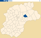
Basisdaten
Region: Norte
Unterregion: Cávado
Distrikt: Braga
Concelho: Braga
Koordinaten: 41° 33′ N, 8° 23′ W41.55738-8.384456Koordinaten: 41° 33′ N, 8° 23′ W
Einwohner: 1.067 (Stand: 2001)
Fläche: 1,7 km²
Bevölkerungsdichte: 628 Einwohner pro km²

Vorlage:Infobox Ort in Portugal/Wartung/Art ist leer

Vorlage:Infobox Ort in Portugal/Wartung/Karte ist ausgefüllt


Vorlage:Infobox Ort in Portugal/Wartung/Höhe ist leer Vorlage:Infobox Ort in Portugal/Wartung/PLZ ist leer Vorlage:Infobox Ort in Portugal/Wartung/Bürgermeister ist leer

Vorlage:Infobox Ort in Portugal/Wartung/Einwohnerstand ist leer

Vorlage:Infobox Ort in Portugal/Wartung/Verwaltungsort ist leer Vorlage:Infobox Ort in Portugal/Wartung/Webseite ist leer Vorlage:Infobox Ort in Portugal/Wartung/Email ist leer

Tenões ist eine Gemeinde im Norden Portugals.

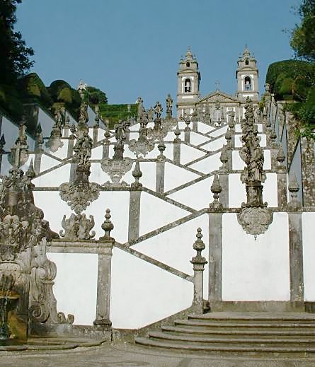
Treppe und Kirche Bom Jesus in Tenões

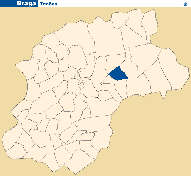
Tenões gehört zum Kreis und zur Stadt (pt: Cidade) Braga im Distrikt Braga, besitzt eine Fläche von 1,7 km² und hat 1067 Einwohner (Stand: 2001).[1]

Einzelnachweise

  1. Daten zu Tenões (en). alea.pt. Abgerufen am 21. Mai 2011.

Weblinks

 Commons: Sanctuary of Bom Jesus do Monte (Braga) – Sammlung von Bildern, Videos und Audiodateien

Wikimedia Foundation.

Игры ⚽ Поможем написать курсовую

Schlagen Sie auch in anderen Wörterbüchern nach:

  • Tenões — Freguesia de Portugal Igreja de Tenões …   Wikipedia Español

  • Tenões — Infobox Parish PT official name = Tenões image coat of arms = image location = Tenões loc.png Municipality = Braga area total = 2.13 population total = 1 067 population density = 500.9 postal code = website = Tenões is a Portuguese parish,… …   Wikipedia

  • Тенойнш — Район Тенойнш Tenões Страна ПортугалияПортугалия …   Википедия

  • Районы округа Брага — …   Википедия

  • List of postal codes in Portugal — Aveiro districtMealhada municipality*3050 Antes *3050 Barcouço *3050 Casal Comba *3050 Luso *3050 Mealhada *3050 Pampilhosa *3050 Vacariça *3050 Ventosa do BairroMurtosa municipality*3870 Bunheiro *3870 Monte *3870 Murtosa *3870 TorreiraOliveira… …   Wikipedia

  • Dume — São Martinho de Dume   Parish   Location in the municipality of Braga Country Portugal …   Wikipedia

  • Mire de Tibães —   Parish   Location in the municipality of Braga Country Portugal …   Wikipedia

  • São Pedro de Merelim — For other uses, see São Pedro (disambiguation). The title of this article contains the character ã. Where it is unavailable or not desired, the name may be represented as Sao Pedro de Merelim. São Pedro de Merelim   Parish   …   Wikipedia

  • Merelim São Paio —   Parish   Coat of arms …   Wikipedia

  • Saint Eulalia Church — The Saint Eulalia Church in Portuguese, Igreja de Santa Eulália is a Romanesque Portuguese church in Tenões, Braga, Portugal, near Bom Jesus.The church is dedicated to Saint Eulalia.It is classified by IPPAR. [ [http://www.ippar.pt/pls/dippar/pat …   Wikipedia

Share the article and excerpts

Direct link
Do a right-click on the link above
and select “Copy Link”