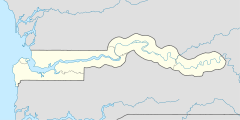
- Toniataba
-
Toniataba 13.438926798333-15.577094206944{{{elevation_save}}}Koordinaten: 13° 26′ N, 15° 35′ W Region: Lower River Distrikt: Jarra West Einwohner: 1.941 (2010) 
Toniataba (Schreibvariante: Tonia Taba) ist eine Ortschaft im westafrikanischen Staat Gambia.
Nach einer Berechnung für das Jahr 2010 leben dort etwa 1941 Einwohner, das Ergebnis der letzten veröffentlichten Volkszählung von 1993 betrug 1452.[1]
Inhaltsverzeichnis
Geographie
Toniataba liegt in der Lower River Region im Distrikt Jarra West und liegt rund fünf Kilometer von Soma entfernt. Von der South Bank Road ist der Ort rund zwei Kilometer entfernt.
Kultur und Sehenswürdigkeiten
In Toniataba ist ein historisches Gebäude als Kultstätte bekannt.[2] Es ist Gambias größte traditionelle strohbedeckte Rundhütte, unter ihr ist ein berühmter Mandinka-Marabout begraben, ein Nachfahre lebt in der Hütte.[3]
Nach einer Auflistung des National Centre for Arts & Culture war Toniataba ein Standort eines Tatos.[2]
Siehe auch
Einzelnachweise
- ↑ Toniataba in World Gazetteer, Zugriff Juni 2010
- ↑ a b Allen Meagher, Andrew Samuel, Baba Ceesay, National Council for the Arts and Culture (Gambia) et al: Historic sites of The Gambia : an official guide to the monuments and sites of The Gambia. National Council for the Arts and Culture, Banjul, The Gambia 1998, ISBN 9983-80-011-014 (formal falsche ISBN)
- ↑ Rosel Jahn, Wolfgang Jahn: Gambia. Reiseführer mit Landeskunde 1997, ISBN 3-87936-239-4
Kategorie:- Ort in der Lower River Region
Wikimedia Foundation.

