Urumaco

Urumaco
11.2-70.25
Urumaco
Urumaco (Venezuela)
Urumaco
Urumaco

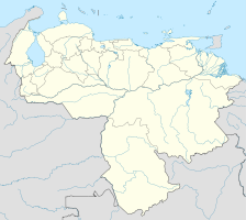
Urumaco auf der Karte von Venezuela

Basisdaten
Staat Venezuela
Bundesstaat Falcón
Einwohner 5107 (2001)
Detaildaten
Zeitzone UTC–4

Urumaco ist ein Dorf im venezolanischen Bundesstaat Falcón, 75 Kilometer westlich von Coro. Im Jahr 2010 hatte es nach Schätzungen der Universidad de los Andes etwa 5107 Einwohner.

Urumaco ist Verwaltungssitz des gleichnamigen Bezirks. Das Dorf ist durch die Nationalstraße 3 mit Dabajuro und Maracaibo im Westen und mit Coro im Osten verbunden.

Sehenswürdigkeiten

Urumaco hat ein paläontologisches Museum.[1] In der Nähe gibt es indianische Petroglyphen und eine bedeutende Fossilfundstelle aus dem Miozän.

Hauptplatz von Urumaco
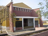
Kirche von Urumaco

Referenzen

  1. Paläontologisches Museum

Weblinks


Wikimedia Foundation.

Игры ⚽ Поможем написать курсовую

Schlagen Sie auch in anderen Wörterbüchern nach:

  • Urumaco — Plaza Bolívar de Urumaco. Urumaco es un poblado del estado Falcón (Venezuela) capital del municipio homónimo, ubicado a 75 km al oeste de Coro. Pueblo de criadores, agricultores y comerciantes. Para el año 2000 su población se estimaba en… …   Wikipedia Español

  • Urumaco — Cette page d’homonymie répertorie les différents sujets et articles partageant un même nom. Urumaco peut désigner : Toponymes  Venezuela Urumaco : l une des 25 …   Wikipédia en Français

  • Urumaco — It is of world importance for its fossils. The arid climate of the region means that the fossils are not hidden by vegetation. They were first made known to science by geologists who came across them while looking for oil (which is abundant in… …   Wikipedia

  • Urumaco — Original name in latin Urumaco Name in other language Urumaco State code VE Continent/City America/Caracas longitude 11.19913 latitude 70.25499 altitude 66 Population 0 Date 2012 01 03 …   Cities with a population over 1000 database

  • Urumaco (municipalité) — Pour les articles homonymes, voir Urumaco. Urumaco Place Bolívar à Urumaco, chef lieu de la municipalité …   Wikipédia en Français

  • Municipio Urumaco — Urumaco Municipio de Venezuela Idioma oficial …   Wikipedia Español

  • Municipio Urumaco — Admin ASC 2 Code Orig. name Municipio Urumaco Country and Admin Code VE.11.1124 VE …   World countries Adminstrative division ASC I-II

  • Ikanogavialis —   Ikanogavialis Rango temporal: Mioceno Superior …   Wikipedia Español

  • Gryposuchus —   Rhamphosuchus crassidens Rango temporal: Mioceno Medio a Superior …   Wikipedia Español

  • Stupendemys —   Stupendemys Rango fósil: Mioceno Plioceno …   Wikipedia Español

Share the article and excerpts

Direct link
Do a right-click on the link above
and select “Copy Link”