- Vojčice
-
Vojčice
Wappen Karte 
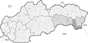

Vojčice BasisdatenKraj: Košický kraj Okres: Trebišov Region: Dolný Zemplín Fläche: 17,896 km² Einwohner: 2.170 (31. Dez. 2010) Bevölkerungsdichte: 121,26 Einwohner je km² Höhe: 111 m n.m. Postleitzahl: 076 22 Telefonvorwahl: 0 56 Geographische Lage: 48° 41′ N, 21° 43′ O48.67777777777821.715277777778111Koordinaten: 48° 40′ 40″ N, 21° 42′ 55″ O Kfz-Kennzeichen: TV Gemeindekennziffer: 543951 StrukturGemeindeart: Gemeinde Verwaltung (Stand: Juni 2011)Bürgermeister: Vlastimil Kiral-Varga Adresse: Obecný úrad Vojčice
P. O. Hviezdoslava 408
076 22 VojčiceWebpräsenz: www.vojcice.sk Gemeindeinformation
auf portal.gov.skStatistikinformation
auf statistics.skVojčice (ungarisch Vécse) ist eine Gemeinde im Osten der Slowakei, mit 2170 Einwohnern (Stand 31. Dezember 2010). Administrativ gehört sie zum Okres Trebišov, der ein Teil des Bezirks Košický kraj ist.
Geographie
Die Gemeinde liegt im Ostslowakischen Tiefland auf der Höhe von 108 m n.m. und ist nur sechs Kilometer von Trebišov entfernt.
Geschichte
Die erste schriftliche Erwähnung stammt aus dem Jahr 1217. Zuerst gehörte der Ort den örtlichen Grundbesitzern, dann seit dem späten 14. Jahrhundert zum Herrschaftsgut von Trebischau. Im 19. und 20. Jahrhundert hatten die Familien Csáky, Forgách und Andrássy ihre Güter hier. 1828 gab es hier 98 Häuser und 713 Einwohner.
Gemeinden im Okres TrebišovBačka | Bačkov | Bara | Biel | Boľ (Boltsch) | Borša | Boťany | Brehov | Brezina | Byšta | Cejkov | Čeľovce | Čerhov | Černochov | Čierna | Čierna nad Tisou | Dargov | Dobrá | Dvorianky | Egreš | Hraň | Hrčeľ | Hriadky | Kašov | Kazimír | Klin nad Bodrogom | Kožuchov | Kráľovský Chlmec | Kravany | Kuzmice | Kysta | Ladmovce | Lastovce | Leles | Luhyňa | Malá Tŕňa | Malé Ozorovce | Malé Trakany | Malý Horeš | Malý Kamenec | Michaľany | Nižný Žipov | Novosad | Nový Ruskov | Parchovany | Plechotice | Poľany | Pribeník | Rad | Sečovce | Sirník | Slivník | Slovenské Nové Mesto | Soľnička | Somotor | Stanča | Stankovce | Strážne | Streda nad Bodrogom | Svätá Mária | Svätuše | Svinice | Trebišov (Trebischau) | Trnávka | Veľaty | Veľká Tŕňa | Veľké Ozorovce | Veľké Trakany | Veľký Horeš | Veľký Kamenec | Viničky | Višňov | Vojčice | Vojka | Zatín | Zbehňov | Zemplín (Semplin) | Zemplínska Nová Ves | Zemplínska Teplica | Zemplínske Hradište | Zemplínske Jastrabie | Zemplínsky Branč
Wikimedia Foundation.
Schlagen Sie auch in anderen Wörterbüchern nach:
Vojčice — (Village) Administration Pays Slovaquie … Wikipédia en Français
Vojčice — is a village and municipality in the Trebišov District in the Košice Region of south eastern Slovakia.HistoryIn historical records the village was first mentioned in 1217.GeographyThe village lies at an altitude of 111 metres and covers an area… … Wikipedia
Trebišov District — District Country Slovakia Region … Wikipedia
District de Trebišov — Trebišov Informations Pays … Wikipédia en Français
Lya De Putti — Nombre real Amalia de Putti Nacimiento 10 de enero de 1899 … Wikipedia Español
Košice Region — Geobox | Region name = Košice other name = category = Region image caption = image caption = symbol = symbol type = Coat of arms etymology = official name = motto = nickname = country = Slovakia country state = region = district = commune =… … Wikipedia
Dargov — Coordinates: 48°44′N 21°35′E / 48.733°N 21.583°E / 48.733; 21.583 … Wikipedia
List of municipalities and towns in Slovakia — Slovakia This is a comprehensive list of municipalities and towns in Slovakia. For lists of towns and municipalities sorted by Regions see the individual articles on Regions. For an outdated list of towns only in Slovakia see also List of towns… … Wikipedia
Cejkov — Location of Trebišov District in the Region Cejkov (Hungarian: Céke) is a village and municipality in the Trebišov District in the Košice Region of eastern Slovakia. Con … Wikipedia
Zemplínske Jastrabie — Location of Trebišov District in the Region Zemplínske Jastrabie (Hungarian: Magyarsas) is a village and municipality in the Trebišov District in the Košice Region of eastern Slovakia … Wikipedia
Vojčice


18+
© Academic, 2000-2026
- Kontaktieren Sie uns: Unterstützung, Werbung
Wörterbücher Export, schritte mit PHP, Joomla, Drupal, WordPress, MODx.