Wapiti River

Wapiti River
Wapiti RiverVorlage:Infobox Fluss/GKZ_fehlt
Lage British Columbia, Alberta (Kanada)
Flusssystem Mackenzie River
Abfluss über Smoky River → Peace River → Slave River → Mackenzie River
Quelle Tuck Lake am Wapiti Pass
54° 26′ 26″ N, 120° 47′ 25″ W54.44069-120.790211370
Quellhöhe 1.370 mVorlage:Infobox Fluss/NACHWEISE_fehlen
Mündung in den Smoky River
55.13784-118.30152485

55° 8′ 16″ N, 118° 18′ 5″ W55.13784-118.30152485
Mündungshöhe 485 mVorlage:Infobox Fluss/NACHWEISE_fehlen
Höhenunterschied 885 mVorlage:Infobox Fluss/LÄNGE_fehltVorlage:Infobox Fluss/EINZUGSGEBIET_fehlt
AbflussmengeVorlage:Infobox Fluss/NACHWEISE_fehlen MQ: 100 m³/s
Durchflossene Seen Wapiti LakeVorlage:Infobox Fluss/BILD_fehlt

Der Wapiti River ist ein Fluss im Osten von British Columbia und im Westen von Alberta in Kanada. Er ist ein Hauptzufluss des Smoky River, im südlichen Einzugsgebiet des Peace River gelegen.

Der Name Wapiti stammt von dem Cree-Wort für Wapiti-Hirsch ("waapiti").

Flusslauf

Der Alberta Highway 40 überquert den Wapiti River südlich von Grande Prairie

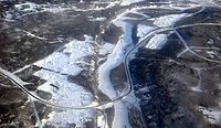
Der Wapiti River entfließt dem Tuck Lake östlich des Wapiti Pass im Wapiti Lake Provincial Park in Westzentral-British Columbia in the Kanadischen Rockies. Von dort fließt er in nordöstlicher Richtung, überquert die Grenze nach Alberta, wo er durch das Gebiet des Grande Prairie County No. 1 mäandert. 30 km östlich von Grande Prairie mündet er schließlich in den Smoky River.

Von West nach Osten durchfließt der Wapiti River alpine Landschaften der Rocky Mountains, eine Hügellandschaft, Farmland, sowie das Aspen Parkland im westlichen Alberta. Der Wapiti Lake Provincial Park, Bear River Park, O'Brien Provincial Park und der Pipestone Creek Park[1] sind Schutzgebiete entlang des Flusslaufs.

Nahe seiner Mündung beträgt der mittlere Abfluss des Wapiti River 100 m³/s.[2]

Einzelnachweise

  1. Discover the Peace Country - Pipestone Creek Park
  2. Alberta Environment - Wapiti Discharge graph

Wikimedia Foundation.

Игры ⚽ Нужно сделать НИР?

Schlagen Sie auch in anderen Wörterbüchern nach:

  • Wapiti River — Superimpose base = Major Rivers in West Canada.png base width = 280px base caption = Western Canada rivers float = Map symbol pin.gif float width = 20px float caption = Wapiti River x = 158 y = 81 Wapiti River in western Canada Wapiti River is a… …   Wikipedia

  • Wapiti River — Sp Élnių ùpė Ap Wapiti River L Kanadoje (Alberta) …   Pasaulio vietovardžiai. Internetinė duomenų bazė

  • Wapiti — may refer to: Animals * Elk ( Cervus canadensis ), from the Cree language: waapiti , a large deer species native to western North America and eastern Asia * Manchurian wapiti ( Cervus canadensis xanthopygus ), a subspecies of elk, native to… …   Wikipedia

  • Wapiti Lake Provincial Park — is a 16,837 ha provincial park in British Columbia, Canada. It is located 60 km south of Tumbler Ridge, at the headwaters of Wapiti River, including its watershed from the Wapiti Pass to Wapiti Lake in the Canadian Rockies. The area contains… …   Wikipedia

  • Wapiti Pass — Infobox Mountain pass Name = Wapiti Pass Photo = Caption = Elevation = convert|1375|m|ft|0 Location =British Columbia, CAN Range = Canadian Rockies Coordinates = coord|54|26|N|120|49|W|type:pass region:CA|display=inline,title Topographic… …   Wikipedia

  • Wapiti-Hirsch — Wapiti Wapiti Bulle Systematik Ordnung: Paarhufer (Artiodactyla) Unterordnung …   Deutsch Wikipedia

  • Wapiti Ranger Station — Die Wapiti Ranger Station ist eine Einrichtung des United States Forest Service und gilt als älteste Ranger Station in den Vereinigten Staaten.[1] Die Station befindet sich im Shoshone National Forest im US Bundesstaat …   Deutsch Wikipedia

  • Wapiti — (Hour,Бельгия) Категория отеля: Адрес: 5563 Hour, Бельгия Описание …   Каталог отелей

  • Wapiti, Wyoming — Wapiti is an unincorporated community in Park County, Wyoming, United States. It is situated along the Shoshone River in Shoshone National Forest, between Cody and the eastern entrance of Yellowstone National Park. The location is named after the …   Wikipedia

  • Spirit River Formation — Stratigraphic range: middle Albian …   Wikipedia

Share the article and excerpts

Direct link
Do a right-click on the link above
and select “Copy Link”