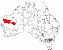
Western Australian Mulga Shrublands
- Western Australian Mulga Shrublands
-
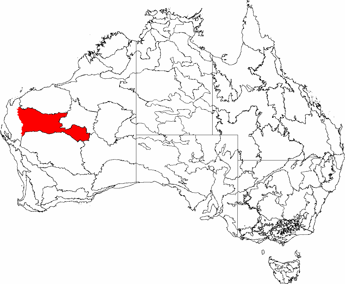
Die IBRA Region,
Gascoyne ist rot eingezeichnet

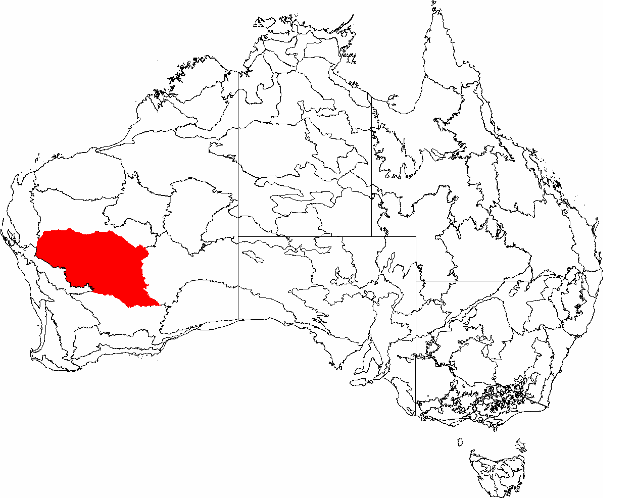
Die IBRA Regions,
Murchison ist
Die Western Australian Mulga Shrublands sind ein großes, arides Gebiet, das vom World Wildlife Fund als Ökoregion im Inland Westaustraliens unterhalten wird.[1].
Beschreibung
Die Western Australian Mulga Shrublands sind gekennzeichnet durch ein sehr heißes Klima mit sehr wenig Regenfall. Die Region besteht aus der biogeographischen Regionen Gascoyne und Murchison (festgelegt durch die vorläufige biographische Einteilung für Australien, in Englisch Interim Biogeographic Regionalisation for Australia, abgekürzt IBRA).[2] Die Region grenzt an die Wheatbelt Region (West Australien) an, eine heute landwirtschaftlich intensiv genutzte Region. Die dominierende Vegetation dieser Region besteht aus Mulga-Bäumen, einer Akaziengattung, die an heißes trockenes Klima angepasst ist. In der Region leben Emus, Wammentrappen, Kakadus und Honigfresser.
Die Region ist überwiegend unbewohnt. Allerdings werden hier immer noch Rohstoffe abgebaut und nach wie vor werden in dieser Region Schafe gehalten. Beide Aktivitäten haben Auswirkungen auf die Biodiversität dieser Region.
Quellen
- ↑ http://www.worldwildlife.org/wildworld/profiles/terrestrial/aa/aa1310_full.html
- ↑ name="IBRA 6.1">IBRA Version 6.1 data
Wikimedia Foundation.
Schlagen Sie auch in anderen Wörterbüchern nach:
Mulga — (Acacia aneura) Systematik Ordnung: Schmetterlingsblütenartige (Fabales) Familie … Deutsch Wikipedia
Western Australia — Coordinates: 26°0′S 121°0′E / 26°S 121°E / 26; 121 … Wikipedia
Western Australia — Western Australian. a state in W Australia. 1,273,624; 975,920 sq. mi. (2,527,635 sq. km). Cap.: Perth. * * * State (pop., 2001: 1,906,114), western Australia. Covering 976,790 sq mi (2,529,880 sq km), it constitutes one third of the continent s… … Universalium
Deserts and xeric shrublands — Xeric redirects here. For the comic book grant foundation, see Xeric Foundation. Deserts and xeric shrublands is a biome characterized by, relating to, or requiring only a small amount of moisture.[1] Contents 1 Definition and occurrence 2… … Wikipedia
Carnarvon xeric shrublands — The Carnarvon xeric shrublands or Carnarvon bioregion is a deserts and xeric shrublands ecoregion of Western Australia. The ecoregion covers an area of 90,500 square kilometers (34,900 square miles). The ecoregion is bounded by the Indian Ocean… … Wikipedia
Geography of Western Australia — Western Australia occupies nearly one third of the Australian continent.Due to the size and the isolation of the state, considerable emphasis has been made of these features; it is the second largest administrative territory in the world, after… … Wikipedia
List of ecoregions (WWF) — This is a list of ecoregions as compiled by the World Wildlife Fund (WWF). The WWF identifies terrestrial, freshwater, and marine ecoregions.The terrestrial scheme divides the Earth s land surface into 8 terrestrial ecozones, containing 867… … Wikipedia
Australia — This article is about the country. For other uses, see Australia (disambiguation). Commonwealth of Australia … Wikipedia
Ecoregions in Australia — are geographically distinct plant and animal communities, defined by the World Wide Fund for Nature based on geology, soils, climate, and predominant vegetation.The World Wide Fund for Nature (WWF) identified 825 terrestrial ecoregions that cover … Wikipedia
Écorégion d'Australie — Le World Wide Fund for Nature, qui définit une liste d écorégions au niveau mondial, reconnaît 8 biomes types pour l Australie, soit 40 écorégions. Pour ce faire, le WWF s appuie sur les travaux de l Interim Biogeographic Regionalisation for… … Wikipédia en Français