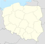
Wisznia Mała

Wisznia Mała
Wisznia Mała
Wappen von Wisznia Mała
Wisznia Mała (Polen)
Wisznia Mała
Wisznia Mała
Basisdaten
Staat: Polen
Woiwodschaft: Niederschlesien
Landkreis: Trzebnica
Geographische Lage: 51° 15′ N, 17° 3′ O51.2517.05Koordinaten: 51° 15′ 0″ N, 17° 3′ 0″ O
Einwohner:

-
(31. Dez. 2010)[1]

Postleitzahl: 55-114
Telefonvorwahl: (+48) 71
Kfz-Kennzeichen: DTR
Wirtschaft und Verkehr
Nächster int. Flughafen: Breslau
Gemeinde
Gemeindeart: Landgemeinde
Fläche: 103,3 km²
Einwohner:

8763
(31. Dez. 2010) [2]

Bevölkerungsdichte: 85 Einw./km²
Gemeindenummer (GUS): 0220042
Verwaltung (Stand: 2006)
Bürgermeister: Stanisław Moik
Adresse: ul. Wrocławska 9
55-114 Wisznia Mała
Webpräsenz: www.wiszniamala.pl

Wisznia Mała (deutsch: Wiese) ist ein Ort im Powiat Trzebnicki in der Woiwodschaft Niederschlesien in Polen.

Geschichte

Bis 1945 war Wiese eine Gemeinde im Landkreis Trebnitz, Regierungsbezirk Breslau der Provinz Schlesien.

Gemeinde

Zur Landgemeinde Wisznia Mała gehören Ortsteile (deutsche Namen bis 1945)[3] mit einem Schulzenamt:

  • Gaj
  • Kalina
  • Kryniczno (Kapsdorf)
  • Krzyżanowice (Kryschanowitz, 1936–1945: Weidebrück)
  • Ligota Piękna (Schön Ellguth)
  • Machnice (Machnitz)
  • Malin (Mahlen)
  • Mienice (Mühnitz)
  • Ozorowice (Sponsberg)
  • Pierwoszów (Pürbischau)
  • Piotrkowiczki (Peterwitz)
  • Psary (Hünern)
  • Rogoż (Rux)
  • Strzeszów (Striese)
  • Szewce (Schebitz)
  • Szymanów (Simsdorf)
  • Wisznia Mała (Wiese)
  • Wysoki Kościół (Hochkirch)

Fußnoten

  1. Population. Size and Structure by Territorial Division. As of June 30, 2010. Główny Urząd Statystyczny (GUS), abgerufen am 30. Juli 2011.
  2. Population. Size and Structure by Territorial Division. As of June 30, 2010. Główny Urząd Statystyczny (GUS), abgerufen am 30. Juli 2011.
  3. Das Genealogische Orts-Verzeichnis

Wikimedia Foundation.

Игры ⚽ Нужен реферат?

Schlagen Sie auch in anderen Wörterbüchern nach:

  • Wisznia Mała — Infobox Settlement name = Wisznia Mała settlement type = Village total type = image shield = subdivision type = Country subdivision name = POL subdivision type1 = Voivodeship subdivision name1 = Lower Silesian subdivision type2 = County… …   Wikipedia

  • Gmina Wisznia Mała — Infobox Settlement name = Gmina Wisznia Mała other name = Wisznia Mała Commune settlement type = Gmina total type = Total image shield = subdivision type = Country subdivision name = POL subdivision type1 = Voivodeship subdivision name1 = Lower… …   Wikipedia

  • Mienice —   Village   Country  Poland Voivodeship Lower Silesian …   Wikipedia

  • Ozorowice —   Village   …   Wikipedia

  • Malin, Poland — Malin   Village   Country  Poland Voivodeship Lower Silesian …   Wikipedia

  • Гмина Вишня-Мала — gmina Wisznia Mała Герб Файл:Wisznia Mala.jpg Страна:  Польша Повят:  Тшебницкий повят Глава:  Станислав Моик (2006) Площадь:  103,33 км² Население:  7869 чел …   Википедия

  • Gmina Oborniki Śląskie — Oborniki Śląskie Commune   Gmina   …   Wikipedia

  • Kryniczno, Trzebnica County — Infobox Settlement name = Kryniczno settlement type = Village total type = image shield = subdivision type = Country subdivision name = POL subdivision type1 = Voivodeship subdivision name1 = Lower Silesian subdivision type2 = County subdivision… …   Wikipedia

  • Krzyżanowice, Lower Silesian Voivodeship — Infobox Settlement name = Krzyżanowice settlement type = Village total type = image shield = subdivision type = Country subdivision name = POL subdivision type1 = Voivodeship subdivision name1 = Lower Silesian subdivision type2 = County… …   Wikipedia

  • Ligota Piękna — Infobox Settlement name = Ligota Piękna settlement type = Village total type = image shield = subdivision type = Country subdivision name = POL subdivision type1 = Voivodeship subdivision name1 = Lower Silesian subdivision type2 = County… …   Wikipedia

Share the article and excerpts

Direct link
Do a right-click on the link above
and select “Copy Link”