Dahlonega

Dahlonega
Dahlonega
Spitzname: Azalea City
Lumpkin County Georgia Incorporated and Unincorporated areas Dahlonega Highlighted.svg
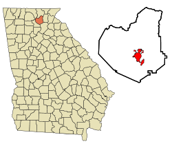
Lage im County und in Georgia
Basisdaten
Staat: Vereinigte Staaten
Bundesstaat: Georgia
County:

Lumpkin County

Koordinaten: 34° 32′ N, 83° 59′ W34.531666666667-83.983888888889442Koordinaten: 34° 32′ N, 83° 59′ W
Zeitzone: Eastern Standard Time (UTC−5)
Einwohner: 3638 (Stand: 2000)
Bevölkerungsdichte: 219,2 Einwohner je km²
Fläche: 16,6 km² (ca. 6 mi²)
davon 16,6 km² (ca. 6 mi²) Land
Höhe: 442 m
Postleitzahlen: 30533, 30597
Vorwahl: +1 706
FIPS: 13-21240
GNIS-ID: 0355420
Webpräsenz: www.cityofdahlonega.com
Bürgermeister: Gary McCullough

Dahlonega ist eine Stadt im US-Bundesstaat Georgia. Sie liegt im Lumpkin County und hat 3.638 (2000) Einwohner.

Der Name der Stadt geht auf das Wort 'talonega' zurück, was Gold in der Sprache der Cherokee Indianer bedeutet. Um 1828 wurde in der Nähe von Dahlonega erstmals Gold entdeckt, was den ersten US-Goldrausch auslöste. Die Stadt kam dabei zu ansehnlichen Wohlstand, der in dem goldenen Dach der Dahlonega Münzanstalt, die heute Teil des North Georgia Colleges ist, zum Ausdruck kommt. Dahlonega war von 1838 bis 1861 Prägeort für Goldmünzen und beherbergt heute ein Goldmuseum. In Dahlonega geprägte Goldmünzen sind an dem eingeprägten „D“ erkennbar. Gold aus Dahlonega findet sich auch auf dem Dach des State Capitols in Atlanta.

Dahlonega: Gold Museum

Wikimedia Foundation.

Игры ⚽ Нужно сделать НИР?

Schlagen Sie auch in anderen Wörterbüchern nach:

  • Dahlonega — Administration Pays …   Wikipédia en Français

  • Dahlonega — Dahlonega, GA U.S. city in Georgia Population (2000): 3638 Housing Units (2000): 1181 Land area (2000): 6.404112 sq. miles (16.586572 sq. km) Water area (2000): 0.000000 sq. miles (0.000000 sq. km) Total area (2000): 6.404112 sq. miles (16.586572 …   StarDict's U.S. Gazetteer Places

  • Dahlonega, GA — U.S. city in Georgia Population (2000): 3638 Housing Units (2000): 1181 Land area (2000): 6.404112 sq. miles (16.586572 sq. km) Water area (2000): 0.000000 sq. miles (0.000000 sq. km) Total area (2000): 6.404112 sq. miles (16.586572 sq. km) FIPS… …   StarDict's U.S. Gazetteer Places

  • Dahlonēga — Dahlonēga, Hauptort der Grafschaft Lumpkin im Staate Georgia (Nordamerika), 3 Kirchen, Akademie; 1400 Ew. In der Nähe reiche Goldminen …   Pierer's Universal-Lexikon

  • Dahlonega — ▪ Georgia, United States       city, seat (1833) of Lumpkin county, northern Georgia, U.S. Gold was discovered in the locality in the late 1820s, and the site was settled and incorporated in 1833 after one of the nation s first gold rushes; its… …   Universalium

  • Dahlonega — Original name in latin Dahlonega Name in other language Dalonega, daronega, deollaneoga, Далонега State code US Continent/City America/New York longitude 34.53259 latitude 83.98491 altitude 444 Population 5242 Date 2011 05 14 …   Cities with a population over 1000 database

  • Dahlonega — Sp Dalònega Ap Dahlonega L JAV: Lampkino apyg. c., plyn. (Džordžija) …   Pasaulio vietovardžiai. Internetinė duomenų bazė

  • Dahlonega, Georgia — Dahlonega, Georgia, USA   City   Historic Lumpkin County Courthouse, which now houses the Dahlonega Gold Museum Historic Site …   Wikipedia

  • Dahlonega Gold Museum Historic Site — Dahlonega Gold Museum The Dahlonega Gold Museum Historic Site is a Georgia state historic site located in Dahlonega that commemorates America s first gold rush[1] …   Wikipedia

  • Dahlonega Mine Train — The front entrance of the attraction. Location Six Flags Over Georgia Status …   Wikipedia

Share the article and excerpts

Direct link
Do a right-click on the link above
and select “Copy Link”