Dawsonville

Dawsonville
Dawsonville
Dawson County Georgia Incorporated and Unincorporated areas Dawsonville Highlighted.svg
Lage im County und in Georgia
Basisdaten
Staat: Vereinigte Staaten
Bundesstaat: Georgia
County:

Dawson County

Koordinaten: 34° 25′ N, 84° 7′ W34.421666666667-84.119166666667416Koordinaten: 34° 25′ N, 84° 7′ W
Zeitzone: Eastern Standard Time (UTC−5)
Einwohner: 619 (Stand: 2000)
Bevölkerungsdichte: 123,8 Einwohner je km²
Fläche: 5 km² (ca. 2 mi²)
Höhe: 416 m
Postleitzahl: 30534
Vorwahl: +1 706
FIPS: 13-21940
GNIS-ID: 0331529
Webpräsenz: www.dawsonville.com
Bürgermeister: Joe Lane Cox

Dawsonville ist ein Ort im US-Bundesstaat Georgia. Er liegt im Dawson County und hat 619 (2000) Einwohner.

Dawsonville, das 1857 gegründet wurde, ist Sitz der County-Verwaltung (County Seat). Der Name des Ortes geht auf William C. Dawson zurück, der 1836 eine Kompanie im Krieg gegen die Muskogee-Indianer anführte und Mitglied des US-Senates von 1849 bis 1855 war.

Prominentester Bürger der Stadt ist der NASCAR Rennfahrer Bill Elliott, dem die Stadt auch ein Museum widmete. Er trägt unter anderem den Spitznamen "Awesome Bill from Dawsonville" als Hommage an seine Heimatstadt.

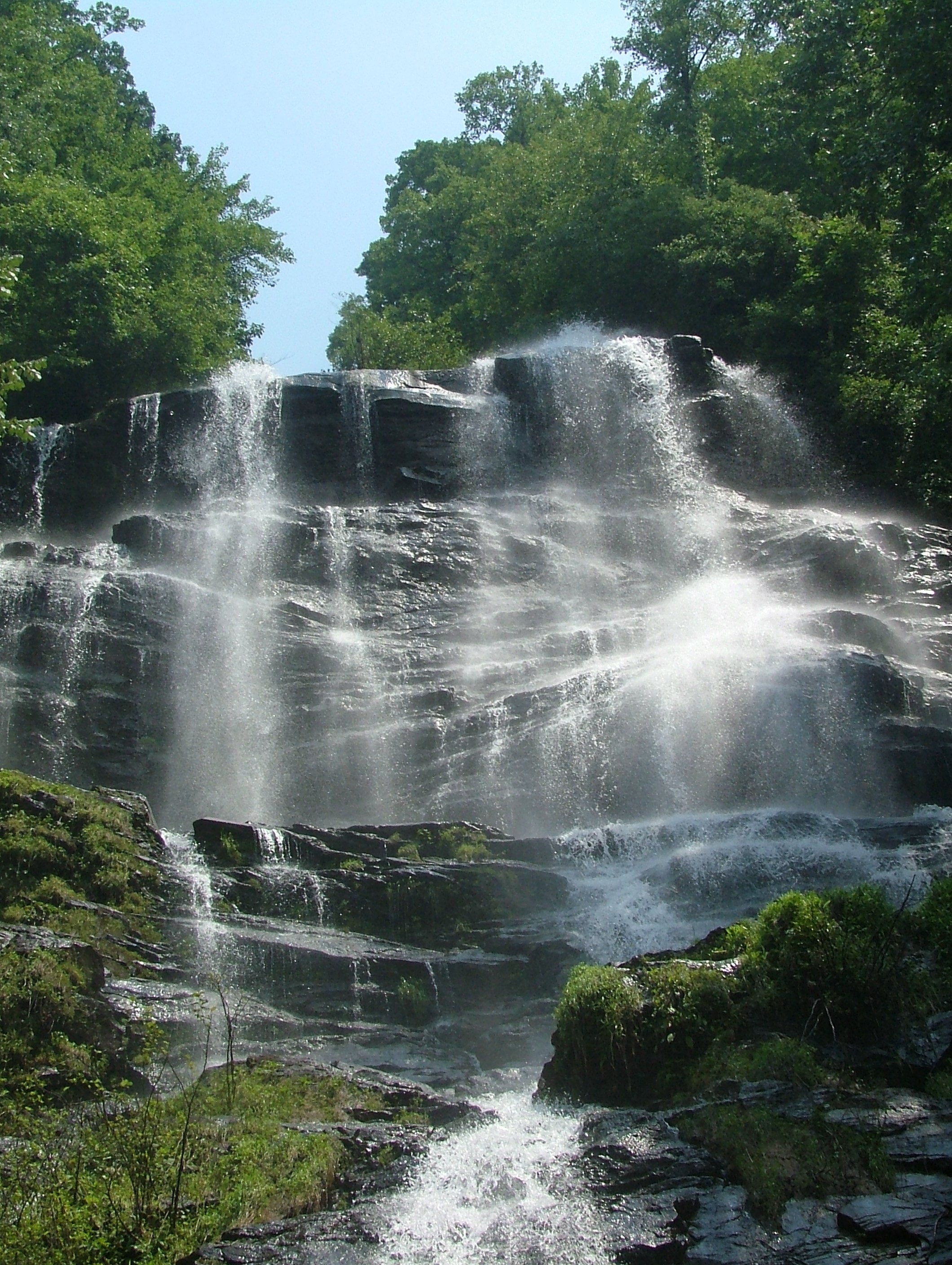
24 km nordwestlich der Stadt liegt der Amicalola Falls State Park mit den höchsten Wasserfällen in den östlichen USA.

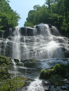
Die Amicalola Falls nahe Dawsonville

Wikimedia Foundation.

Игры ⚽ Нужно сделать НИР?

Schlagen Sie auch in anderen Wörterbüchern nach:

  • Dawsonville — may refer to: Dawsonville, Georgia, United States Dawsonville, Maryland, United States Dawsonville, Kenya This disambiguation page lists articles about distinct geographical locations with the same name. If an …   Wikipedia

  • Dawsonville — Dawsonville, GA U.S. city in Georgia Population (2000): 619 Housing Units (2000): 257 Land area (2000): 1.929164 sq. miles (4.996512 sq. km) Water area (2000): 0.000000 sq. miles (0.000000 sq. km) Total area (2000): 1.929164 sq. miles (4.996512… …   StarDict's U.S. Gazetteer Places

  • Dawsonville, GA — U.S. city in Georgia Population (2000): 619 Housing Units (2000): 257 Land area (2000): 1.929164 sq. miles (4.996512 sq. km) Water area (2000): 0.000000 sq. miles (0.000000 sq. km) Total area (2000): 1.929164 sq. miles (4.996512 sq. km) FIPS code …   StarDict's U.S. Gazetteer Places

  • Dawsonville — Original name in latin Dawsonville Name in other language State code US Continent/City America/New York longitude 34.42121 latitude 84.11908 altitude 417 Population 2536 Date 2011 05 14 …   Cities with a population over 1000 database

  • Dawsonville — Sp Dòsonvilis Ap Dawsonville L JAV Dosono apyg. c. (Džordžija) …   Pasaulio vietovardžiai. Internetinė duomenų bazė

  • Dawsonville, Georgia —   City   Dawson County Courthouse in Dawsonville …   Wikipedia

  • Dawsonville, New Brunswick — Dawsonville   Unincorporated community   …   Wikipedia

  • Dawsonville, Maryland — Dawsonville is an unincorporated community in Montgomery County, Maryland, United States.[1] References ^ U.S. Geological Survey Geographic Names Information System: Dawsonville, Maryland …   Wikipedia

  • Dawsonville, Virginia — Dawsonville is an unincorporated community in Greene County, Virginia, United States. References GNIS reference …   Wikipedia

  • Dawsonville, Kenya — Dawsonville is a railway town and junction in Kenya, lying on the main line to Uganda and the branches to Kisumu and Solai. Contents 1 See also 2 Statistics 3 References 4 …   Wikipedia

Share the article and excerpts

Direct link
Do a right-click on the link above
and select “Copy Link”