East Cape Lighthouse

East Cape Lighthouse
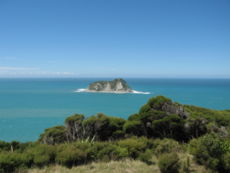
Blick vom East Cape aufs offene Meer

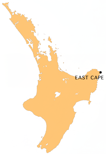
East Cape ist der östlichste Punkt der Hauptinseln Neuseelands und bezeichnet ein Kap im Nordosten der Nordinsel nördlich von Gisborne.

Lage des Kaps

Dieser Punkt wird damit als der Ort bezeichnet, an dem die ersten Sonnenstrahlen des Tages auf Neuseeland treffen, noch euphorischer ist die von Einheimischen genutzte Bezeichnung, das hier der neue Tag erstmals auf festen Boden trifft. Dies vernachlässigt allerdings, dass es einige Inseln gibt, die noch näher an der Datumsgrenze liegen.

Der Name East Cape wird auch stellvertretend für die gesamte Region nördlich von Gisborne nördlich der Mahia Peninsula und landeinwärts bis zum Te Urewera National Park verwendet. Diese Region war Schauplatz einiger großer Kämpfe der Māori in den 1860er Jahren.

Leuchtturm

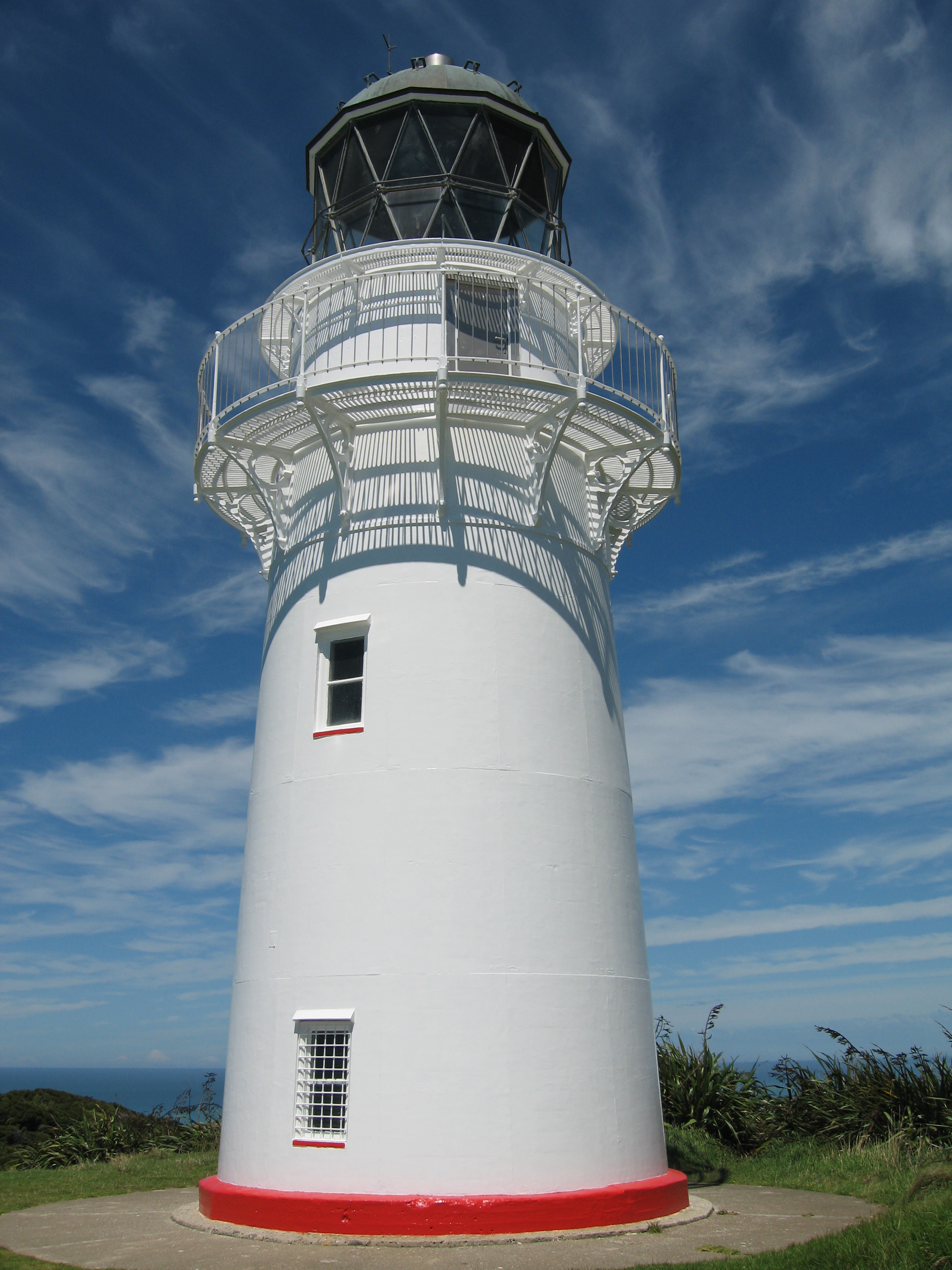
Der 14 Meter hohe East Cape - Leuchtturm

Der Leuchtturm wurde 1900 auf East Island erbaut, wegen zahlreicher Erdbeben und Felsabbrüche wurde er jedoch 1922 auf die Spitze von East Cape versetzt. Der Leuchtturm ist ein 14 Meter hoher Turm aus aufeinander geschweißten Stahlblechringen, das Leuchtfeuer befindet sich 154 Meter über dem Meeresspiegel. Das Licht blinkt in einem 10-Sekunden-Intervall und kann über 19 nautische Meilen (rund 35 Kilometer) gesehen werden.

Bis 1985 versah im Leuchtturm noch ein Leuchtturmwärter Dienst. Heute wird der Turm vollständig automatisch betrieben und untersteht der Maritime Safety Authority in Wellington.

Tourismus

Die Zufahrt zum East Cape ist nur über eine schmale Küstenstraße möglich, auf die man in Te Araroa vom Pacific Coast Highway abbiegen muss. Nach rund 20 Kilometern erreicht man das Ende der Straße und muss nun durch ein privates Farmgelände den Berg zum Leuchtturm erklimmen. Er bietet eine gute Aussicht auf den Pazifik und die umliegende Landschaft.

Weblinks

-37.692694444444178.549444444447Koordinaten: 37° 41′ 34″ S, 178° 32′ 58″ O


Wikimedia Foundation.

Игры ⚽ Поможем решить контрольную работу

Schlagen Sie auch in anderen Wörterbüchern nach:

  • East Cape Lighthouse — Infobox lighthouse|name= East Cape Lighthouse [http://www.maritimenz.govt.nz/publications/lighthouses/eastcape.pdf East Cape Lighthouse Profile] (from the Maritime New Zealand website)] location= East Cape, North Island, New Zealand caption=… …   Wikipedia

  • East Cape — For other uses, see East Cape (disambiguation). East Cape (coord|37.6927|S|178.5497|E|) is the easternmost point of the main islands of New Zealand. It is located to the north of Gisbornein the northeast of the North Island.The name East Cape is… …   Wikipedia

  • Cape Henlopen — is the southern cape of the Delaware Bay along the Atlantic coast of the United States. It lies in the state of Delaware, near the town of Lewes, Delaware. Off the coast on the bay side are two lighthouses, called the Harbor of Refuge Light and… …   Wikipedia

  • Cape Finisterre — ( gl. Cabo Fisterra) is a rock bound peninsula on the west coast of Galicia, Spain. [ [http://www.lavozdegalicia.es/default/2007/07/09/0012A9BC5F48D4A6BC83005B9D445042711E/Foto/fisterra.jpgPhotograph of Cape Finisterre, seen from the air, facing… …   Wikipedia

  • Cape Matapan — Cape Matapan, also known as Cape Tenaro or Tainaro ( el. Ακρωτήριο Ταίναρο), is situated at the end of the Mani, Laconia, Greece. Cape Matapan is the southernmost point of mainland Greece and of Europe. It separates the Messenian Gulf in the west …   Wikipedia

  • Cape Palliser — Lage des Cape Palliser Cape Palliser mit Leuchtturm. Cape Pallise …   Deutsch Wikipedia

  • Cape Point — is a promontory at the south east corner of the Cape Peninsula, which is a mountainous and very scenic landform that runs north south for about thirty kilometres at the extreme southwestern tip of the African continent in the Republic of South… …   Wikipedia

  • Cape Canaveral — from the Spanish Cabo Cañaveral , is a headland in Brevard County, Florida, United States, near the center of that state s Atlantic coast 45 minutes East of Orlando by car. Known as Cape Kennedy from 1963 to 1973, it sits due east of Merritt… …   Wikipedia

  • Cape Spear — Cape Spear, located on the Avalon Peninsula near St. John s, Newfoundland, is the easternmost point in Canada (52°37 W).There is currently a dispute as to whether Cape Spear is the most easterly point in North America. Nordost Rundingen,… …   Wikipedia

  • Cape Reinga — (Te Reinga or Te Rerenga Wairua in Māori) is the northwesternmost tip of the Aupouri Peninsula, at the northern end of the North Island of New Zealand. Cape Reinga is located over 100 km north of the nearest small town of Kaitaia. There is a road …   Wikipedia

Share the article and excerpts

Direct link
Do a right-click on the link above
and select “Copy Link”