- East Fork (Arizona)
-
East Fork 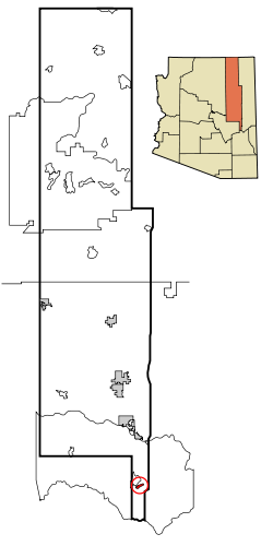 Lage im County und in Arizona
Basisdaten Staat: Vereinigte Staaten Bundesstaat: Arizona County: Koordinaten: 33° 48′ N, 109° 56′ W33.800277777778-109.928611111111597Koordinaten: 33° 48′ N, 109° 56′ W Zeitzone: Mountain Standard Time (UTC−7) Einwohner: 880 (Stand: 2000) Bevölkerungsdichte: 117,3 Einwohner je km² Fläche: 7,5 km² (ca. 3 mi²)
davon 7,5 km² (ca. 3 mi²) LandHöhe: 1597 m FIPS: 04-21310 GNIS-ID: 0025319 East Fork (Westliche Apachen: Hawú'ishįįhé) ist ein Census-designated place im Navajo County im US-Bundesstaat Arizona. East Fork hat 880 Einwohner auf einer Fläche von 7.5 km². East Fork liegt auf 1597 m.ü.M. in der Fort-Apache-Reservation im Süden des Countys.
Bildung
East Fork liegt im Whiteriver Unified School District.
Verkehr
Westlich von East Fork verläuft die Arizona State Route 73.
 Orte im Navajo County
Holbrook | Pinetop-Lakeside | Show Low | Snowflake | Taylor | Winslow | Chilchinbito | Cibecue | Dilkon | East Fork | First Mesa | Greasewood | Heber-Overgaard | Hotevilla-Bacavi | Jeddito | Kayenta | Keams Canyon | Kykotsmovi Village | McNary (auch im Apache County) | Oljato-Monument Valley | Pinon | Second Mesa | Shongopovi | Shonto | Whiteriver | Winslow West
Wikimedia Foundation.
Schlagen Sie auch in anderen Wörterbüchern nach:
East Fork, Arizona — Infobox Settlement official name = East Fork, Arizona settlement type = CDP imagesize = image caption = image imagesize = image caption = image mapsize = 250px map caption = Location in Navajo County and the state of Arizona mapsize1 = map… … Wikipedia
East Fork — is the name of the following places in the United States of America:*East Fork, Alaska *East Fork, Arizona *East Fork, California *East Fork Township, Montgomery County, Illinois *East Fork Township, Clinton County, Illinois *East Fork Township,… … Wikipedia
East Fork — ist der Name mehrerer Orte in den Vereinigten Staaten: East Fork (Alaska) East Fork (Arizona) East Fork (Kalifornien) East Fork (Pennsylvania) diverse East Fork Townships East Fork ist der Name mehrerer Gewässer in den Vereinigten Staaten: East… … Deutsch Wikipedia
East Fork — East Fork, AZ U.S. Census Designated Place in Arizona Population (2000): 880 Housing Units (2000): 228 Land area (2000): 2.876547 sq. miles (7.450223 sq. km) Water area (2000): 0.000000 sq. miles (0.000000 sq. km) Total area (2000): 2.876547 sq.… … StarDict's U.S. Gazetteer Places
East Fork, AZ — U.S. Census Designated Place in Arizona Population (2000): 880 Housing Units (2000): 228 Land area (2000): 2.876547 sq. miles (7.450223 sq. km) Water area (2000): 0.000000 sq. miles (0.000000 sq. km) Total area (2000): 2.876547 sq. miles… … StarDict's U.S. Gazetteer Places
Arizona locations by per capita income — Arizona has the twenty ninth highest per capita income in the United States of America, at $20,275 (2000). Its personal per capita income is $26,838 (2003). Arizona counties ranked by per capita income There are fifteen counties located in… … Wikipedia
Navajo County, Arizona — Historic Navajo County Courthouse and Museum in Holbrook, Arizona … Wikipedia
Liste der Städte in Arizona — Die folgende Liste zeigt alle Kommunen und Siedlungen in Arizona. Sie enthält sowohl Citys, Towns und Villages als auch Census designated places (CDP). Die obere Tabelle enthält die Städte mit mehr als 40.000 Einwohnern: Karte von Arizona … Deutsch Wikipedia
National Register of Historic Places listings in Navajo County, Arizona — Location of Navajo County in Arizona This is a list of the National Register of Historic Places listings in Navajo County, Arizona. It is intended to be a complete list of the properties and districts on the National Register of Historic Places… … Wikipedia
Passenger train stations in Arizona — NOTOC This is a list of Historic and Existing Passenger Train Stations in Arizona United States. The stations are sorted by location name. Select the first letter of the location from the following list.A B C D E F G H I J K L M N O P Q R S T U V … Wikipedia
East Fork (Arizona)


18+
© Academic, 2000-2026
- Kontaktieren Sie uns: Unterstützung, Werbung
Wörterbücher Export, schritte mit PHP, Joomla, Drupal, WordPress, MODx.