- Shonto
-
Shonto 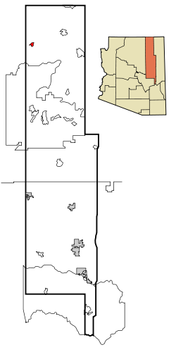 Lage im County und in Arizona
Basisdaten Staat: Vereinigte Staaten Bundesstaat: Arizona County: Koordinaten: 36° 36′ N, 110° 39′ W36.598333333333-110.658055555561902Koordinaten: 36° 36′ N, 110° 39′ W Einwohner: 568 (Stand: 2000) Bevölkerungsdichte: 48,1 Einwohner je km² Fläche: 11,9 km² (ca. 5 mi²)
davon 11,8 km² (ca. 5 mi²) LandHöhe: 1902 m Postleitzahl: 86054 Vorwahl: +1 928 FIPS: 04-66260 GNIS-ID: 0011241 Shonto (Navajo:Shą́ą́ʼtóhí) ist ein Census-designated place im Navajo County im US-Bundesstaat Arizona. Shonto hat 568 Einwohner auf einer Fläche von 11,8 km². Er liegt in der Navajo Nation auf 1902 m. Shonto wird vom U.S. Highway 160 und von der Arizona State Route 98 tangiert.
 Orte im Navajo County
Holbrook | Pinetop-Lakeside | Show Low | Snowflake | Taylor | Winslow | Chilchinbito | Cibecue | Dilkon | East Fork | First Mesa | Greasewood | Heber-Overgaard | Hotevilla-Bacavi | Jeddito | Kayenta | Keams Canyon | Kykotsmovi Village | McNary (auch im Apache County) | Oljato-Monument Valley | Pinon | Second Mesa | Shongopovi | Shonto | Whiteriver | Winslow West
Wikimedia Foundation.
Schlagen Sie auch in anderen Wörterbüchern nach:
Shonto — Shonto, AZ U.S. Census Designated Place in Arizona Population (2000): 568 Housing Units (2000): 220 Land area (2000): 4.567827 sq. miles (11.830617 sq. km) Water area (2000): 0.000000 sq. miles (0.000000 sq. km) Total area (2000): 4.567827 sq.… … StarDict's U.S. Gazetteer Places
Shonto, AZ — U.S. Census Designated Place in Arizona Population (2000): 568 Housing Units (2000): 220 Land area (2000): 4.567827 sq. miles (11.830617 sq. km) Water area (2000): 0.000000 sq. miles (0.000000 sq. km) Total area (2000): 4.567827 sq. miles… … StarDict's U.S. Gazetteer Places
Shonto (Arizona) — Shonto Lugar designado por el censo de los Estados Unidos … Wikipedia Español
Shonto, Arizona — Infobox Settlement official name = Shonto, Arizona settlement type = CDP imagesize = image caption = image imagesize = image caption = image mapsize = 250px map caption = Location in Navajo County and the state of Arizona mapsize1 = map caption1 … Wikipedia
86054 — Shonto, Az (Miscellaneous » ZIP Codes) … Abbreviations dictionary
Arizona State Route 98 — Karte … Deutsch Wikipedia
Navajo County, Arizona — Historic Navajo County Courthouse and Museum in Holbrook, Arizona … Wikipedia
Chilchinbito, Arizona — CDP Location in Navajo Count … Wikipedia
Dilkon, Arizona — CDP Location in Navajo County … Wikipedia
List of Indian reservations in the United States — This is a list of Indian reservations and other tribal homelands in the United States. In Canada, the Indian reserve is a similar institution.ReservationsMost of the tribal land base in the United States were set aside by the Federal government… … Wikipedia
Shonto


18+
© Academic, 2000-2024
- Kontaktieren Sie uns: Unterstützung, Werbung
Wörterbücher Export, schritte mit PHP, Joomla, Drupal, WordPress, MODx.