Frederiksted — Fort Fredrik Administration Pays … Wikipédia en Français
Frederiksted — ▪ United States Virgin Islands also called Westend town on the west coast of St. Croix, U.S. Virgin Islands, 17 miles (27 km) southwest of Christiansted. Historically, the town was a mercantile centre for the sugar based economy of St.… … Universalium
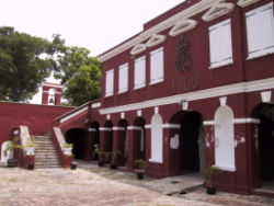
Frederiksted Historic District — Infobox nrhp2 | name =Frederiksted Historic District nrhp type = hd caption = location= Roughly bounded by Fisher St., the cemetery, Fort Frederick, Frederiksted, United States Virgin Islands lat degrees = 17 lat minutes = 42 lat seconds = 53 lat … Wikipedia
Frederiksted, United States Virgin Islands — Infobox Settlement name = official name = Frederiksted, United States Virgin Islands other name = native name = nickname = settlement type = total type = motto = imagesize = 250px image caption = Rooftops in Frederiksted, St. Croix. flag size =… … Wikipedia
Фредерикстед — (Frederiksted)Frederiksted, торговый центр на зап. побережье о.Св. Креста в архипелаге Виргинские о ва, США. Основан в 1751г. Ф. – гл. порт архипелага и основной пункт экспорта сахара … Страны мира. Словарь
00840 — Frederiksted, Vi (Miscellaneous » ZIP Codes) … Abbreviations dictionary
00841 — Frederiksted, Vi (Miscellaneous » ZIP Codes) … Abbreviations dictionary
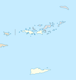
National Register of Historic Places listings in the United States Virgin Islands — Map of the United States Virgin Islands This is a list of the buildings, sites, districts, and objects listed on the National Register of Historic Places in the United States Virgin Islands. There are currently 86 listed sites spread across 16 of … Wikipedia
Saint Croix, U.S. Virgin Islands — Infobox Islands name = Saint Croix image caption = Saint Croix from space, January 1992 image size = locator Location map|US Virgin Islands|lat=17.75|long= 64.75 map custom = yes native name = native name link = nickname = Twin City location =… … Wikipedia
Saint Croix (Islas Vírgenes) — Saltar a navegación, búsqueda Mapa de las Islas Vírgenes de Estados Unidos Saint Croix (español: Santa Cruz) es una isla del Mar Caribe y un condado y distrito constituyente de los Estados U … Wikipedia Español