- Fujioka (Gunma)
-
Fujioka-shi
藤岡市
Geographische Lage in Japan 

Region: Kantō Präfektur: Gunma Koordinaten: 36° 16′ N, 139° 4′ O36.258611111111139.07444444444Koordinaten: 36° 15′ 31″ N, 139° 4′ 28″ O Basisdaten Fläche: 180,09 km² Einwohner: 67.775
(1. Juli 2011)Bevölkerungsdichte: 376 Einwohner je km² Gemeindeschlüssel: 10209-1 Symbole Baum: Campherbaum, Osmanthus Blume: Japanische Wisteria, Feuersalbei Rathaus Adresse: Fujioka City Hall
327 Nakakurisu
Fujioka-shi
Gunma 375-8601Webadresse: http://www.city.fujioka.gunma.jp Lage Fujiokas in der Präfektur Gunma 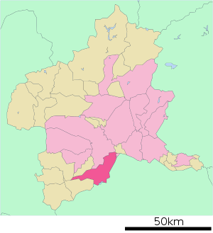
Fujioka (jap. 藤岡市, -shi) ist eine Stadt in der Präfektur Gunma auf Honshū, der Hauptinsel von Japan.
Inhaltsverzeichnis
Geographie
Fujioka liegt nördlich von Chichibu und südlich von Takasaki.
Verkehr
- Straße:
- Jōshinetsu-Autobahn
- Nationalstraße 17, nach Niigata
- Nationalstraße 254,354,462
- Zug:
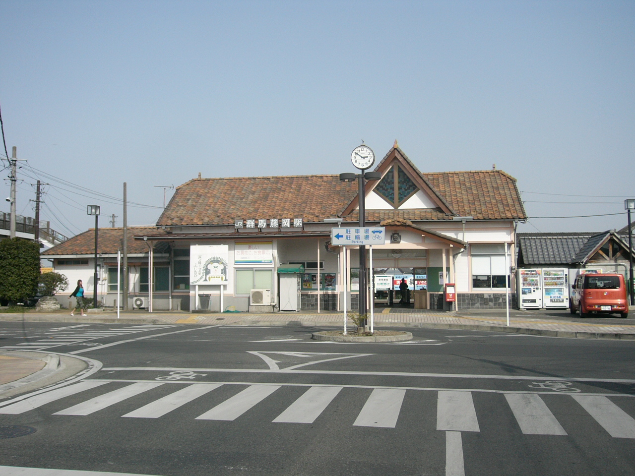
- JR Hachikō-Linie nach Hachioji oder Takasaki
Söhne und Töchter der Stadt
- Seki Takakazu (Wasan-Mathematiker)
Angrenzende Städte und Gemeinden
- Präfektur Gunma
- Takasaki
- Tamamura
- Kanna
- Kanra
- Shimonita
- Präfektur Saitama
Weblinks
 Commons: Fujioka – Sammlung von Bildern, Videos und Audiodateien
 Gemeinden und Landkreise in der Präfektur Gunma
Kreisfreie Städte (shi): Annaka | Fujioka | Isesaki | Kiryū | Maebashi (Verwaltungssitz) | Midori | Numata | Ōta | Shibukawa | Takasaki | Tatebayashi | Tomioka
Agatsuma-gun: Higashiagatsuma | Kusatsu | Naganohara | Nakanojō | Takayama | Tsumagoi | Kanra-gun: Kanra | Nammoku | Shimonita | Kitagumma-gun: Shintō | Yoshioka | Ōra-gun: Chiyoda | Itakura | Meiwa | Ōizumi | Ōra | Sawa-gun: Tamamura | Tano-gun: Kanna | Ueno | Tone-gun: Katashina | Kawaba | Minakami | Shōwa
Wikimedia Foundation.
Schlagen Sie auch in anderen Wörterbüchern nach:
Fujioka, Gunma — Japanese city| Name = Fujioka JapaneseName = 藤岡市| Region = Kanto Prefecture = Gunma Prefecture Area km2 = 180.09| Population = 70676 PopDate = May 1, 2008 Density km2 = 392.44 Mayor = Arai Toshiaki Coords = coord|36|16|N|139|4|E|region:JP… … Wikipedia
Fujioka — may refer to: *Fujioka, Aichi, a town located in Nishikamo District, Aichi, Japa *Fujioka, Gunma, a city in Gunma, Japan *Fujioka, Tochigi, a town located in Shimotsuga District, Tochigi, JapanPeople with the surname Fujioka*Hiroshi Fujioka, (b.… … Wikipedia
Fujioka — 藤岡市 Fujioka shi Geographische Lage in Japan … Deutsch Wikipedia
Gunma-Fujioka Station — infobox japan station caption= name= 群馬藤岡 namerom= Gunma Fujioka pref= Gunma district= city= Fujioka town= open= 1931 close= presentname= line= Hachikō Line operator= JR East bus=nihongo|Gunma Fujioka Station|群馬藤岡駅|Gunma Fujioka eki is a train… … Wikipedia
Gunma — Karte Basisdaten Verwaltungssitz: Maebashi Region: Kantō … Deutsch Wikipedia
Gunma — Préfecture de Gunma Préfecture de Gunma · 群馬県 Gunma ken Carte du Japon avec la Préfecture de Gunma mise en évidence. Pays … Wikipédia en Français
Gunma Prefecture — Infobox Prefecture Japan Name = Gunma Fullname = Gunma Prefecture JapaneseName = 群馬県 Rōmaji = Gunma ken Symbol = PrefSymbol Gunma.png Capital = Maebashi Region = Kantō Island = Honshū TotalArea = 6,363.16 AreaRank = 21st PCWater = 0.2 PopDate =… … Wikipedia
Kita-Fujioka Station — infobox japan station caption= Entrance to the station name= 北藤岡 namerom= Kita Fujioka pref= Gunma district= city= Fujioka town= open= 1961 close= presentname= line= Hachikō Line operator= JR East bus=nihongo|Kita Fujioka Station|北藤岡駅|Kita… … Wikipedia
Tano District, Gunma — Tano (多野郡; gun) is a district located in Gunma, Japan.As of 2003, the district had an estimated population of 49,743 and a density of 121.00 persons per km². The total area is 411.09 km².On January 1, 2006, the district lost Onishi when it merged … Wikipedia
Prefectura de Gunma — Gunma 群馬県 Gunma ken Prefectura de Japón … Wikipedia Español
- Straße:
Fujioka (Gunma)


18+
© Academic, 2000-2026
- Kontaktieren Sie uns: Unterstützung, Werbung
Wörterbücher Export, schritte mit PHP, Joomla, Drupal, WordPress, MODx.