- Ganassi (Lanao del Sur)
-
Municipality of Ganassi Lage von Ganassi in der Provinz Lanao del Sur 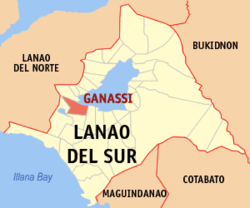
Basisdaten Bezirk: Autonomous Region in Muslim Mindanao Provinz: Lanao del Sur Barangays: 32 Distrikt: 2. Distrikt von Lanao del Sur PSGC: 153609000 Einkommensklasse: 5. Einkommensklasse Haushalte: 3038 Zensus 1. Mai 2000Einwohnerzahl: 25.456 Zensus 1. August 2007Koordinaten: 7° 50′ N, 124° 6′ O7.8333333333333124.1Koordinaten: 7° 50′ N, 124° 6′ O Postleitzahl: 9311 Bürgermeister: Baguio A. Macapodi Offizielle Webpräsenz: Ganassi Geographische Lage auf den Philippinen 

Ganassi Ganassi ist eine philippinische Stadtgemeinde in der Provinz Lanao del Sur. Nach dem Zensus vom 1. Mai 2000 hat sie 18.947 Einwohner in 3038 Haushalten.
Baranggays
Ganassi ist politisch in 32 Baranggays unterteilt.
- Bagoaingud
- Balintad
- Barit
- Bato Batoray
- Campong a Raya
- Gadongan
- Gui
- Linuk
- Lumbac
- Macabao
- Macaguiling
- Pagalongan
- Panggawalupa
- Pantaon A
- Para-aba
- Pindolonan
- Poblacion
- Baya
- Sogod Madaya
- Tabuan
- Taganonok
- Taliogon
- Masolun
- Lumbacaingud
- Sekun Matampay
- Dapaan
- Balintad A
- Barorao
- Campong Sabela
- Pangadapun
- Pantaon
- Pamalian
Städte und Stadtgemeinden in der Provinz Lanao del SurStädte: Marawi City
Stadtgemeinden: Bacolod-Kalawi | Balabagan | Balindong | Bayang | Binidayan | Buadiposo-Buntong | Bubong | Bumbaran | Butig | Calanogas | Ditsaan-Ramain | Ganassi | Kapai | Kapatagan | Lumba-Bayabao | Lumbaca-Unayan | Lumbatan | Lumbayanague | Madalum | Madamba | Maguing | Malabang | Marantao | Marogong | Masiu | Mulondo | Pagayawan | Piagapo | Picong | Poona Bayabao | Pualas | Saguiaran | Sultan Dumalondong | Tagoloan II | Tamparan | Taraka | Tubaran | Tugaya | Wao
Wikimedia Foundation.
Schlagen Sie auch in anderen Wörterbüchern nach:
Ganassi, Lanao del Sur — Ganassi is a 1st class municipality in the province of Lanao del Sur, Philippines. According to the 2000 census, it has a population of 18,947 people in 3,038 households.BarangaysGanassi is politically subdivided into 32 barangays. * Bagoaingud * … Wikipedia
Lanao del Sur — Localisation de la province de Lanao del Sur (en rouge) dans les Philippines. Administration Pays … Wikipédia en Français
Lanao del Sur — Lage von Lanao del Sur Lanao del Sur ist eine Provinz im Zentralteil der Insel Mindanao auf den Philippinen. Lanao del Sur gehört zum Bezirk ARMM, der Autonomous Region in Muslim Mindanao. Die Hauptstadt der Provinz liegt am Lake Lanao und heißt… … Deutsch Wikipedia
Lanao del Sur — Infobox Philippine province name = Lanao del Sur sealfile = Ph seal lanao del sur.png region = Autonomous Region in Muslim Mindanao (ARMM) capital = Marawi City founded = 1959 pop2000 = 800,162 pop2000rank = 29th largest popden2000 = 207… … Wikipedia
Malabang, Lanao del Sur — Malabang is a 4th class municipality in the province of Lanao del Sur, Philippines. According to the 2000 census, it has a population of 33,177 people in 4,883 households. Contents 1 Municipality Mayor Anwar Balindong 2 History … Wikipedia
Mulondo, Lanao del Sur — Mulondo formerly known as Bato Intan, geographically situated at the farthest East part of Masiu,one of the four (4) Principalities of Lanao (Pangampong A Ranao)the governing bodies of the Lanao Sultanate. Strategically located in the 1st… … Wikipedia
Marogong, Lanao del Sur — Marogong is a 4th class municipality in the province of Lanao del Sur, Philippines. According to the 2000 census, it has a population of 16,165 people in 2,209 households. Barangays Marogong is politically subdivided into 24 barangays. Balut… … Wikipedia
Kapatagan (Lanao del Sur) — Municipality of Kapatagan Lage von Kapatagan in der Provinz Lanao del Sur Basisdaten Bezirk … Deutsch Wikipedia
Taraka (Lanao del Sur) — Municipality of Taraka Lage von Taraka in der Provinz Lanao del Sur Basisdaten Bezirk … Deutsch Wikipedia
Maguing, Lanao del Sur — Maguing is a 3rd class municipality in the province of Lanao del Sur, Philippines. According to the 2000 census, it has a population of 18,095 people in 2,734 households. Contents 1 Barangays 2 History 3 … Wikipedia
Ganassi (Lanao del Sur)


18+
© Academic, 2000-2026
- Kontaktieren Sie uns: Unterstützung, Werbung
Wörterbücher Export, schritte mit PHP, Joomla, Drupal, WordPress, MODx.