Bumbaran

Bumbaran
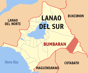
Municipality of Bumbaran
Lage von Bumbaran in der Provinz Lanao del Sur
Karte
Basisdaten
Bezirk: Autonomous Region in Muslim Mindanao
Provinz: Lanao del Sur
Barangays: 17
Distrikt: 1. Distrikt von Lanao del Sur
PSGC: 153637000
Einkommensklasse: 4. Einkommensklasse
Haushalte: 1133
Zensus 1. Mai 2000
Einwohnerzahl: 13.297
Zensus 1. August 2007
Koordinaten: 7° 48′ N, 124° 39′ O7.8124.65Koordinaten: 7° 48′ N, 124° 39′ O
Postleitzahl: 9320
Bürgermeister: Amstura C. Manabilang
Offizielle Webpräsenz: www.bumbaran-lds.gov.ph
Geographische Lage auf den Philippinen
Bumbaran (Philippinen)
Bumbaran
Bumbaran

Bumbaran ist eine philippinische Stadtgemeinde in der Provinz Lanao del Sur. Nach dem Zensus vom 1. Mai 2000 hat sie 6589 Einwohner in 1133 Haushalten.

Baranggays

Bumbaran ist politisch in 17 Baranggays unterteilt.

  • Poblacion (Apartfort)
  • Bagumbayan
  • Bandara-Ingud
  • Comara
  • Frankfort
  • Lambanogan
  • Lico
  • Mansilano
  • Natangcopan
  • Pagonayan
  • Pagalamatan
  • Piagma
  • Punud
  • Ranao-Baning
  • Salam
  • Sagua-an
  • Sumugot

Wikimedia Foundation.

Игры ⚽ Нужно сделать НИР?

Schlagen Sie auch in anderen Wörterbüchern nach:

  • Bumbaran — Original name in latin Bumbaran Name in other language Bumbaran State code PH Continent/City Asia/Manila longitude 7.8 latitude 124.65 altitude 1191 Population 0 Date 2011 07 31 …   Cities with a population over 1000 database

  • Bumbaran, Lanao del Sur — Bumbaran is a 4th class municipality in the province of Lanao del Sur, Philippines. According to the 2000 census, it has a population of 6,589 people in 1,133 households.BarangaysBumbaran is politically subdivided into 17 barangays.External… …   Wikipedia

  • Dagami, Leyte —   Municipality   Seal …   Wikipedia

  • Malabang, Lanao del Sur — Malabang is a 4th class municipality in the province of Lanao del Sur, Philippines. According to the 2000 census, it has a population of 33,177 people in 4,883 households. Contents 1 Municipality Mayor Anwar Balindong 2 History …   Wikipedia

  • PH-LAS — Lage von Lanao del Sur Lanao del Sur ist eine Provinz im Zentralteil der Insel Mindanao auf den Philippinen. Lanao del Sur gehört zum Bezirk ARMM, der Autonomous Region in Muslim Mindanao. Die Hauptstadt der Provinz liegt am Lake Lanao und heißt… …   Deutsch Wikipedia

  • Provinces of the Philippines — The provinces of the Philippines are the primary administrative divisions of the Philippines. There are 81 provinces, further subdivided into cities and municipalities. The National Capital Region is autonomous of provincial government. Each… …   Wikipedia

  • Lanao del Sur — Infobox Philippine province name = Lanao del Sur sealfile = Ph seal lanao del sur.png region = Autonomous Region in Muslim Mindanao (ARMM) capital = Marawi City founded = 1959 pop2000 = 800,162 pop2000rank = 29th largest popden2000 = 207… …   Wikipedia

  • Ditsaan-Ramain, Lanao del Sur — Ditsaan Ramain is a 4th class municipality in the province of Lanao del Sur, Philippines. According to the 2000 census, it has a population of 19,157 people in 2,682 households. Barangays Ditsaan Ramain is politically subdivided into 35 barangays …   Wikipedia

  • Maguing, Lanao del Sur — Maguing is a 3rd class municipality in the province of Lanao del Sur, Philippines. According to the 2000 census, it has a population of 18,095 people in 2,734 households. Contents 1 Barangays 2 History 3 …   Wikipedia

  • Marantao, Lanao del Sur — Marantao is a 3rd class municipality in the province of Lanao del Sur, Philippines. According to the 2000 census, it has a population of 24,647 people in 3,598 households. Barangays Marantao is politically subdivided into 34 barangays. Bacayawan… …   Wikipedia

Share the article and excerpts

Direct link
Do a right-click on the link above
and select “Copy Link”