- Hateruma
-
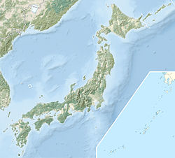
Hateruma Gewässer Ostchinesisches Meer Inselgruppe Yaeyama-Inseln Geographische Lage 24° 3′ 31″ N, 123° 46′ 50″ O24.058611111111123.78055555556Koordinaten: 24° 3′ 31″ N, 123° 46′ 50″ O Hateruma (jap. 波照間島, Hateruma-jima) ist die südlichste bewohnte Insel Japans. Zucker- und Ananasplantagen machen den größten Teil ihrer Industrie aus. Außerdem wird dort Awanami, ein Schnaps, der nur auf Hateruma hergestellt wird, gebrannt. Das Wasser Haterumas, dessen Farbe in Japan als Hateruma Blue bezeichnet wird, ist extrem klar und die Strände bestechen durch weißen Sand.
Siehe auch
Schlagen Sie auch in anderen Wörterbüchern nach:
Hateruma — (波照間島; Hateruma jima ; Yaeyama: Hatirōma Okinawan: Hatiruma ) is an island in the Yaeyama District of Okinawa Prefecture, Japan. Part of the town Taketomi, it is the southern most inhabited island in Japan at 24°2’25” north latitude, 123°47’16”… … Wikipedia
Hateruma — Monument au point le plus méridional du Japon Hateruma (波照間島; Hateruma jima) est une île dans le district de Yaeyama de la préfecture d Okinawa, Japon. Faisant partie de la ville de Taketomi, elle est l île habitée la plus méridionale du Japon.… … Wikipédia en Français
Hateruma — Isla Hateruma 波照間島; Hateruma jima / Hatirōma / Hatiruma Monumento en el punto más al sur de Japón Localización País … Wikipedia Español
Hateruma-jima — Hateruma (jap. 波照間島, Hateruma jima) ist die südlichste bewohnte Insel Japans. Zucker und Ananasplantagen machen den größten Teil ihrer Industrie aus. Außerdem wird dort Awanami, ein Schnaps, der nur auf Hateruma hergestellt wird, gebrannt. Das… … Deutsch Wikipedia
Hateruma Airport — Infobox Airport name = Hateruma Airport nativename a = 波照間空港 nativename r = Hateruma Kūkō IATA = HTR ICAO = RORH type = Public owner = operator = Okinawa Prefecture city served = Taketomi, Okinawa, Japan location = Hateruma elevation f = 43… … Wikipedia
Hateruma-jima — 24°04′N 123°47′E / 24.067, 123.783 … Wikipédia en Français
Flughafen Hateruma — 波照間空港 Hateruma Kūkō … Deutsch Wikipedia
Haterumajima — Hateruma (jap. 波照間島, Hateruma jima) ist die südlichste bewohnte Insel Japans. Zucker und Ananasplantagen machen den größten Teil ihrer Industrie aus. Außerdem wird dort Awanami, ein Schnaps, der nur auf Hateruma hergestellt wird, gebrannt. Das… … Deutsch Wikipedia
Ryukyu Air Commuter — Saltar a navegación, búsqueda Ryukyu Air Commuter Archivo:Archivo:RyukyuAirCommuterLogo.png Callsign RYUKYU Fundación 1985 … Wikipedia Español
Islas Yaeyama — (八重山諸島 Yaeyama shotō / Yaima / Ēma) Hateruma la isla mas al sur del Japón esta en las islas Localización geográf … Wikipedia Español

