- Hunza Peak
-
Hunza Peak 
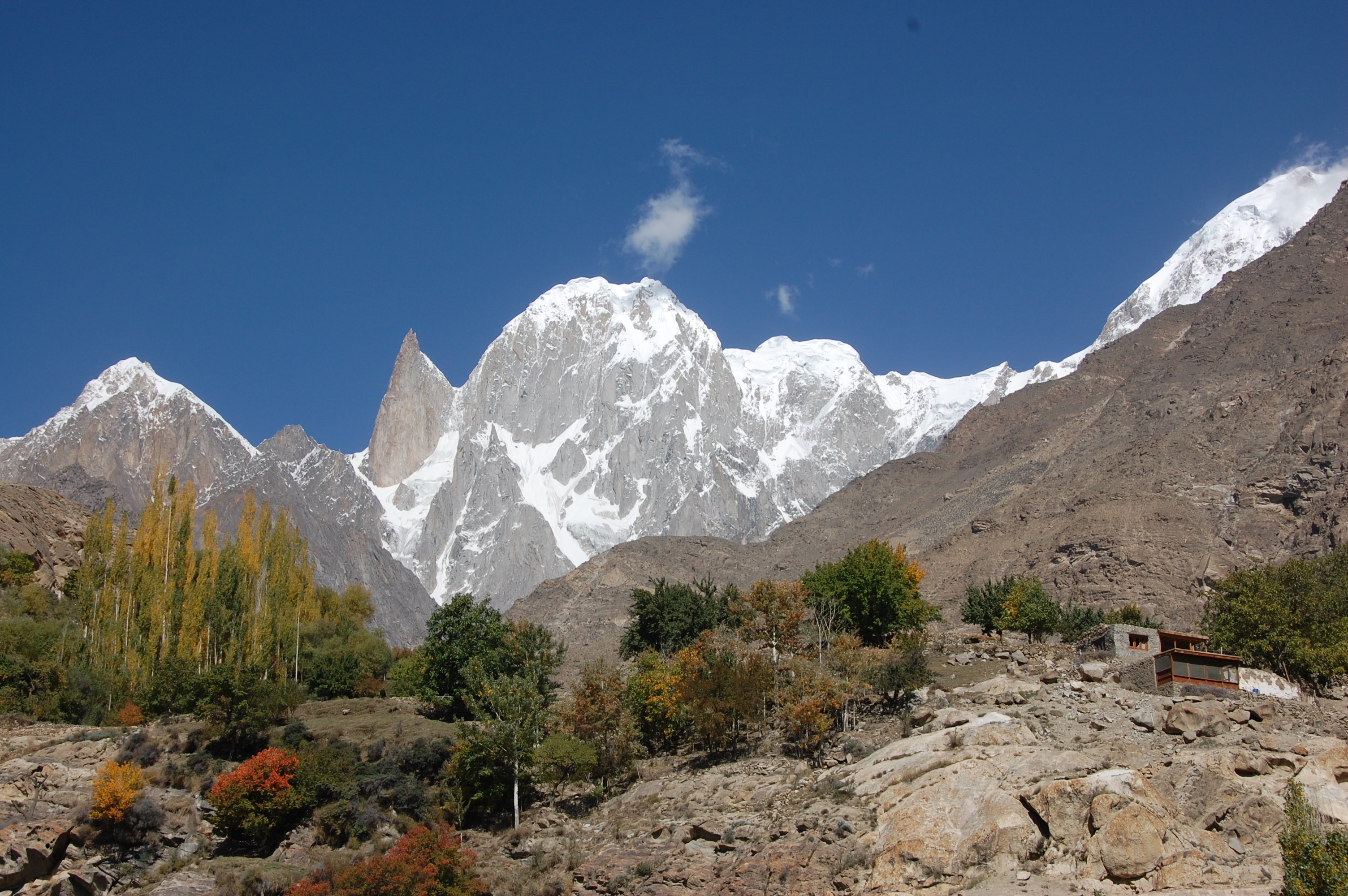
Hunza Peak (Mitte) und Bublimotin (Felsnadel, links)
Höhe 6.270 m Lage Gilgit-Baltistan, Pakistan Gebirge Batura Muztagh, Karakorum Geographische Lage 36° 22′ 12″ N, 74° 39′ 0″ O36.3774.656270Koordinaten: 36° 22′ 12″ N, 74° 39′ 0″ O 

Erstbesteigung 1991 durch britische Seilschaft Der Hunza Peak ist zusammen mit dem Bublimotin (Ladyfinger Peak) ein Berg im Batura Muztagh im westlichen Teilbereich des Karakorum.
Lage und Eigenschaften
Er liegt auf dem Südwestkamm des Ultar-Sar-Massivs, dem südöstlichen Ende des Hauptkammes des Batura Muztagh und erhebt sich auf der Nordwestseite des Hunzatals.
Der Nebengipfel Bublimotin ist eine bekannte scharfe Felsnadel, hat aber eine zu geringe Schartenhöhe um als eigenständiger Gipfel zu gelten.
Besteigungsgeschichte
1991 wurde der Gipfel von einer britischen Expedition mit Caradog Jones und Mick Fowler erstbestiegen. Im gleichen Jahr erreichte auch ein schwedisches Team über eine andere Route den Gipfel. 2008 scheiterte eine österreichische Expedition bestehend aus Harry Grün, Klaus Bonazza und Jakob Karner wegen schlechten Wetters an der noch undurchstiegenen 1200 m hohen Südwand des Hunza Peaks.[1][2]
Einzelnachweise
Kategorien:- Sechstausender
- Karakorum (Gebirge)
- Berg in Pakistan
- Berg in Asien

Wikimedia Foundation.