- Idaho Springs (Colorado)
-
Idaho Springs 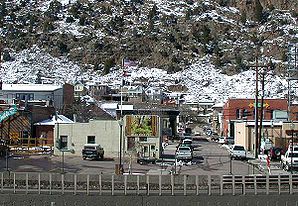
Idaho SpringsLage in Colorado 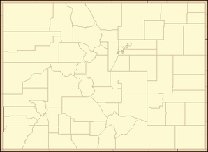

Idaho Springs Basisdaten Staat: Vereinigte Staaten Bundesstaat: Colorado County: Clear Creek County Koordinaten: 39° 45′ N, 105° 31′ W39.7425-105.51444444444Koordinaten: 39° 45′ N, 105° 31′ W Zeitzone: Mountain Standard Time (UTC−7) Einwohner: 1889 (Stand: 2000) Bevölkerungsdichte: 699,6 Einwohner je km² Fläche: 2,7 km²
davon 2,7 km² LandHöhe: 2294 m Postleitzahl: 80452 Vorwahl: +1 303, 720 FIPS: 08-38370 GNIS-ID: 204710 Webpräsenz: http://www.idahospringsco.com/ Bürgermeister: Dennis Lunbery Idaho Springs ist eine Stadt im Clear Creek County, Colorado, Vereinigte Staaten. Die Einwohnerzahl (Stand 2000) beträgt 1.889, die Flächenausdehnung 2,7 km². Es liegt etwa 45 km westlich von Denver.
Die Stadt wurde 1859 zu Beginn des Goldrausches in Colorado gegründet und erlangte regionale Bedeutung als Versorgungspunkt für die umliegenden Minen.
Heutzutage liegt der Ort an der Autobahn I-70 und fungiert als eine Art "Schlafstadt" für die Angestellten des nahegelegenen Loveland-Skigebietes.
Obwohl Idaho Springs die größte Gemeinde im Clear Creek County ist, so ist doch aus historischen Gründen Georgetown Verwaltungssitz des Countys.
Wikimedia Foundation.