Illinois State Route 101

Illinois State Route 101
Straßenschild der Illinois State Route 101
Basisdaten
Gesamtlänge:  19 mi/31 km
Eröffnung:  1924
Anfangspunkt:  US 67.svg US 67 bei Littleton
Endpunkt:  Illinois 61.svg IL 61 in Augusta
Countys:  Schuyler County
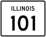
Hancock County

Die Illinois State Route 101 (kurz IL 101) ist eine State Route im US-Bundesstaat Illinois, die in Ost-West-Richtung verläuft.

Die State Route beginnt am U.S. Highway 67 nahe Littleton und endet nach 31 Kilometern in Augusta an der Illinois State Route 61. Westlich von Brooklyn beginnt die Illinois State Route 99. Kurz vor Augusta verläuft die IL 101 durch den Weinberg-King State Park.

Seit der Eröffnung der Straße im Jahr 1924 gab es keine Änderungen im Verlauf.

Siehe auch

Weblinks


Wikimedia Foundation.

Игры ⚽ Нужен реферат?

Schlagen Sie auch in anderen Wörterbüchern nach:

  • Illinois State Route 99 — Basisdaten Gesamtlänge:  32 mi/52 km Eröffnung:  …   Deutsch Wikipedia

  • Illinois Route 101 — Infobox Illinois state route article route = 101 prev route = 100 next route = 102 length mi = 19.43 length round = 2 length ref = cite web |author=Illinois Technology Transfer Center |url=http://www.dot.state.il.us/gist2/select.html |title=T2… …   Wikipedia

  • Illinois Route 99 — Basisdaten Gesamtlänge:  32 mi/52 km Eröffnung:  1936 Bundesstaat:  …   Deutsch Wikipedia

  • U.S. Route 101 in California — This article is about the section of U.S. Route 101 in California. For the entire length of the highway, see U.S. Route 101. U.S. Route 101 …   Wikipedia

  • Illinois Route 102 — Infobox Illinois state route article route = 102 length mi = 18.33 length round = 2 length ref = cite web |author=Illinois Technology Transfer Center |url=http://www.dot.state.il.us/gist2/select.html |title=T2 GIS Data |accessdate=2007 11 08… …   Wikipedia

  • Route sixtysix — Die Route 66 Die Route 66 galt ab 1926, abgesehen vom Lincoln Highway, als eine der ersten durchgehenden Straßenverbindungen zur US amerikanischen Westküste. Heute sind die verbliebenen Teilstücke der einst 2448 Meilen (3939,67 Kilometer) langen… …   Deutsch Wikipedia

  • Illinois Route 116 — Infobox Illinois state route article route = 116 length mi = 176.07 length round = 2 length ref = cite web |author=Illinois Technology Transfer Center |url=http://www.dot.state.il.us/gist2/select.html |title=T2 GIS Data |accessdate=2007 11 08… …   Wikipedia

  • Illinois Route 119 — Infobox Illinois state route article route = 119 length mi = 7.78 length round = 2 length ref = cite web |author=Illinois Technology Transfer Center |url=http://www.dot.state.il.us/gist2/select.html |title=T2 GIS Data |accessdate=2007 11 08 |date …   Wikipedia

  • Illinois Route 105 — Infobox Illinois state route article route = 105 length mi = 37.58 length round = 2 length ref = cite web |author=Illinois Technology Transfer Center |url=http://www.dot.state.il.us/gist2/select.html |title=T2 GIS Data |accessdate=2007 11 08… …   Wikipedia

  • Illinois Route 117 — Infobox Illinois state route article route = 117 length mi = 33.85 length round = 2 length ref = cite web |author=Illinois Technology Transfer Center |url=http://www.dot.state.il.us/gist2/select.html |title=T2 GIS Data |accessdate=2007 11 08… …   Wikipedia

Share the article and excerpts

Direct link
Do a right-click on the link above
and select “Copy Link”