Illinois State Route 104

Illinois State Route 104
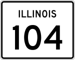
Straßenschild der Illinois State Route 104
Basisdaten
Gesamtlänge:  128 mi /206 km
Eröffnung:  1924
Anfangspunkt:  Downtown von Quincy
Endpunkt:  Illinois 29.svg IL 29 nördlich von Taylorville
Countys:  Adams County
Pike County
Morgan County
Sangamon County
Wichtige Stadt:  Jacksonville

Die Illinois State Route 104 (kurz IL 104) ist eine State Route im US-Bundesstaat Illinois, die in Ost-West-Richtung verläuft.

Die State Route beginnt in der Downtown von Quincy und endet nördlich von Taylorville an der Illinois State Route 29. Früher führte die IL 104 von Mount Sterling nach Taylorville. Der alte Abschnitt gehört seit 1937 zur Illinois State Route 99.

Siehe auch

Weblinks


Wikimedia Foundation.

Игры ⚽ Нужно сделать НИР?

Schlagen Sie auch in anderen Wörterbüchern nach:

  • Illinois State Route 99 — Basisdaten Gesamtlänge:  32 mi/52 km Eröffnung:  …   Deutsch Wikipedia

  • Illinois State Route 107 — Basisdaten Gesamtlänge:  19 mi/ 31 km Eröffnung:  …   Deutsch Wikipedia

  • Illinois State Route 54 — Basisdaten Gesamtlänge:  104 mi/ 167 km Eröffnung:  …   Deutsch Wikipedia

  • Illinois State Highway 107 — Basisdaten Gesamtlänge:  19 mi/ 31 km Eröffnung:  1924 Bundesstaat:  …   Deutsch Wikipedia

  • Illinois Route 104 — Infobox Illinois state route article route = 104 length mi = 125.91 length round = 2 length ref = cite web |author=Illinois Technology Transfer Center |url=http://www.dot.state.il.us/gist2/select.html |title=T2 GIS Data |accessdate=2007 11 08… …   Wikipedia

  • Illinois State Highway 54 — Basisdaten Gesamtlänge:  104 mi/ 167 km Eröffnung:  1972 Bundesstaat:  …   Deutsch Wikipedia

  • Illinois State Toll Highway Authority — The Illinois State Toll Highway Authority (often abbreviated ISTHA) is an instrumentality and administrative agency of the State of Illinois. The Tollway is governed by an 11 member board of directors. The Governor of the State of Illinois and… …   Wikipedia

  • Illinois Route 99 — Basisdaten Gesamtlänge:  32 mi/52 km Eröffnung:  1936 Bundesstaat:  …   Deutsch Wikipedia

  • Illinois Route 267 — Infobox Illinois state route article route = 267 length mi = 59 length round = 0 length ref = length notes = The distance reflects actual signage as of April 14, 2006. 2006 GIS data shows Illinois 267 to be convert|39.46|mi|km|2 long. direction b …   Wikipedia

  • Illinois Route 105 — Infobox Illinois state route article route = 105 length mi = 37.58 length round = 2 length ref = cite web |author=Illinois Technology Transfer Center |url=http://www.dot.state.il.us/gist2/select.html |title=T2 GIS Data |accessdate=2007 11 08… …   Wikipedia

Share the article and excerpts

Direct link
Do a right-click on the link above
and select “Copy Link”