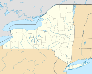
Amity (New York)

Amity (New York)
Amity
Amity (New York)
Amity
Amity
Lage in New York
Basisdaten
Staat: Vereinigte Staaten
Bundesstaat: New York
County:

Allegany County

Koordinaten: 42° 14′ N, 78° 2′ W42.226944444444-78.031944444444422Koordinaten: 42° 14′ N, 78° 2′ W
Zeitzone: Eastern Standard Time (UTC−5)
Einwohner: 2245 (Stand: 2000)
Bevölkerungsdichte: 25,1 Einwohner je km²
Fläche: 89,7 km² (ca. 35 mi²)
davon 89,4 km² (ca. 35 mi²) Land
Höhe: 422 m
FIPS: 36-02011
GNIS-ID: 0978676

Amity ist eine Stadt im Allegany County, New York, Vereinigte Staaten. Während der Volkszählung im Jahr 2000 hatte die Stadt 2.245 Einwohner. Der Name Amity bedeutet Freundschaft.

Inhaltsverzeichnis

Geschichte

Gegründet wurde die Stadt 1830 aus zwei Stadtteilen (Angelica und Scio), wobei die ersten Siedler sich bereits 1804 niederließen.

Geographie

Die Stadt umfasst 89,7 km², davon sind 89,5 km² Landmasse und 0,2 km² Wasser.

Der Genesee River fließt in nördlicher Richtung durch die Stadt.

Demographie

Die 2.245 Einwohner leben in 885 Haushalten und 601 Familien. Die Bevölkerungsdichte beträgt 25,1 Einwohner/km².

Söhne und Töchter der Stadt

Hamilton Ward, Kongreßmann und Richter.

Trivia

Die Stadt wurde durch den Film Der weiße Hai bekannt. Tatsächlich liegt Amity, New York jedoch nicht an der Küste. Die im Film gezeigte Insel Amity Island ist rein fiktiv, die Dreharbeiten fanden auf Martha’s Vineyard statt.[1]

Weblinks

Quellen

  1. http://en.wikipedia.org/wiki/Amity_Island

Wikimedia Foundation.

Игры ⚽ Нужно сделать НИР?

Schlagen Sie auch in anderen Wörterbüchern nach:

  • Amity, New York — For the hamlet in Orange County, see Amity, Orange County, New York Infobox Settlement official name = Amity, New York settlement type = Town nickname = motto = imagesize = image caption = image |pushpin pushpin label position = pushpin map… …   Wikipedia

  • Amity, Orange County, New York — Infobox Settlement name = Amity, New York settlement type = Hamlet nickname = motto = imagesize = image caption = image pushpin pushpin label position = none pushpin map caption = Location of Amity in New York pushpin mapsize =subdivision type =… …   Wikipedia

  • New Windsor, New York —   Town   …   Wikipedia

  • New Hudson, New York —   Town   …   Wikipedia

  • New York State Route 244 — NYS Route 244 Route information Maintained by NYSDOT Length: 15.80 mi[ …   Wikipedia

  • New York City ethnic enclaves — Since its founding in 1625 by Dutch traders as New Amsterdam, New York City has been a major destination for immigrants of many nationalities, naturally forming ethnic enclaves, neighborhoods dominated by one ethnicity.[1][2] Freed African… …   Wikipedia

  • New York State Route 19 — NY 19 redirects here. NY 19 may also refer to New York s 19th congressional district. This article is about the current alignment of NY 19. For the former alignment of NY 19 in Ulster and Delaware Counties, see New York State Route 19 (1924–1930) …   Wikipedia

  • New York State Route 408 — This article is about the current alignment of NY 408. For the former alignment of NY 408 in Franklin County, see New York State Route 408 (1930–1938). NYS Route 408 Route information Maintained by NYSDOT …   Wikipedia

  • New York State Route 446 — NYS Route 446 Map of Allegany and Cattaraugus Counties with NY 446 highlighted in red Route inf …   Wikipedia

  • New Windsor (CDP), New York — Coordinates: 41°29′15″N 74°01′08″W / 41.4875°N 74.01889°W / 41.4875; 74.01889 …   Wikipedia

Share the article and excerpts

Direct link
Do a right-click on the link above
and select “Copy Link”