- Katagami (Akita)
-
Katagami-shi
潟上市

Geographische Lage in Japan Region: Tōhoku Präfektur: Akita Koordinaten: 39° 53′ N, 139° 59′ O39.883333333333139.98861111111Koordinaten: 39° 53′ 0″ N, 139° 59′ 19″ O Basisdaten Fläche: 97,96 km² Einwohner: 34.460
(1. Juli 2011)Bevölkerungsdichte: 352 Einwohner je km² Gemeindeschlüssel: 05211-6 Rathaus Adresse: Katagami City Hall
47-100, Aza Kamiegawa, Tennō
Katagami-shi
Akita 010-0201Webadresse: http://www.city.katagami.akita.jp Lage Katagamis in der Präfektur Akita 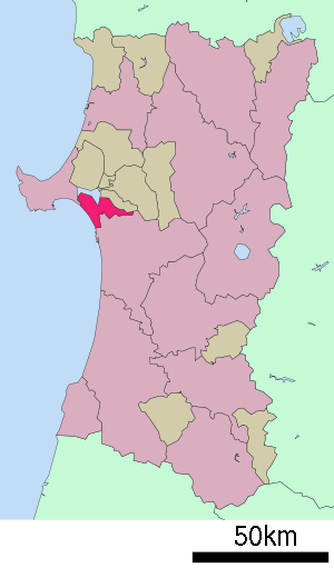
Katagami (jap. 潟上市, -shi) ist eine Stadt in der Präfektur Akita auf Honshu, der Hauptinsel von Japan.
Inhaltsverzeichnis
Geographie
Katagami liegt nördlich von Akita am Japanischen Meer.
Geschichte
Die Stadt Kagagami wurde am 22. März 2005 aus dem Zusammenschluss der Gemeinden Tennō (天王町, -machi), Iitagawa (飯田川町, -machi) und Shōwa (昭和町, -machi) im Landkreis Minami-Akita gegründet.
Verkehr
- Zug:
- JR Ōu-Hauptlinie
- JR Oga-Linie
- Straße:
- Akita-Autobahn
- Nationalstraße 7: nach Aomori und Niigata
- Nationalstraße 101
- Raststätten:
- Showa; an der Route 7 ("Blume Messe Akita")
- Tenno; an der Route 101 ("Greenland")
Söhne und Töchter der Stadt
- Kazushi Sakuraba (Wrestler)
Angrenzende Städte und Gemeinden
Weblinks
 Commons: Katagami – Sammlung von Bildern, Videos und Audiodateien
 Gemeinden und Landkreise in der Präfektur Akita
Kreisfreie Städte (shi): Akita (Verwaltungssitz) | Daisen | Katagami | Kazuno | Kita-Akita | Nikaho | Noshiro | Oga | Ōdate | Semboku | Yokote | Yurihonjō | Yuzawa
Kazuno-gun: Kosaka | Kitaakita-gun: Kamikoani | Minamiakita-gun: Gojōme | Hachirogata | Ikawa | Ōgata | Ogachi-gun: Higashinaruse | Ugo | Senboku-gun: Misato | Yamamoto-gun: Fujisato | Happo | Mitane
Wikimedia Foundation.
Schlagen Sie auch in anderen Wörterbüchern nach:
Katagami, Akita — Infobox City Japan Name= Katagami City JapaneseName= 潟上市 Map Region= Tōhoku Prefecture= Akita prefecture District= Area km2= 97.96 PopDate= 2006 Population= 35,560 Density km2= 363.01 Tree= Flower= Bird= Symbol SymbolDescription= Mayor=… … Wikipedia
Katagami — 潟上市 Katagami shi … Deutsch Wikipedia
Akita (Stadt) — 秋田市 Akita shi Geographische Lage in Japan … Deutsch Wikipedia
Akita (Akita) — Akita shi 秋田市 Geographische Lage in Japan … Deutsch Wikipedia
Akita, Akita — Japanese city| Name = Akita City JapaneseName = 秋田市| Region = Tōhoku Prefecture = Akita prefecture Area km2 = 905.67 | Population = 335,455 PopDate = 2005 Density km2 = 370 Mayor = Norihisa Satake Coords= LatitudeDegrees= 39 LatitudeMinutes= 43… … Wikipedia
Kitaakita (Akita) — 北秋田市 Kita Akita shi … Deutsch Wikipedia
Shōwa, Akita — Shōwa (昭和町; machi) was a town located in Minamiakita District, Akita, Japan.On March 222005, the towns of Tennō, Iitagawa and Shōwa merged together to form the city of Katagami, Akita.In 2003, the town had an estimated population of 8,685 and a… … Wikipedia
Tennō, Akita — Ten nou (天王町; machi) was a town located in Minamiakita District, Akita, Japan.On March 222005, the towns of Tennō, Iitagawa and Shōwa merged to form the city of Katagami, Akita.In 2003, the town had an estimated population of 22,115 and a density … Wikipedia
Iitagawa, Akita — Iitagawa (飯田川町; machi) was a town located in Minamiakita District, Akita, Japan.On March 222005, the towns of Tennō, Iitagawa and Shōwa merged together to form the city of Katagami, Akita.In 2003, the town had an estimated population of 4,929 and … Wikipedia
Minamiakita District, Akita — Minamiakita (南秋田郡, Minamiakita gun?) is a district located in Akita, Japan. As of 2003, the district has an estimated population of 28,411. The total area is 454.97 km². Towns and villages Gojōme Hachirōgata Ikawa … Wikipedia
- Zug:
Katagami (Akita)


18+
© Academic, 2000-2026
- Kontaktieren Sie uns: Unterstützung, Werbung
Wörterbücher Export, schritte mit PHP, Joomla, Drupal, WordPress, MODx.