Keezer See

Keezer See
Keezer See

Photo-request.svg

Bild gesucht 

BW

Geographische Lage Landkreis Ludwigslust-Parchim
Zuflüsse diverse Bäche
Abfluss Bach zum Mühlenbach
Orte am Ufer Häven, Keez
Größere Städte in der Nähe Brüel
Daten
Koordinaten 53° 44′ 9″ N, 11° 37′ 54″ O53.73591944444411.63177522.6Koordinaten: 53° 44′ 9″ N, 11° 37′ 54″ O
Keezer See (Mecklenburg-Vorpommern)
Keezer See
Höhe über Meeresspiegel 22,6 m ü. NHN
Fläche 1,17 km²f5
Länge 2,99 kmf6
Breite 650 mf7
Umfang 8,2 kmf9

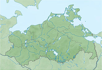
Der Keezer See ist ein See auf dem Gemeindegebiet von Brüel und Langen Jarchow in Mecklenburg-Vorpommern innerhalb der Sternberger Seenlandschaft.

Der See entstand in der Pommerschen Staffel der Weichseleiszeit zwischen Sander der Haupteisrandlage und Grundmoräne des maximalen Eisvorstoßes.

Der namensgebende Ort Keez liegt auf einer Halbinsel am südlichen Ufer des Sees. Am Nordufer liegt der Langen-Jarchower Ortsteil Häven.

Der nährstoffreiche Flachsee hat bei einer Ausdehnung von etwa drei Kilometern in Ost-West-Richtung eine Breite von maximal 650 Metern und eine Fläche von 117 Hektar. Die Wasserfläche liegt 20,1 m ü. NHN. Die Umgebung des Sees wird landwirtschaftlich genutzt. Das Angeln ist möglich.

Das Ufer ist teilweise mit einem schmalen Waldstreifen bewachsen.


Wikimedia Foundation.

Игры ⚽ Поможем написать реферат

Schlagen Sie auch in anderen Wörterbüchern nach:

  • Liste der Seen in Mecklenburg-Vorpommern — Die flächengrößten Seen in Mecklenburg Vorpommern See Fläche in km² Müritz 117,00 Schweriner See 61,54 Plauer See 38,40 Kummerower See 32,55 Kleiner Jasmunder Bodden[1] …   Deutsch Wikipedia

  • Brüel — Wappen Deutschlandkarte …   Deutsch Wikipedia

  • Zahrensdorf — Wappen Deutschlandkarte …   Deutsch Wikipedia

  • Langen Jarchow — Wappen Deutschlandkarte …   Deutsch Wikipedia

  • Boonton, New Jersey — see also: Boonton Township, New Jersey Infobox Settlement official name = Boonton, New Jersey settlement type = Town nickname = motto = imagesize = image caption = image mapsize = 250 px map caption = Boonton highlighted in Morris County. Inset… …   Wikipedia

  • Liste der Baudenkmale in Brüel — In der Liste der Baudenkmale in Brüel sind alle Baudenkmale der Stadt Brüel (Landkreis Ludwigslust Parchim) und ihrer Ortsteile aufgelistet (Stand: 17. August 2009). Inhaltsverzeichnis 1 Brüel 2 Alt Necheln 3 Golchen 4 Keez …   Deutsch Wikipedia

  • DIW Records — is a Japanese record label. It is a subsidiary label of Disc Union and specializes in jazz and avant garde music.[1] Kazunori Sugiyama was an executive producer for the label before starting Tzadik Records with John Zorn. Discography Catalog… …   Wikipedia

  • Music of The Lord of the Rings film trilogy — This article is about the music of The Lord of the Rings film trilogy. For the concert band composition by Johan de Meij, see Symphony No. 1 The Lord of the Rings . The music of the The Lord of the Rings film trilogy was composed, orchestrated,… …   Wikipedia

  • Eau Claire, Wisconsin — Infobox Settlement official name = Eau Claire, Wisconsin settlement type = City nickname = motto = imagesize = 250px image caption = Barstow St. flag size = image seal size = image shield = shield size = image blank emblem = blank emblem size =… …   Wikipedia

  • List of Moog synthesizer players — This is a list of notable musicians who use Moog synthesizers. Only add names here if the person has their own article on Wikipedia, please. Anything else will be removed. Contents: Top · 0–9 A B C D E F G H I J K L M N O P Q R S T U V W X Y …   Wikipedia

Share the article and excerpts

Direct link
Do a right-click on the link above
and select “Copy Link”