Keya Paha River

Keya Paha River
Keya Paha River
Verlauf des Keya Paha River

Verlauf des Keya Paha River

DatenVorlage:Infobox Fluss/GKZ_fehlt
Lage South Dakota, Nebraska (USA)
Flusssystem Niobrara RiverMissouri RiverMississippi RiverVorlage:Infobox Fluss/FLUSSSYSTEM_falsch

Vorlage:Infobox Fluss/ABFLUSSWEG_fehlt

Quelle im südlichen South Dakota
43° 13′ 38″ N, 100° 23′ 18″ W43.227222222222-100.38833333333
Vorlage:Infobox Fluss/QUELLHÖHE_fehlt
Mündung in den Niobrara River in der Nähe von Butte, NE
42.898333333333-98.985

42° 53′ 54″ N, 98° 59′ 6″ W42.898333333333-98.985
Vorlage:Infobox Fluss/MÜNDUNGSHÖHE_fehltVorlage:Infobox Fluss/HÖHENUNTERSCHIED_fehlt
Länge 163 kmVorlage:Infobox Fluss/NACHWEISE_fehlenVorlage:Infobox Fluss/EINZUGSGEBIET_fehlt

Vorlage:Infobox Fluss/ABFLUSS_fehltVorlage:Infobox Fluss/BILD_fehlt


Keya Paha River

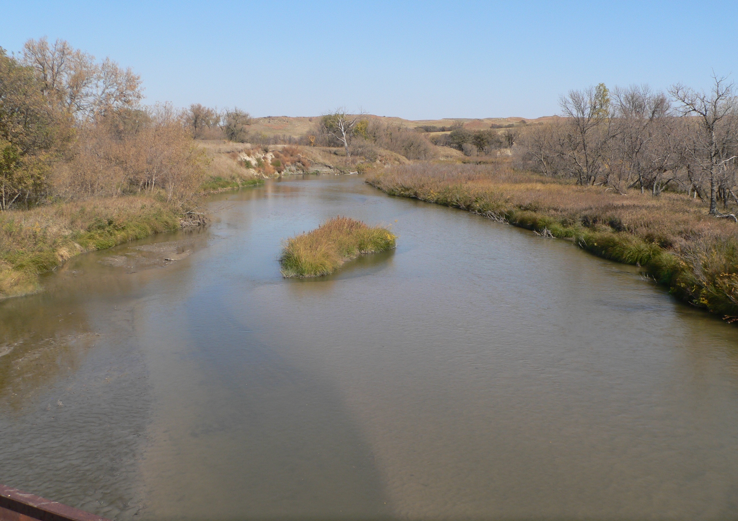
Der Keya Paha River ist ein Zufluss des Niobrara Rivers, schätzungsweise 163 km lang und fließt durch die US-Staaten South Dakota und Nebraska.

Flussverlauf

Der Keya Paha River entspringt in der Prärie des südöstlichen South Dakota, im Rosebud-Indianerreservat, in Todd County, nahe Antelope, SD. Anschließend fließt er ostsüdöstlich in den nordöstlichen Teil Nebraskas und vereinigt sich mit dem Niobrara River 16 km westlich von Butte, NE.

Zwischen 1861 und 1882 markierte die Strecke des Keya Paha von dem 43° N bis zu seinem Zusammenfluss mit dem Niobrara die Grenze zwischen Nebraska und dem Dakota-Territorium.

Siehe auch


Wikimedia Foundation.

Игры ⚽ Нужен реферат?

Schlagen Sie auch in anderen Wörterbüchern nach:

  • Keya Paha River — The Keya Paha River is a tributary of the Niobrara River, approximately 101 mi (163 km) long, in the U.S. states of South Dakota and Nebraska.It rises in the prairie country of southeastern South Dakota, on the Rosebud Indian Reservation in Todd… …   Wikipedia

  • Keya Paha County — courthouse in Springview Verwaltung US Bundesstaat: Nebraska …   Deutsch Wikipedia

  • Keya Paha County, Nebraska — Infobox U.S. County county = Keya Paha County state = Nebraska founded = 1884 seat wl = Springview largest city wl = Springview area total sq mi =774 area land sq mi =773 area water sq mi =1 area percentage = 0.13% census yr = 2000 pop = 983… …   Wikipedia

  • Condado de Keya Paha — Condado de los Estados Unidos …   Wikipedia Español

  • Niobrara River — River The Niobrara at its confluence with the Missouri. The Niobrara r …   Wikipedia

  • Niobrara River — Verlauf des Niobrara River Daten Gewässerkennzahl US …   Deutsch Wikipedia

  • Niobrara National Scenic River — IUCN Category III (Natural Monument) …   Wikipedia

  • North Fork Republican River — North Fork Republican River[1] Origin 39°59′58″N 102°27′14″W …   Wikipedia

  • National Register of Historic Places listings in Nebraska — …   Wikipedia

  • National Register of Historic Places listings in Tripp County, South Dakota — Location of Tripp County in South Dakota This is a list of the National Register of Historic Places listings in Tripp County, South Dakota. This is intended to be a complete list of the properties on the National Register of Historic Places in… …   Wikipedia

Share the article and excerpts

Direct link
Do a right-click on the link above
and select “Copy Link”