Kontovazena

Kontovazena
Gemeinde Kondovazena
Δήμος Κοντοβάζαινας
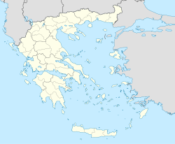
Kondovazena (Griechenland)
DEC
Basisdaten
Staat: Griechenland
Verwaltungsregion: Peloponnes
Präfektur: Arkadien
Geographische Koordinaten: 37° 48′ N, 21° 54′ O37.821.97Koordinaten: 37° 48′ N, 21° 54′ O
Höhe ü. d. M.: 960–1080 m
Fläche: f4137,5 km²
Einwohner: f22.048 (2001[1])
Bevölkerungsdichte: 14,9 Ew./km²
Sitz: Kondovazena
LAU-1-Code-Nr.: 120900
Gemeindegliederung: 9 Gemeindeteilef7
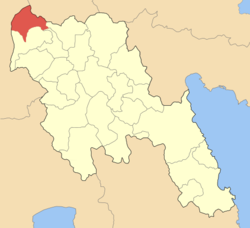
Lage in der Präfektur Arkadien
Bild:Dimos_Kontovazenis.png

f9f10f3

Kondovazena (griechisch Κοντοβάζαινα (f. sg.), auch Kontovazena) ist eine Gemeinde im Hochland von Arkadien auf dem Peloponnes in Griechenland. Verwaltungssitz ist der gleichnamige Ort.

Einzelnachweise

  1. Angaben des griechischen Innenministeriums

Wikimedia Foundation.

Игры ⚽ Поможем написать курсовую

Schlagen Sie auch in anderen Wörterbüchern nach:

  • Arcadie — 37°35′N 22°15′E / 37.583, 22.25 …   Wikipédia en Français

  • Arcadia — Para otros usos de este término, véase Arcadia (desambiguación). Unidad periférica de Arcadia Arcadia Unidad periférica de Grecia …   Wikipedia Español

  • List of postal codes in Greece — The Greek postal code system is is administered by ELTA (Ελληνικά Ταχυδρομεία, Hellenic Post). Each city street or rural region has a unique five digit number. The first three digits identify the city, municipality or prefecture. In major cities …   Wikipedia

  • Kondovazena — Stadtgemeinde Kondovazena (1997–2010) Δήμος Κοντοβαζαίνης …   Deutsch Wikipedia

Share the article and excerpts

Direct link
Do a right-click on the link above
and select “Copy Link”