- Lemon Township (Ohio)
-
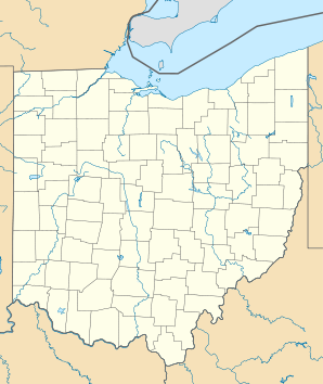
Lemon Township Lage in OhioBasisdaten Gründung: 1803 Staat: Vereinigte Staaten Bundesstaat: Ohio County: Koordinaten: 39° 27′ N, 84° 24′ W39.454722222222-84.392777777778198Koordinaten: 39° 27′ N, 84° 24′ W Zeitzone: Eastern Standard Time (UTC−5) Einwohner: 8607 (Stand: 2000) Bevölkerungsdichte: 225,9 Einwohner je km² Fläche: 39,1 km² (ca. 15 mi²)
davon 38,1 km² (ca. 15 mi²) LandHöhe: 198 m Vorwahl: +1 513 FIPS: 39-42672 GNIS-ID: 1085811
Townships des Butler CountysLemon Township ist eines von dreizehn Townships des Butler Countys im US-Bundesstaat Ohio. Nach der Volkszählung im Jahr 2000 waren hier 8607 Einwohner registriert.[1]
Geografie
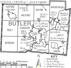
Lemon Township liegt im Osten des Butler Countys im Südwesten von Ohio und grenzt im Uhrzeigersinn an die Townships: Turtlecreek Township im Warren County, Liberty Township und Madison Township.
Verwaltung
Das Township wird durch ein Board of Trustees, bestehend aus drei gewählten Mitgliedern, verwaltet. Zwei Personen werden jeweils im Jahr nach der Präsidentschaftswahl gewählt und eine jeweils im Jahr davor. Die Amtszeit dauert in der Regel vier Jahre und beginnt jeweils am 1. Januar. Daneben gibt es noch einen Township Clerk (zuständig für Finanzen und Budget), der ebenfalls im Jahr vor der Präsidentschaftswahl auf eine vierjährige Amtszeit gewählt wird. Dessen Amtszeit beginnt jeweils am 1. April.
Einzelnachweise
Schlagen Sie auch in anderen Wörterbüchern nach:
Lemon Township — heißen Lemon Township (Ohio) im Butler County Lemon Township (Pennsylvania) im Wyoming County (Pennsylvania) Diese Seite ist eine Begriffsklärung zur Unterscheidung mehrerer mit demselben Wort bezeichne … Deutsch Wikipedia
Lemon Township, Butler County, Ohio — Infobox Settlement official name = Lemon Township, Butler County, Ohio settlement type = Township nickname = motto = imagesize = 250px image caption = Countryside in Lemon Township image mapsize = 250px map caption = Municipalities and townships… … Wikipedia
Ohio State Route 4 — State Route 4 Route information Maintained by ODOT Length: 206.51 mi[1] … Wikipedia
Ohio Derby — Grade III race Ohio Derby Location Thistledown Racecourse North Randall, Ohio Inaugurated … Wikipedia
Ohio high school athletic conferences — This is a list of high school athletic conferences in Ohio.[1] Because the names of localities and their corresponding high schools do not always match and because there is often a possibility of ambiguity with respect to either the name of a… … Wikipedia
List of Ohio townships — The List of Ohio Townships provides an alphabetic list of the 1362 current and historic townships in Ohio. While some have been totally absorbed into cities or towns, the list does not give historic names for any that were renamed. See: List of… … Wikipedia
List of townships in Ohio — The List of Ohio Townships provides an alphabetic list of the 1362 current and historic townships in Ohio. While some have been totally absorbed into cities or towns, the list does not give historic names for any that were renamed. See: List of… … Wikipedia
National Register of Historic Places listings in Butler County, Ohio — Location of Butler County in Ohio This is a list of the National Register of Historic Places listings in Butler County, Ohio. This is intended to be a complete list of the properties and districts on the National Register of Historic Places in… … Wikipedia
Madison Township, Butler County, Ohio — Infobox Settlement official name = Madison Township, Ohio settlement type = Township nickname = motto = imagesize = image caption = image mapsize = 250x200px map caption = Municipalities and townships of Butler County. mapsize1 = map caption1 =… … Wikipedia
Middletown, Ohio — City Aerial view of Middletown … Wikipedia


