Lunsar

Lunsar
Lunsar
Lunsar (Sierra Leone)
Lunsar
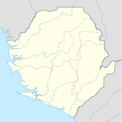
Lunsar
Lage in Sierra LeoneSierra Leone Sierra Leone
8° 41′ N, 12° 32′ W8.6881-12.535555Koordinaten: 8° 41′ N, 12° 32′ W
Basisdaten
Provinz: Nord-Provinz
Distrikt: Port Loko
Einwohner (2010, geschätzt) 23.890[1]

Lunsar ist eine Stadt in Sierra Leone. Sie liegt im Distrikt Port Loko in der Nord-Provinz.

Die Stadt wird mehrheitlich von Temne bewohnt. Wegen ihrer Bedeutung sind allerdings auch zahlreiche Angehörige anderer Volksgruppen zugewandert. Die Bevölkerung wuchs von 12.132 Personen 1963 auf 16.723 im Jahre 1974 an. Durch die Schließung der Minen trat danach eine Stagnation ein. 1985 wurden 16.073 Menschen gezählt. 2010 schätzte man die Einwohnerzahl auf 23.890 Personen [1].

Lunsar liegt an der Straße von der Landeshauptstadt Freetown nach Makeni. Wirtschaftlich bedeutend war früher der Eisenerzabbau im sechs Kilometer östlich gelegenen Magampa.

Heute ist der Ort Markt- und Umschlagplatz für Reis, Palmöl und Palmkerne.

In der Stadt gibt es ein privat (römisch-katholisch) geführtes Krankenhaus.

Quellen

  1. a b World Gazetteer: Lunsar. Abgerufen am 3. Januar 2010 (deutsch, englisch, französisch, spanisch).

Wikimedia Foundation.

Игры ⚽ Поможем написать курсовую

Schlagen Sie auch in anderen Wörterbüchern nach:

  • Lunsar — Infobox Settlement official name = PAGENAME other name = native name = nickname = settlement type = motto = imagesize = image caption = flag size = image seal size = image shield = shield size = image blank emblem = blank emblem type = blank… …   Wikipedia

  • Lunsar — Original name in latin Lunsar Name in other language Lansar, Lunsar, Lunsare, Лунсаре State code SL Continent/City Africa/Freetown longitude 8.68333 latitude 12.53333 altitude 65 Population 22461 Date 2012 01 18 …   Cities with a population over 1000 database

  • Lunsar — ▪ Sierra Leone       town, west central Sierra Leone, western Africa. A traditional trade centre of the Marampa–Masimera chiefdom for rice and palm oil and kernels, it developed after 1933 with the exploitation of iron ore, mined at Marampa, 4… …   Universalium

  • Port Loko District — Infobox City official name = Port Loko District nickname = | subdivision type = Country subdivision type1 = Capital subdivision type2 = Province subdivision name = Sierra Leone subdivision name1 = Port Loko subdivision name2 = Northern Province… …   Wikipedia

  • Sierra Leone — Sierra Leonean /lee oh nee euhn/. /lee oh nee, lee ohn / an independent republic in W Africa: member of the Commonwealth of Nations; formerly a British colony and protectorate. 4,891,546; 27,925 sq. mi. (72,326 sq. km). Cap.: Freetown. * * *… …   Universalium

  • List of cities in Sierra Leone — This is a list of cities and towns in Sierra Leone.Largest cities#Freetown 1,070,200 #Bo 500,000 [http://www.lawcla.org/bo.html] ] #Kenema (128,402 ) #Koidu Town 111,800 [http://www.mongabay.com/igapo/Sierra%20Leone.htm] #Makeni 105,900… …   Wikipedia

  • Ratangarh, Churu — Infobox Indian Jurisdiction native name = Dhani Badhan | type = city | latd = 28.08 | longd = 74.6 locator position = right | state name = Rajasthan district = Jhunjhunu leader title = |Parvat Shekhawatleader name = |Parvat Shekhawataltitude =… …   Wikipedia

  • Sierra Leone Civil War — Map of Sierra Leone Date 23 March 1991 – 18 January 2002 Location …   Wikipedia

  • Kasewe Forest Reserve — is an area of hills in the Moyamba District of Sierra Leone . It is designated as a forest reserve and contains moist semi deciduous and evergreen forests that cover an area of 1.224 km². [ [http://sea.unep… …   Wikipedia

  • Railway stations in Sierra Leone — include: Maps The MSN and FallingRain and UNHCR maps still show the railway lines closed in 1974.* [http://www.un.org/Depts/Cartographic/map/profile/sierrale.pdf UN Map of Sierra Leone no railways shown at all.] *… …   Wikipedia

Share the article and excerpts

Direct link
Do a right-click on the link above
and select “Copy Link”