- Magdalena (New Mexico)
-
Magdalena 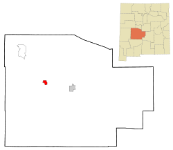 Lage in New Mexico
Basisdaten Staat: Vereinigte Staaten Bundesstaat: New Mexico County: Koordinaten: 34° 7′ N, 107° 14′ W34.1125-107.237777777782003Koordinaten: 34° 7′ N, 107° 14′ W Zeitzone: Mountain Standard Time (UTC−7) Einwohner: 913 (Stand: 2000) Bevölkerungsdichte: 56,7 Einwohner je km² Fläche: 16,1 km² (ca. 6 mi²)
davon 16,1 km² (ca. 6 mi²) LandHöhe: 2003 m Postleitzahl: 87825 Vorwahl: +1 505, 575 FIPS: 35-46310 GNIS-ID: 0908353 Webpräsenz: www.magdalena-nm.com Magdalena ist ein Ort mit 913 Einwohnern (Stand: 2000) im US-Bundesstaat New Mexico im Socorro County.
Bekannt ist der Ort, weil sich mit dem Very Large Array (VLA) eine Anlage aus 27 einzelnen Radioteleskopen auf der Ebene von San Augustin zwischen den Städten Magdalena und Datil befindet.
Kategorie:- Ort in New Mexico

Wikimedia Foundation.