- Maquoketa
-
Maquoketa Spitzname: Timber City 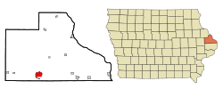 Lage in Iowa
Basisdaten Staat: Vereinigte Staaten Bundesstaat: Iowa Countys: Koordinaten: 42° 4′ N, 90° 40′ W42.066944444444-90.666111111111214Koordinaten: 42° 4′ N, 90° 40′ W Zeitzone: Central Standard Time (UTC−6) Einwohner: 6112 (Stand: 2000) Bevölkerungsdichte: 686,7 Einwohner je km² Fläche: 9,0 km² (ca. 3 mi²)
davon 8,9 km² (ca. 3 mi²) LandHöhe: 214 m Postleitzahl: 52060 Vorwahl: +1 563 FIPS: 19-49215 GNIS-ID: 0458789 Webpräsenz: www.maquoketaia.com Bürgermeister: Tom Messerli Maquoketa, umgangssprachlich auch Timber City, ist die Bezirkshauptstadt (County Seat) des Jackson County in Iowa, Vereinigte Staaten. Zu einem Teil erstreckt sich das Stadtgebiet auch in das Clinton County. Im Jahre 2000 hatte die Stadt eine Bevölkerungszahl von 6112.
Inhaltsverzeichnis
Lage
Maquoketa liegt bei 42°4'1" Nord, 90°39'58" West (42.066901, -90.666238).
Geschichte
Maquoketa wurde 1838 gegründet. Zuerst lautete der Name der Stadt Springfield, aber am 13. März 1844 entschloss man sich, den Namen in Maquoketa zu ändern, da es schon eine Menge Städte und Dörfer mit dem Namen Springfield gab.
Politik
Bürgermeister
- Tom Messerli
- Jack Roseberg
Söhne und Töchter der Stadt
- Norris Brown (1863–1960), Senator für Nebraska
- Herbert E. Hitchcock (1867–1958), Senator für South Dakota
- George Ryan (* 1934), Gouverneur von Illinois
Weblinks
- Maquoketa Informationen (engl.)
- Maquoketa Area Chamber of Commerce (engl.)
- Maquoketa´s Radio Station KMAQ (engl.)
- Maquoketa Sentinel-Press
- Old City Hall Gallery
Städte und Gemeinden im Clinton County (Iowa)Andover | Bryant | Calamus | Camanche | Charlotte | Clinton | Delmar | DeWitt | Elvira | Elwood | Folletts | Goose Lake | Grand Mound | Hauntown | Lost Nation | Low Moor | Malone | Maquoketa | North Welton | Petersville | Shaffton | Six Mile | Sugar Creek | Teeds Grove | Ten Mile | Toronto | Welton | Wheatland
Wikimedia Foundation.
Schlagen Sie auch in anderen Wörterbüchern nach:
Maquoketa — can refer to some places in the United States: The Maquoketa River in Iowa Maquoketa, Iowa, a city Maquoketa Caves State Park, near Maquoketa, Iowa This disambiguation page lists articles associated with the same title. If an … Wikipedia
Maquoketa — Maquoketa, IA U.S. city in Iowa Population (2000): 6112 Housing Units (2000): 2797 Land area (2000): 3.446646 sq. miles (8.926772 sq. km) Water area (2000): 0.029610 sq. miles (0.076689 sq. km) Total area (2000): 3.476256 sq. miles (9.003461 sq.… … StarDict's U.S. Gazetteer Places
Maquoketa, IA — U.S. city in Iowa Population (2000): 6112 Housing Units (2000): 2797 Land area (2000): 3.446646 sq. miles (8.926772 sq. km) Water area (2000): 0.029610 sq. miles (0.076689 sq. km) Total area (2000): 3.476256 sq. miles (9.003461 sq. km) FIPS code … StarDict's U.S. Gazetteer Places
Maquoketa — Maquoketa, Hauptort der Grafschaft Jackson im nordamerikan. Staat Iowa, Bahnknotenpunkt, hat Kalkbrüche, Fabriken und (1900) 3777 Einw … Meyers Großes Konversations-Lexikon
Maquoketa — 42° 04′ 01″ N 90° 39′ 58″ W / 42.066944, 90.666111 … Wikipédia en Français
Maquoketa — Original name in latin Maquoketa Name in other language Makuokehta, makwwkta, aywwa, Макуокэта State code US Continent/City America/Chicago longitude 42.06891 latitude 90.66569 altitude 215 Population 6141 Date 2011 05 14 … Cities with a population over 1000 database
Maquoketa — Sp Makòketa Ap Maquoketa L JAV: u., Džeksono apyg. c. (Ajova) … Pasaulio vietovardžiai. Internetinė duomenų bazė
Maquoketa, Iowa — City Nickname(s): Timber City Motto: One of a Kind … Wikipedia
Maquoketa River — River The North Fork of the Maquoketa River at Dyersville, Iowa in 1996 … Wikipedia
Maquoketa (Iowa) — Maquoketa Ciudad de los Estados Unidos … Wikipedia Español
Maquoketa

18+
© Academic, 2000-2026
- Kontaktieren Sie uns: Unterstützung, Werbung
Wörterbücher Export, schritte mit PHP, Joomla, Drupal, WordPress, MODx.