Matatiele

Matatiele
Matatiele
Matatiele (Ostkap)
Matatiele
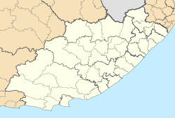
Matatiele
Basisdaten
Staat Südafrika
Provinz Ostkap
Distrikt Alfred Nzo
Gemeinde Matatiele
Einwohner 5.935 (2010)
ISO 3166-2 ZA-EC
-30.33333333333328.8

Matatiele ist eine Kleinstadt in der Gemeinde Matatiele, Distrikt Alfred Nzo, Provinz Ostkap in Südafrika. Sie hat 5.935 Einwohner (Stand: 2010; Hochrechnung).[1]

Der Stadt- und Gemeindename ist vom Sesotho-Begriff für die Enten sind geflogen abgeleitet, ein Hinweis auf die Vielzahl von Feuchtgebieten in der Umgebung, welche den Enten als Lebensraum dienen.[2]

Gegründet wurde sie durch die Griqua, deren Hauptstadt das 70 Kilometer entfernte Kokstad ist. Die Stadt und ihre Umgebung waren Ende des 19. Jahrhunderts so etwas wie eine afrikanische Version des Wilden Westens. Matatiele war eine Anlaufstelle für Pferdediebe und Schmuggler, die die nahe gelegenen Drakensberge als Rückzugsgebiet benutzten.[3]

Heute ist die Stadt der Mittelpunkt der umliegenden landwirtschaftlichen Produktionsbetriebe (Mais- und Molkereiprodukte sowie Pferdezucht). Matatiele ist von Qacha's Nek in Lesotho aus die nächstgelegene Stadt.

Einzelnachweise

  1. World Gazetteer: Republik Südafrika - die wichtigsten Städte. World Gazetteer. Abgerufen am 6. April 2010.
  2. Namensbedeutung Gemeinden
  3. Griqualand Tourismusseite

Wikimedia Foundation.

Игры ⚽ Поможем сделать НИР

Schlagen Sie auch in anderen Wörterbüchern nach:

  • Matatiele — Country  South Africa Province Eastern Cape Time zone SAST (UTC+2) …   Wikipedia

  • Matatiele — Original name in latin Matatiele Name in other language Matatiele State code ZA Continent/City Africa/Johannesburg longitude 30.34357 latitude 28.81161 altitude 1489 Population 0 Date 2012 07 11 …   Cities with a population over 1000 database

  • Matatiele (Gemeinde) — Matatiele Matatiele Local Municipality Symbole …   Deutsch Wikipedia

  • Matatiele, Eastern Cape — Matatiele is a mid sized town serving the farming and trading communities of East Griqualand in the foothills of the western Drakensberg, Eastern Cape, South Africa, 20 km from the southern border of Lesotho. Dairy farming is the principal… …   Wikipedia

  • Matatiele Local Municipality — Matatiele   Local municipality   Location in the …   Wikipedia

  • Matatiele Stadium — Location Matatiele, Eastern Cape Matatiele Stadium is a multi use stadium in Matatiele, Eastern Cape, South Africa. It is currently used mostly for football matches and is the home ground of Matat Professionals. Categories: Eastern… …   Wikipedia

  • Twelfth Amendment of the Constitution of South Africa — Constitution Twelfth Amendment Act of 2005 Act to amend the Constitution of the Republic of South Africa, 1996, so as to effect a technical change; to re determine the geographical areas of the nine provinces of the Republic of South Africa; and… …   Wikipedia

  • Thirteenth Amendment of the Constitution of South Africa — Constitution Thirteenth Amendment Act of 2007 Act to amend the Constitution of the Republic of South Africa, 1996, so as to correct invalid provisions inserted into the Constitution; and to provide for matters connected therewith. Enacted by …   Wikipedia

  • Vehicle registration plates of South Africa — South African number plates are unique in each of the provinces. Each province has their own number plate design and colours, as well as numbering scheme.The nine provincesKey: * UPPER CASE LETTERS: Literal letters in the numberplate * a:… …   Wikipedia

  • Liste der Gemeinden in der Provinz Ostkap — Die Provinz Ostkap mit eingezeichneten Distrikten und Gemeinden Die Liste der Gemeinden in der Provinz Ostkap führt alle Gemeinden (Local Municipalities) in der südafrikanischen Provinz Ostkap auf. Die Provinz Ostkap ist in 7 Distrikte (District… …   Deutsch Wikipedia

Share the article and excerpts

Direct link
Do a right-click on the link above
and select “Copy Link”