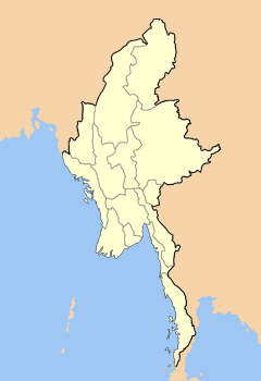
Maymyo

Maymyo
Pyin U Lwin (Myanmar)
DMS
Pyin U Lwin
Pyin U Lwin
Pyin U Lwin

22.0345596.4587472222227Koordinaten: 22° 2′ N, 96° 28′ O

Pyin U Lwin (ehemals Maymyo) ist eine Stadt in der Mandalay-Division von Myanmar, 67 km östlich von Mandalay auf einer Höhe von 1070 m. Die geschätzte Einwohnerzahl im Jahre 2006 betrug 120.149.

Der britische Oberst May errichtete nach dem 3. Britisch-Birmanischen Krieg von 1885 in dem Dorf Pyin U Lwin eine Garnisonsstadt. Es entstand "Maystadt" ("Maymyo") nach dem birmanischen Wort myo für „Stadt“. Die Stadt hat ein kühles Klima und wurde von den Briten bis zum Zweiten Weltkrieg als Sommer-Residenzstadt genutzt. Nach dem Militärputsch von 1988 wurde die Stadt zu Pyin U Lwin zurückbenannt.

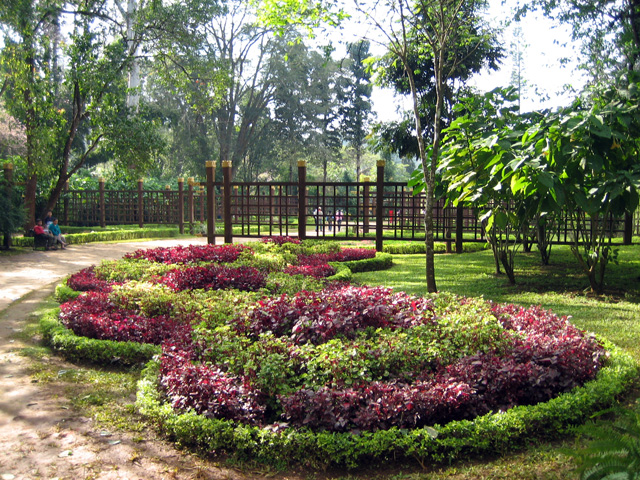
Nach der Unabhängigkeit Birmas gründete die Armee in Maymyo die Militärakademie Defence Services Academy (DSA). Bekannt sind der von Engländern eingerichtete botanische Garten National Kandawgyi Gardens, der Clock Tower und die eigenartigen Pferdekutschen, die für Birma untypisch sind.

Im Juni 2006 begannen die Bauarbeiten zum IT-Zentrum Yadanabon Information and Communication Technology Park, auch als Yadanabon Cyber City oder Yadanabon Teleport bezeichnet. Auf dem gut 40 km² (10.000 Acres) großen Gelände in Yadanabon Myothit unweit von Pyin U Lwin soll die Entwicklung und Produktion von Hard- und Software staffinden. Das Zentrum wurde am 14. Dezember 2007 eröffnet [1][2].

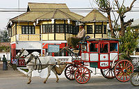
Pferdefuhrwerke und Häuser im Kolonialstil prägen das Aussehen von Pyin U Lwin
Anlage im Botanischen Garten
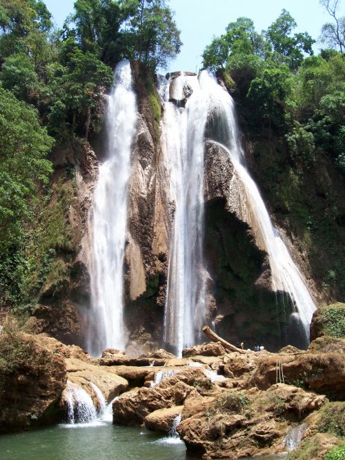
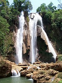
Anisakan Wasserfall, 5km von der Stadt entfernt

Quellen

  1. The Irrawaddy: Burma’s Largest IT Center Opens—But For How Long?
  2. The New Light of Myanmar, Ausgabe vom 17. Dezember 2007

Wikimedia Foundation.

Игры ⚽ Поможем решить контрольную работу

Schlagen Sie auch in anderen Wörterbüchern nach:

  • Maymyo — Pyin U Lwin Pyin U Lwin ou Pyin Oo Lwin (birman : ‌ / MLCTS : prang u: lwang mrui), jadis nommée Maymyo (22° 2 4.38 N 96°27 31.49 E), est une ville de Birmanie située au Nord Est de la division de Mandalay, à 67 km de Mandalay, à une… …   Wikipédia en Français

  • Maymyo — ▪ Myanmar       town, central Myanmar (Burma). It lies at the head of a shallow valley, at an elevation of about 3,450 feet (1,050 m). The town, named for Colonel (later Major General) James May of the 5th Bengal Infantry stationed there in 1886 …   Universalium

  • Maymyo — Original name in latin Maymyo Name in other language Maymo, Maymyo, Meimyu, Memyo State code MM Continent/City Asia/Rangoon longitude 22.02826 latitude 96.47066 altitude 1074 Population 117303 Date 2012 12 06 …   Cities with a population over 1000 database

  • Maymyo —    (Pyin Oo Lwin, Pyin U Lwin)    Located in Mandalay Division on the edge of the Shan Plateau, Maymyo, named after a British officer who participated in the Pacification of Burma, was the summer capital of the British governor and other… …   Historical Dictionary of Burma (Myanmar)

  • Pyin U Lwin —   town   …   Wikipedia

  • Pyinoolwin Township — Maymyo Township   Township   …   Wikipedia

  • Nawnghkio Township —   Township   …   Wikipedia

  • Pyin U Lwin — Saltar a navegación, búsqueda El Kandawgyi National Garden . Pyin U Lwin ó Pyin Oo Lwin, anteriormente Maymyo (22° 2 4.38 N 96°27 31.49 E), es una ciudad turística del interior de Birmania, localizada a unos 67 kilómetros al este de Mandalay, y a …   Wikipedia Español

  • Sino-Burmese War (1765–1769) — Part of Ten Great Campaigns Burma and China prior t …   Wikipedia

  • Anglo-Burmese people — ethnic group group=Anglo Burmese poptime=1.6 million worldwide, including 52,000 in Burma popplace=Australia,United Kingdom,United States, Burma langs=English, Burmese religions=Buddhism, Christianity related=English, Bamar, Anglo Indians, Dutch… …   Wikipedia

Share the article and excerpts

Direct link
Do a right-click on the link above
and select “Copy Link”