- Arborg (Manitoba)
-
Arborg Lage in Manitoba 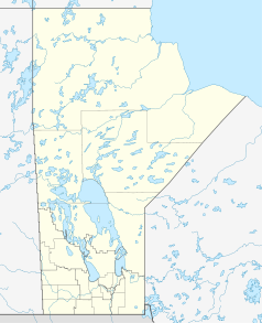

Arborg Staat: Kanada Provinz: Manitoba Region: Interlake Region Rural municipality: Bifrost Koordinaten: 50° 54′ N, 97° 13′ W50.906944444444-97.2175227Koordinaten: 50° 54′ N, 97° 13′ W Höhe: 227 m Fläche: 2,26 km² Einwohner: 1021 (Stand: 2006) Bevölkerungsdichte: 451,8 Einw./km² Zeitzone: Central Time (UTC−6) Gründung: 1887 Webpräsenz: www.townofarborg.ca Der kanadische Ort Arborg liegt im Gemeindegebiet von Bifrost [1] in Manitoba, Interlake Region, 100 Kilometer nördlich von Winnipeg.
Hauptwirtschaftsfaktor von Arbog ist die Landwirtschaft.
Im Jahre 2005 wurde in Arborg zum ersten Mal in Manitoba ein Biodiesel-Kraftwerk gebaut, genannt Bifrost Bio-Blends. Der Hauptkunde des Kraftwerkes ist Manitoba Hydro.[2]
Persönlichkeiten
Söhne und Töchter der Stadt
- Carolyn Darbyshire (* 1963), Curlerin
Fußnoten
- ↑ Community Profiles: Interlake Region. Abgerufen am 12. September 2009.
- ↑ Manitoba Hydro Press Release on Bio-Diesel (englisch)
 Städte in Manitoba
Altona | Arborg | Beausejour | Birtle | Boissevain | Brandon | Carberry | Carman | Churchill | Dauphin | Deloraine | Emerson | Erickson | Flin Flon | Gilbert Plains | Gillam | Gladstone | Grand Rapids | Grandview | Gretna | Hamiota | Hartney | Killarney | Lac du Bonnet | Leaf Rapids | Lynn Lake | Manitou | Melita | Minitonas | Minnedosa | Morden | Morris | Neepawa | Niverville | Oak Lake | Pilot Mound | Plum Coulee | Portage la Prairie | Powerview-Pine Falls | Rapid City | Rivers | Roblin | Rossburn | Russell | Selkirk | Shoal Lake | Snow Lake | Souris | Ste. Anne | Steinbach | Ste. Rose du Lac | Stonewall | Swan River | Teulon | The Pas | Thompson | Treherne | Virden | Winkler | Winnipeg | Winnipeg Beach |
Wikimedia Foundation.
Schlagen Sie auch in anderen Wörterbüchern nach:
Arborg, Manitoba — Arborg (2006 Population 1,021) is a town located in the Rural Municipality of Bifrost in Manitoba s Interlake Region, 100 kilometres north of Winnipeg.The picturesque setting along the Icelandic River was first settled more than 100 years ago.… … Wikipedia
Arborg (Manitoba) — Cet article concerne une ville du Manitoba. Pour la municipalité d Islande, voir Árborg. Arborg Administration Pays … Wikipédia en Français
Manitoba Highway 7 — Highway 7 Route information Length: 108 km (67 mi) Major junctions … Wikipedia
Árborg — 63° 56′ 10″ N 21° 00′ 00″ W / 63.9361, 21 … Wikipédia en Français
Árborg — Infobox City official name = Árborg, Iceland image mapsize = 300px map caption =Location of Mosfellsbær, Iceland (left/center) subdivision type = Constituency subdivision name = Southwest area magnitude = area total sq mi = area total km2 = 197… … Wikipedia
Arborg Airport — is located convert|3.5|NM|abbr=on|lk=in west of Arborg, Manitoba, Canada.External links* [http://www.copanational.org/PlacesToFly/airport view.php?pr id=4 ap id=810 Page about this airport] on COPA s Places to Fly airport directoryReferences … Wikipedia
Arborg — is the name of several places in the world:*Arborg, a town in Manitoba, Canada. *Árborg, a municipality in Iceland.arborg is home of the famous giant curling rock … Wikipedia
Manitoba Highway 5 — Highway 5 Northern Woods and Water Route (section) Northern Cypress Trail (section) Route information Length: 401 km (249 mi) … Wikipedia
Manitoba Highway 6 — Highway 6 Northern Woods and Water Route (section) Route information Length: 732 km (455 mi) … Wikipedia
Manitoba Highway 68 — Highway 68 Northern Woods and Water Route Route information Length: 213 km (132 mi) … Wikipedia
Arborg (Manitoba)

18+
© Academic, 2000-2026
- Kontaktieren Sie uns: Unterstützung, Werbung
Wörterbücher Export, schritte mit PHP, Joomla, Drupal, WordPress, MODx.