Mount Takahe

Mount Takahe
Mount Takahe
MountTakahe.jpg
Höhe 3.460 m
Lage Marie-Byrd-Land, Antarktis
Geographische Lage 76° 18′ 0″ S, 112° 6′ 0″ W-76.3-112.13460Koordinaten: 76° 18′ 0″ S, 112° 6′ 0″ W
Mount Takahe (Antarktis)
Mount Takahe
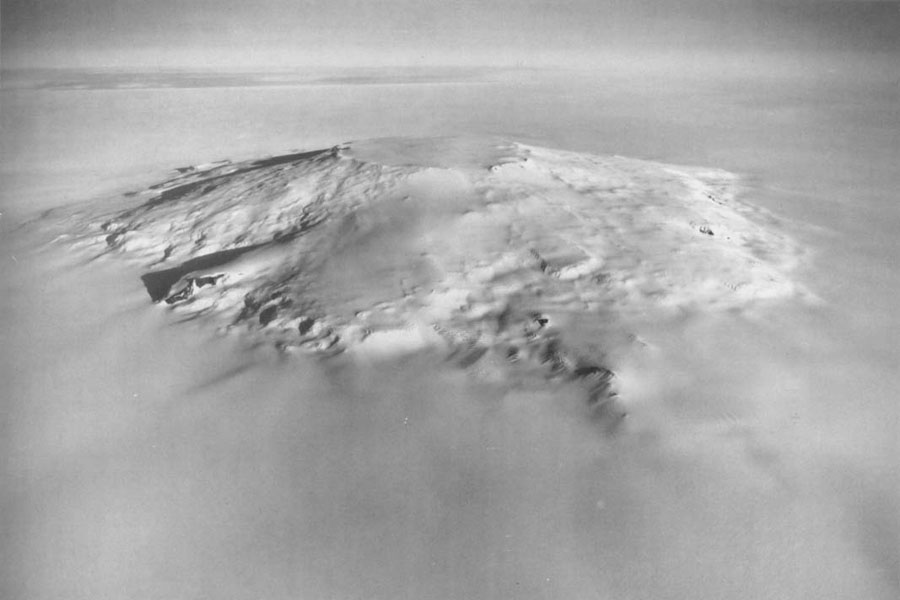
Typ Schildvulkan, schlafend

Der Mount Takahe ist ein inaktiver Schildvulkan im Marie-Byrd-Land in der West-Antarktis.

Analysierte Gesteinsproben des 3460 m hohen Mount Takahe bestanden aus Basanit, Benmoreit, Mugearit, Hawaiit und Trachyt.

Der Berg war wahrscheinlich unter denen, die der US-amerikanische Polarforscher Richard Evelyn Byrd bei Überflügen des United States Antarctic Service (USAS) im Februar 1940 entdeckte.

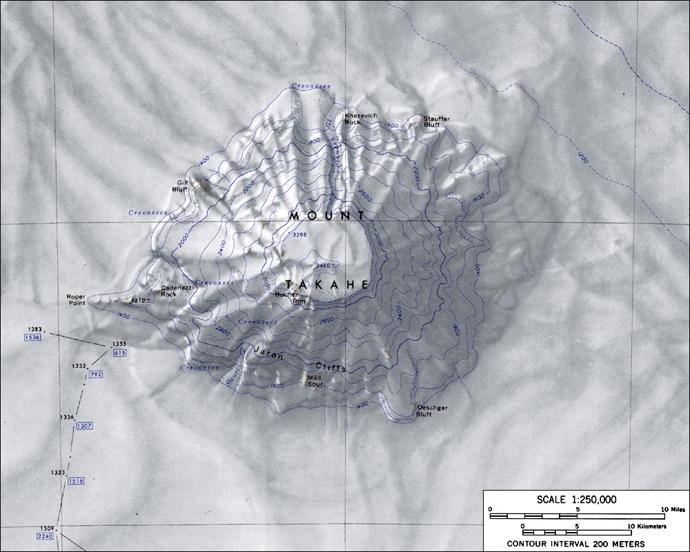
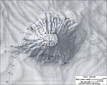
Topografische Karte von Mount Takahe (Maßstab 1:250.000)

Seinen Namen erhielt der Vulkan, der wie ein neuseeländischer Vogel heißt, im Dezember 1957 von den Mitgliedern einer Forschergruppe. „Takahe“ war der Spitzname der LC-47, eines Flugzeuges der US-Marine, das die Gruppe nahe dem Berg mit Nachschub versorgte und Luftaufklärung zur Erkennung gangbarer Routen ermöglichte.


Weblinks


Wikimedia Foundation.

Игры ⚽ Поможем написать курсовую

Schlagen Sie auch in anderen Wörterbüchern nach:

  • Mount Takahe — Aerial view of Mt. Takahe from the west. Elevation 3,460 m (11,352 ft) …   Wikipedia

  • Mount Bruce Wildlife Centre — Mount Bruce redirects here. For the mountain in Antarctica, see Mount Bruce (Antarctica). Pukaha Mount Bruce Wildlife Centre is a wildlife restoration organisation based around a protected forest area in New Zealand s Wairarapa district. Mount… …   Wikipedia

  • Mount Bruce — Mt Bruce Wildlife Centre Mt Bruce National Wildlife Centre …   Wikipédia en Français

  • Pukaha Mount Bruce — Mt Bruce Wildlife Centre Mt Bruce National Wildlife Centre …   Wikipédia en Français

  • Byrd-Land — Das Marie Byrd Land (auch bekannt als Byrd Land) ist ein Teil der westlichen Antarktis. Lage des Marie Byrd Lands auf Antarktika Das Marie Byrd Land, das am Nordrand des Westantarktischen Grabensystems liegt, befindet sich östlich des Ross… …   Deutsch Wikipedia

  • Pacific Ring of Fire — The Ring of Fire redirects here. For other uses of the term, see Ring of Fire (disambiguation). The Pacific Ring of Fire (see below) …   Wikipedia

  • Liste der Berge oder Erhebungen in Antarktika — Dies ist eine Liste der höchsten Erhebungen Antarktikas. Die einzelnen Gipfel können Staatsgebieten nicht zugeordnet werden, da territoriale Ansprüche auf die Antarktis nur von wenigen Staaten anerkannt werden. Name des Berges Höhe Gebirge… …   Deutsch Wikipedia

  • List of Ultras of Antarctica — This is a list of all the Ultra prominent peaks (with topographic prominence greater than 1,500 metres) in Antarctica. Some islands in the South Atlantic have also been included and can be found at the end of the list. Antarctica Mount Erebus,… …   Wikipedia

  • Список вулканов Антарктики — См. также: Список вулканов мира Список действующих и потухших вулканов Антарктики. Название Высота Местоположение Последнее извержение метров футов Координаты Андрус 2978 9770 75.8, 132.333333 (Mount Andrus) …   Википедия

  • Liste von Vulkanen in der Antarktis —  Karte mit allen Koordinaten: OSM, Google oder …   Deutsch Wikipedia

Share the article and excerpts

Direct link
Do a right-click on the link above
and select “Copy Link”