Byrd-Land

Byrd-Land

Das Marie-Byrd-Land (auch bekannt als Byrd-Land) ist ein Teil der westlichen Antarktis.

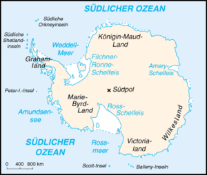
Lage des Marie-Byrd-Lands auf Antarktika

Das Marie-Byrd-Land, das am Nordrand des Westantarktischen Grabensystems liegt, befindet sich östlich des Ross-Schelfeises sowie des Rossmeeres. Es gilt als die vulkanreichste Gegend der Erde. Insgesamt befinden sich 23 große Vulkane in dem Gebiet, zwei wichtige sind der Mount Murphy und der Mount Takahe. Der auch dazu zählende Mount Sidley stellt mit 4.181 m die höchste hiesige Erhebung dar.

Der US-amerikanischen Antarktisforscher Richard Evelyn Byrd entdeckte 1929 das Marie-Byrd-Land, die geografische Erforschung dieses Antarktisteiles erfolgte vor allem auf Byrds zweiter Expedition (1933 bis 1935) und der U.S. Antarctic Service Expedition (1939 bis 1941). Bereits im Januar 1902 wurde die im Nordwesten befindliche Edward-VII-Halbinsel entdeckt.

Das Marie-Byrd-Land ist das größte staatenlose Gebiet der Erde.

-75-1257Koordinaten: 75° 0′ 0″ S, 125° 0′ 0″ W


Wikimedia Foundation.

Игры ⚽ Поможем написать курсовую

Schlagen Sie auch in anderen Wörterbüchern nach:

  • Byrd Land — a part of Antarctica, SE of the Ross Sea: discovered and explored by Adm. Richard E. Byrd. Formerly, Marie Byrd Land. * * * …   Universalium

  • Byrd Land — /ˈbɜdlænd/ (say berdland) noun a part of Antarctica, south east of the Ross Sea; claimed by the US. Formerly, Marie Byrd Land. {named after US naval rear admiral Richard E Byrd, 1888–1957, who discovered and explored it} …  

  • Byrd Land — a part of Antarctica, SE of the Ross Sea: discovered and explored by Adm. Richard E. Byrd. Formerly, Marie Byrd Land …   Useful english dictionary

  • Marie Byrd Land — Map of Antarctica; Marie Byrd Land is in the bottom left between the New Zealand and Chilean claims …   Wikipedia

  • Marie-Byrd-Land — Lage Lage des Marie Byrd Lands auf Antarktika …   Deutsch Wikipedia

  • Mount Burnham (Marie Byrd Land) — Coordinates: 77°16′S 142°5′E / 77.267°S 142.083°E / 77.267; 142.083 Mount Burnham is a mountain, 1,170 metres (3 …   Wikipedia

  • Marie Byrd Land — /meuh ree berrd / former name of Byrd Land. * * * ▪ region, Antarctica       unclaimed region of Antarctica, bordering on the South Pacific Ocean and extending from the Ross Sea and Ice Shelf (west) to Ellsworth Land (east). The barren, ice… …   Universalium

  • Marie-Byrd-Land —   [mə riː bəːd ], Teil der Westantarktis, zwischen Ellsworthhochland und Ross Schelfeis; im Norden überragen mehrere Gebirge die bis 4 000 m mächtige Inlandeisdecke. Von R. E. Byrd erforscht und nach seiner Frau benannt …   Universal-Lexikon

  • Marie Byrd Land — Marie′ Byrd′ Land n. geg a part of Antarctica, SE of the Ross Sea: discovered and explored by Adm. Richard E. Byrd …   From formal English to slang

  • Clarke Glacier (Marie Byrd Land) — Clarke Glacier Coordinates: 75°11′S 139°06′W / 75.183°S 139.1°W / 75.183; 139.1 is a 8 mile long glacier …   Wikipedia

Share the article and excerpts

Direct link
Do a right-click on the link above
and select “Copy Link”