Murdeira

Murdeira
Murdeira
Murdeira (Kap Verde)
Murdeira
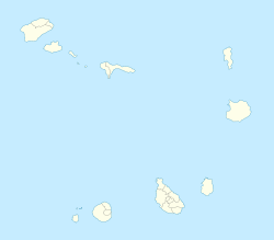
Murdeira
Basisdaten
Staat Kap Verde
Inselgruppe Ilhas de Barlavento
Distrikt Sal
ISO 3166-2 CV-SL
16.677222222222-22.935555555556

Murdeira ist eine junge Siedlung auf der Insel Sal in der Republik Kap Verde.

Die Ortschaft befindet sich rund 6 km südlich der Inselhauptstadt Espargos und somit etwa auf halbem Wege zwischen Espargos un dem touristischen Zentrum Santa Maria. Bis kurz vor der Jahrtausendwende lebten an diesem Ort nur wenige Menschen. Diese ernährten sich vorwiegend von der Landwirtschaft. Mit dem Aufkeimen des Tourismus auf der Insel wuchs allerdings der Bedarf an touristisch attraktiven Orten.

Murdeira liegt an der Westküste der Insel an der weitläufigen namensgegebenden Baía da Murdeira. Innerhalb dieser gestreckten Bucht befindet sich nochmals eine kleine natürlich entstandene Bucht annähernd von der Form eines Halbkreises. Das Innere dieser kleinen Bucht ist vor dem üblichen starken Wellengang des Atlantik geschützt und bietet somit einen idealen Badeort. Als eine Folge davon entstand Murdeira als Freizeitsiedlung, die überwiegend aus Apartmentwohnungen und Hotels mit Bars und Restaurants besteht. Bewohner einer der Wohnungen Murdeiras sind zur kostenlosen Nutzung des Schwimmbades berechtigt, welches im Ort erbaut wurde. Als weiteres Angebot ist für die Zukunft eine Tennisanlage geplant. Die Baía da Murderia ist ferner als Meeresschutzgebiet ausgewiesen und reich an Fischarten. In dem Ort war daher auch eine Taucherschule ansässig, die mit einer Dekompressionskammer ausgerüstet ist. Diese ist, da es in der Gegend zu wenige Kunden gab, nach Santa Maria umgezogen.


Wikimedia Foundation.

Игры ⚽ Нужна курсовая?

Schlagen Sie auch in anderen Wörterbüchern nach:

  • Murdeira — Murdera   Village   …   Wikipedia

  • Nossa Senhora das Dores (Sal) — Nossa Senhora das Dores Statistics Island: Sal Municipality: Sal Altitude: Lowest: Centre: Highest Atlantic Ocea …   Wikipedia

  • Monte Grande (Sal), Cape Verde — For other uses, see Monte Grande (disambiguation). Monte Grande Monte Grande Elevation …   Wikipedia

  • Rabo de Junco — (Capeverdean Crioulo, ALUPEC or ALUPEK: Rabu di Junku, also in the São Vicente Crioulo: Rab d Junk ) is a remote village in the western part of the island of Sal. The area overlooks a nearby promontory as well as a homonymous islet westward. The… …   Wikipedia

  • Мурдейра — Посёлок Мурдейра Murdeira Страна Кабо ВердеКабо Верде …   Википедия

  • Espargos — is the seat town of the island municipality of Sal, Cape Verde and is also in the heart of the island. Espargos means asparagus and refers to the wild vegetable asparagus stalk with its bright yellow flowers which grows in sandy areas around the… …   Wikipedia

  • Santa Maria, Cape Verde — Santa Maria (Portuguese for Saint Mary) is the small fishing town situated in the southern part of the island municipality of Sal, Cape Verde. The town is the third largest city in Cape Verde and is one of the few cities in Cape Verde that it is… …   Wikipedia

  • List of ports in Cape Verde — This article is a list of ports and harbors (or harbours) in Cape Verde. Several of its major ports are owned by the Capeverdean porta authority, ENAPOR:Major and minor ports =Boa Vista= *Sal Rei =Brava= *Fajã da Agua *Furna =Fogo= *Cova Figueira …   Wikipedia

  • List of villages and settlements in Cape Verde — This is a list of villages and settlements in Cape Verde:Boa Vista*Bafureira *Cabeço do Tarafes *Curral Velho *Estancia de Baixo *Funda das Figueiras *Gata *João Barreiro *João Galego *Norte *Povoação Velha *Santo TirsoBrava*Cachaço *Campo Baixo… …   Wikipedia

  • Serra Negra, Cape Verde — Infobox Mountain Name=Serra Negra Elevation=around 96 m Location=island of Sal, Cape Verde Pronunciation=se•rra ne•gras Serra Negra (Portuguese for Black Mountain , also in Capeverdean Crioulo, ALUPEC or ALUPEC and the Sal Crioulo) is a mountain… …   Wikipedia

Share the article and excerpts

Direct link
Do a right-click on the link above
and select “Copy Link”