Muskoka Lakes

Muskoka Lakes
Muskoka Lakes
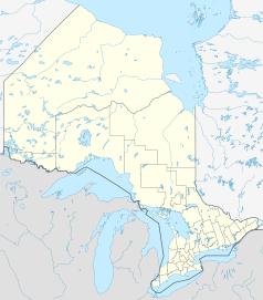
Lage in Ontario
Muskoka Lakes (Ontario)
Muskoka Lakes
Muskoka Lakes
Staat: Kanada
Provinz: Ontario
Koordinaten: 45° 7′ N, 79° 35′ W45.115277777778-79.577777777778Koordinaten: 45° 7′ N, 79° 35′ W
Fläche: 781,55 km²
Einwohner: 6467 (Stand: 2006)
Bevölkerungsdichte: 8,3 Einw./km²
Zeitzone: Eastern Time (UTC−5)
Bürgermeister: Susan Pryke
Webpräsenz: www.muskokalakes.ca/

Muskoka Lakes [məsˌkoʊ̯kəˈleɪ̯ks] ist eine Kleinstadt im Muskoka District Municipality in Ontario, Kanada und hat ca. 6000 Einwohner.

Sie wurde 1971 durch den Zusammenschluss von mehreren kleineren Gemeinden gegründet, nämlich Cardwell, Watt, der Verbundgemeinde Medora und Wood, der Stadt Bala (Ontarios Cranberry-Hauptstadt), Port Carling Windermere und Teilen der früheren Gemeinde Monck. Sitz der Verwaltung ist Port Carling.

Die Gegend ist durchzogen von Seen und Wäldern. Der Boden, das kanadische Schild (Canadian Shield) ist eher felsig und wenig geeignet für Ackerbau. Deshalb war früher die Holzindustrie sehr stark vertreten. Heute ist der Tourismus die Haupteinnahmequelle. Besonders im Städtchen Bala (Ontario) findet man riesige Cranberry-Felder und -Kulturen. Dort kann man sich bei Führungen über den Anbau und die Ernte informieren.

Der größte See des Distrikts ist der Lake Muskoka.

Weblinks

 Commons: Muskoka Lakes – Sammlung von Bildern, Videos und Audiodateien

Wikimedia Foundation.

Игры ⚽ Нужна курсовая?

Schlagen Sie auch in anderen Wörterbüchern nach:

  • Muskoka Lakes — Not to be confused with Lake Muskoka. Township of Muskoka Lakes   Township   A typical lake scene in Muskoka Lakes …   Wikipedia

  • Muskoka Lakes Township Public Libraries — Muskoka Lakes Library, Ontario, consists of the Norma and Miller Alloway Muskoka Lakes Library main branch in the town of Port Carling, and three small branches housed in the community centres of Bala, Milford Bay, and Walker s Point. Each branch …   Wikipedia

  • Muskoka Lakes — ▪ lakes, Ontario, Canada       chain of lakes, Muskoka District, southeastern Ontario, Canada, about 80 miles (130 km) north of Toronto. They consist of the chain of lakes drained by the Muskoka River into Georgian Bay, the largest of which are… …   Universalium

  • Muskoka Lakes, Ontario — Infobox City official name = Township of Muskoka Lakes other name = native name = nickname = motto = imagesize = image caption = A typical lake scene in Muskoka Lakes. flag size = image seal size = image shield = shield size = image blank emblem …   Wikipedia

  • Bracebridge and Muskoka Lakes Secondary School — Infobox Education in Canada name= Bracebridge and Muskoka Lakes Secondary School imagesize= motto=Nihil Sine Labore motto translation= streetaddress= 100 Clearbrook Trail, Bracebridge, ON city= Bracebridge province= Ontario postalcode= P1L 2E9… …   Wikipedia

  • Muskoka District Municipality — Lage von Muskoka in Ontario Provinz Ontario Verwaltungssitz Bracebridge …   Deutsch Wikipedia

  • Muskoka District Municipality, Ontario — Infobox Settlement official name = Muskoka District Municipality nickname = motto = imagesize = image caption = image imagesize = image caption = image mapsize = 300px map caption = Map showing Muskoka District Municipality location in Ontario… …   Wikipedia

  • Muskoka District municipal elections, 2010 — Elections will be held in the Muskoka District Municipality of Ontario on October 25, 2010 in conjunction with municipal elections across the province. Contents 1 Muskoka District Council 2 Bracebridge 3 Georgian Bay …   Wikipedia

  • Muskoka — Municipalité de district de Muskoka Municipalité de district de Muskoka Administration Pays   …   Wikipédia en Français

  • Muskoka — Fairy Lake, einer der zahlreichen Seen in Muskoka Muskoka ist eine Landschaft in der kanadischen Provinz Ontario, die ab den 1860er Jahren von der Holzindustrie und von Siedlern in Besitz genommen wurde, nachdem die dort lebenden Anishinabe… …   Deutsch Wikipedia

Share the article and excerpts

Direct link
Do a right-click on the link above
and select “Copy Link”