Nahanni Butte

Nahanni Butte
Nahanni Butte
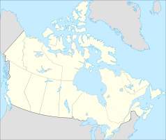
Lage in Kanada
Nahanni Butte (Kanada)
Nahanni Butte
Nahanni Butte
Staat: Kanada
Territorium: Nordwest-Territorien
Region: Dehcho Region
Koordinaten: 61° 2′ N, 123° 23′ W61.033889-123.380556Koordinaten: 61° 2′ N, 123° 23′ W
Einwohner: 115 (Stand: 2006)

Nahanni Butte (Slavey: Tthenáágó „starker Fels“) ist ein „Designated Authority“[1] in der Dehcho Region in den Nordwest-Territorien, Kanada. Die Gemeinde liegt am Zusammenfluss von Liard und South Nahanni River im südwestlichen Teil der NWT. Es wird eine Allwetterstraße gebaut.Im Moment wird jeden Winter eine Winterstraße konstruiert.

Dick Turner, unter anderem Trapper, Buschpilot und Ladenbesitzer, zog in en 1930ern aus Calgary nach Nahanni Butte. Er schrieb drei Bücher.

Der Zensus von 2006 zählte 115 Einwohner.[2]

Die Dene der Gemeinde werden von der Nahanni Butte Dene Band vertreten und gehören den Dehcho First Nations an.[3]

Referenzen

  1. Unterschiede in der Gemeindeverwaltung
  2. 2001 Census
  3. Dehcho First Nations

Weblinks


Wikimedia Foundation.

Игры ⚽ Нужна курсовая?

Schlagen Sie auch in anderen Wörterbüchern nach:

  • Nahanni Butte — Tthenáágó   First Nations/Dene Band Designated Authority (Nahanni Butte Dene Band)   The Band Office in Nahanni Butte …   Wikipedia

  • Nahanni Butte Water Aerodrome — IATA: none – ICAO: none – TC LID: CET8 Summary Airport type Public Operator Nahanni Butte Settlement …   Wikipedia

  • Nahanni Butte, Northwest Territories — Nahanni Butte (Slavey language: Tthenáágó strong rock ) is a Designated Authority [ [http://www.maca.gov.nt.ca/resources/Differences in Comm Govt Structure.pdf Differences in Community Government Structure] ] in the Dehcho Region of the Northwest …   Wikipedia

  • Nahanni Butte Airport — IATA: none – ICAO: none – TC LID: CBD6 Summary Airport type Public Operator Government of the Northwest Territories …   Wikipedia

  • Nahanni National Park Reserve — IUCN Category II (National Park) Virginia Falls …   Wikipedia

  • Nahanni Formation — Stratigraphic range: Givetian …   Wikipedia

  • South Nahanni River — Map of the South Nahanni River Origin Selwyn Mountains[1] Mouth …   Wikipedia

  • South Nahanni River — DatenVorlage:Infobox Fluss/GKZ fehlt …   Deutsch Wikipedia

  • Parque Nacional Nahanni — Saltar a navegación, búsqueda Parque Nacional Nahanni (Nahanni National Park) Categoría IUCN II (Parque nacional) Situación País …   Wikipedia Español

  • Dehcho Region — The Dehcho Region is one of five administrative regions in the Northwest Territories. The region consists of six communities with the regional office situated in Fort Simpson. All communities in the Dehcho are predominately First Nations.… …   Wikipedia

Share the article and excerpts

Direct link
Do a right-click on the link above
and select “Copy Link”