Ngerekebesang

Ngerekebesang
Arakabesan
Karte von Palau.
Karte von Palau.
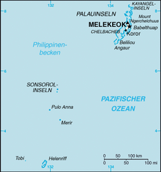
Gewässer Pazifischer Ozean
Inselgruppe Palauinseln
Geographische Lage 7° 19′ 57″ N, 134° 27′ 11″ O7.3325134.4530555555655Koordinaten: 7° 19′ 57″ N, 134° 27′ 11″ O
Arakabesan (Palau)
DEC
Arakabesan
Länge 3 km
Breite 1,25 km
Fläche 2,6 km²dep1
Höchste Erhebung 55 m
Einwohner dep1
Hauptort Meyungs

Arakabesan, auch Ngerekebesang genannt, ist eine kleine Insel im westlichen Pazifischen Ozean; sie gehört geographisch zu den Palauinseln, geopolitisch zum Verwaltungsgebiet Koror der Inselrepublik Palau.

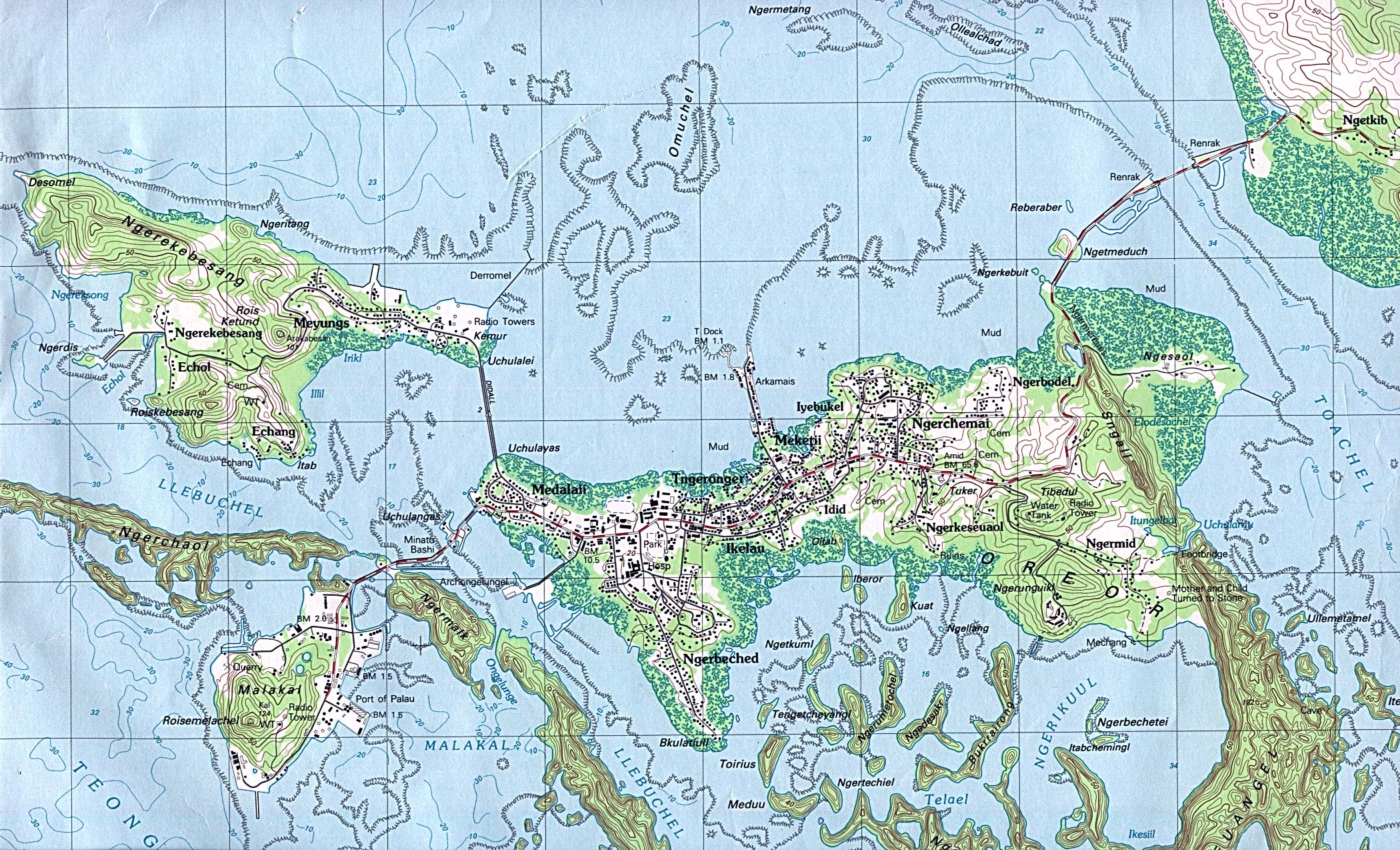
Die etwa 2,6 km² große und dicht bewaldete Insel liegt 600 Meter nordwestlich der Insel Koror, mit der sie über eine Brücke verbunden ist. Hauptort von Arakabesan ist Meyungs an der Ostküste.

Im Westen der Insel finden sich hauptsächlich touristische Freizeiteinrichtungen und Hotelanlagen, die nach 1980 errichtet wurden. Der äußerst nordwestliche Teil von Arakabesan ist nicht bewohnt; dort liegt der höchste Punkt der Insel bei etwa 55 Meter über Meeresniveau.

Weblinks


Wikimedia Foundation.

Игры ⚽ Поможем решить контрольную работу

Schlagen Sie auch in anderen Wörterbüchern nach:

  • Ngerekebesang — Isla de Ngerekebesang Localización País …   Wikipedia Español

  • Ngerekebesang Island — (Arakabesan) is an island in the state of Koror, Palau, where the office of the President of the Republic of Palau was located before the capital was moved to the state of Melekeok. It is composed of three towns: Ngerekebesang, Meyuns, and Echang …   Wikipedia

  • Meyuns — Meyens is the second most populous city in the tiny Pacific island nation of Palau, with a population of approximately 1,000. Meyuns is comparable in population to Palau s third largest city, Airai. It is located in the State of Koror, where the… …   Wikipedia

  • Koror — Palau boatyard on Malakal Island, August 1973 …   Wikipedia

  • Arakabesan — Karte von Palau. Gewässer Pazifischer Ozean Inselgruppe …   Deutsch Wikipedia

  • Koror (île) — Pour les articles homonymes, voir Koror (homonymie). Koror Oreor Géographie Pays …   Wikipédia en Français

  • Liste des îles Palaos — Voici une liste des îles Palaos. Par ordre alphabétique Angaur Babeldaob Fanna Hatohobei Helen Reef Kayangel Malakai Mecherchar Merir Ngerchaol Ngercheu Ngerekebesang Ngeruktabel Îlot Ongiang Peleliu Pulo Anna Sonsorol Urukthapel …   Wikipédia en Français

  • Palaos — Republic of Palau Beluu er a Belau パラオ共和国 Parao kyōwa koku República de Palaos …   Wikipedia Español

  • Koror — Para otros usos de este término, véase Koror (desambiguación). Koror Estado de Palaos Capital Koror Entidad …   Wikipedia Español

  • Isla de Koror — Isla Koror Koror Vista de la isla Localización País …   Wikipedia Español

Share the article and excerpts

Direct link
Do a right-click on the link above
and select “Copy Link”