- OpenJUMP
-
OpenJUMP 

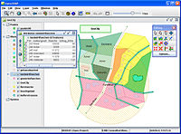
Screenshot von OpenJUMPBasisdaten Entwickler JUMP Pilot Project, Vivid Solutions, Refractions Research Aktuelle Version 1.4.2
(11. September 2011)Betriebssystem multi-platform Programmiersprache Java Kategorie Geoinformationssystem Lizenz GPL (Freie Software) Deutschsprachig ja openjump.org OpenJUMP ist eine freie Software für geografische Informationssysteme, die ursprünglich unter dem Namen JUMP von den kanadischen Unternehmen Vivid Solutions und Refractions Research entwickelt wurde. Der Name JUMP ist die Abkürzung für Unified Mapping Platform, das „J“ deutet auf die zugrunde liegende Programmiersprache Java hin. „Open“ steht für Open Source („quelloffen“), und bedeutet, dass der Quellcode des Programms jedermann zugänglich ist. OpenJUMP unterliegt der GNU General Public License und wird heute im Rahmen des Jump-Pilot-Projects von einer internationalen Gruppe von Freiwilligen gepflegt und weiterentwickelt.
Besondere Merkmale
Die besonderen Merkmale von OpenJUMP sind:
- ursprünglich Vektor-basiertes GIS mit Rasterdaten Unterstützung (TIFF, JPEG, PNG, ECW)
- unterliegt der GNU General Public License
- basiert auf Open-GIS-Standards
- in Java geschrieben; quelloffen (Open Source)
- durch sogenannte PlugIns erweiterbar
- einfach zu bedienende Editier- und Analyse-Funktionen
- unterstützt mehrere Sprachen (Englisch, Französisch, Portugiesisch, Spanisch, Deutsch, Finnisch, Italienisch)
Ein- & Ausgabeformate
Dateiformate:
- GML or "Geography Markup Language"
- ESRI Shapefile
- ESRI ASCII grid format with an OpenJump plugin from the SIGLE team
- TIF files
Datenbanken (via Plugin):
- PostGIS
- Spatiallite
- SIS Database
- ArcSDE
Online (via Plugin):
- Web Feature Service (WFS) v. 1.0.0 and 1.1.0 client
GPS (via Plugin)
- NMEA Textdatei
- GPS-Empfänger für die serielle Schnittstelle
Weblinks
- Offizielle Projekt-Website von OpenJUMP
- Jump-Pilot-Projektseite auf Sourceforge
- Artikel «OpenJUMP» im GIS-Wiki
- JUMP auf der Website der Firma Vivid Solutions
- Website der Firma Refractions Research
- Download-Seite des Forschungsschwerpunktes PIROL der FH Osnabrück
- Zusammenfassung für OpenJUMP in der Datenbank von FreeGIS
- Zusammenfassung für JUMP Unified Mapping Platform in der Datenbank von FreeGIS
Kategorien:- Freie GIS-Software
- Java-Programm
Wikimedia Foundation.
