- Pembina River (North Dakota)
-
Pembina River 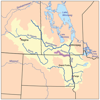
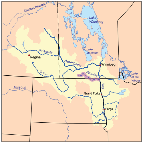
Einzugsgebiet des Red River of the North, der Pembina River ist hervorgehoben
Daten Gewässerkennzahl US: 1035889 Lage Süden von Manitoba (Kanada) und Nordosten von North Dakota (USA) Flusssystem Nelson River Abfluss über Red River of the North → Winnipegsee → Nelson River → Hudson Bay Ursprung Zusammenfluss mehrerer Bäche bei Neelin (Manitoba) Mündung in den Red River of the North bei Pembina, ND 48.9665-97.2395Koordinaten: 48° 57′ 59″ N, 97° 14′ 22″ W
48° 57′ 59″ N, 97° 14′ 22″ W48.9665-97.2395Länge 443 km Einzugsgebiet 8.500 km² Rechte Nebenflüsse Tongue River 
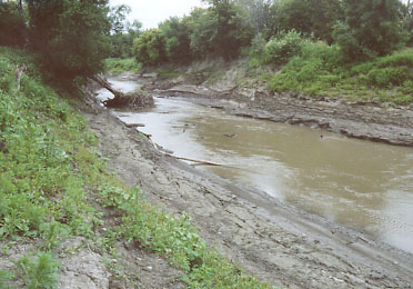
Der Pembina River in der Nähe seiner Mündung bei Pembina, ND
Der Pembina River ist ein linksseitiger Zufluss des Red River of the North und durchfließt auf seiner Länge von 443 Kilometern den Süden von Manitoba in Kanada und den Nordosten von North Dakota in den Vereinigten Staaten. Er entwässert dabei ein Gebiet der Prärie entlang der Grenze zwischen Kanada und den Vereinigten Staaten. Über den Red River, in welchen der Pembina River bei Pembina mündet, gelangt sein Wasser in den Winnipegsee und in den Nelson River. Somit gehört der Pembina River zum Einzugsgebiets der Hudson Bay.
Der Fluss entspringt in mehreren Bächen auf der Ostseite der Turtle Mountains beiderseits der internationalen Grenze, die bei Neelin zusammenfließen und verläuft dann anfänglich nach Nordosten und später nach Südosten, entlang der Westseite der Pembina Hills. Der Fluss fließt dann ins Cavalier County im Nordosten North Dakotas. Er fließt unmittelbar südlich der Grenze nach Osten und passiert Walhalla und Neche. Der rechte Nebenfluss Tongue River mündet etwa 3 Kilometer flussaufwärts von der Mündung des Pembina River in den Red River of the North von Süden her ein.
Kategorien:- Flusssystem Red River of the North
- Fluss in Nordamerika
- Fluss in Manitoba
- Fluss in North Dakota
Wikimedia Foundation.