- Perrysville (Ohio)
-
Perrysville 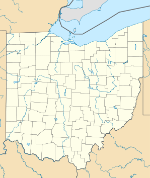

Perrysville Lage in OhioBasisdaten Staat: Vereinigte Staaten Bundesstaat: Ohio County: Koordinaten: 40° 39′ N, 82° 19′ W40.657222222222-82.311388888889303Koordinaten: 40° 39′ N, 82° 19′ W Zeitzone: Eastern Standard Time (UTC−5) Einwohner: 816 (Stand: 2000) Bevölkerungsdichte: 408 Einwohner je km² Fläche: 2,0 km² (ca. 1 mi²)
davon 2,0 km² (ca. 1 mi²) LandHöhe: 303 m Postleitzahl: 44864 Vorwahl: +1 419 FIPS: 39-62190 GNIS-ID: 1068213 Webpräsenz: www.villageofperrysville.com Perrysville ist eine Ortschaft im Ashland County, Ohio, Vereinigte Staaten. Nach den statistischen Angaben der Volkszählung des Jahres 2000 hatte der Ort 816 Einwohner.
Geographie
Der Ort liegt am Black Fork Mohican River, südwestlich des Ortes fließt der Fluss Mohican River. Perrysville ist das Herz des Mohican Country, benannt nach dem von James Fenimore Cooper in seinen Erzählungen geschilderten Indianerstamm der Mohikaner. Die Bezeichnung des Stammes ist teilweise fiktiv und entstand durch die Zusammenziehung der Namen der früher in den Neuenglandstaaten beheimateten Mahican und Mohegan, er charakterisiert aber die Rückzugsgebiete der nordamerikanischen Ureinwohner im Zentrum Ohios.
Geschichte
Am 10. Juni 1815 wurden von Thomas Coulter die Pläne zur Gründung einer Gemeinde eingereicht. Perrysville war also das erste Dorf, das im Ashland County gegründet wurde. Aber die Bevölkerung wuchs nur langsam, im Jahr 1830 gab es erst 9 Einwohner. 1860 war die Bevölkerung auf 1.835 angewachsen.
Benannt ist der Ort nach dem Marineoffizier Oliver Hazard Perry, der durch die Schlacht auf dem Eriesee im Jahr 1812 im Krieg gegen die Briten bekannt wurde.
Weblinks
- Website von Perrysville, Ohio (englisch)
- City-Data.com: Perrysville, Ohio (englisch)
- Loudonville-Perrysville Exempted Village School District (englisch)

Wikimedia Foundation.