Raton Pass

Raton Pass

xBWxxx

Raton Pass
Norden Süden
Passhöhe 2.350 m
Bundesstaat Colorado New Mexico
Talorte Trinidad Raton
Ausbau Passstraße, Bahnstrecke
Karte
Raton Pass (USA)
Raton Pass
x
Koordinaten 36° 59′ 30″ N, 104° 28′ 45″ W36.991666666667-104.479166666672350Koordinaten: 36° 59′ 30″ N, 104° 28′ 45″ W

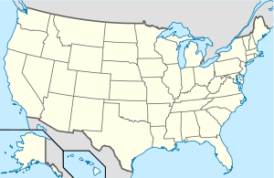
Der Raton Pass (2.350 m über dem Meeresspiegel) ist ein Übergang in Nord-Süd-Richtung zwischen den US-Bundesstaaten Colorado und New Mexico durch die Vorberge der Rocky Mountains. Über ihn verläuft der Interstate-Highway 25 von Denver, Colorado nach Santa Fe, New Mexico und weiter nach Albuquerque. Seit 1960 ist der Pass als National Historic Landmark ausgewiesen.

Im 19. Jahrhundert verlief eine Route des Santa Fe Trails, der ersten Handelsroute zwischen den Vereinigten Staaten und dem damals noch mexikanischen Südwesten, über den Pass. Im Zuge der fortschreitenden Besiedelung des Westens wurde er Teil der wichtigsten Verbindung am Ostrand der Rockies. 1878 war der Pass der Schauplatz eines Wirtschaftskriegs zwischen der Atchison, Topeka and Santa Fe Railway (ATSF) und der kleineren Denver and Rio Grande Western Railroad (DRGW) über das Recht, den Übergang zu nutzen. Als ATSF eine Bande Revolverhelden anheuerte und gleichzeitig DRGW das Geld ausging, setzte ATSF sich durch.

Weil die Steigungen am Raton Pass mit bis zu 3,3 % besonders hoch waren, verlängerte die Gesellschaft bis 1908 das Streckennetz der 1883 angekauften Gulf, Colorado and Santa Fe Railway von Amarillo, Texas zur ATSF-Hauptstrecke im Tal des Rio Grande und umging so den Raton Pass für Züge aus dem Osten. 1930 schaffte ATSF für die Nord-Süd-Verbindung über den Pass besonders leistungsfähige Lokomotiven der Bauart Texas an.


Wikimedia Foundation.

Игры ⚽ Нужен реферат?

Schlagen Sie auch in anderen Wörterbüchern nach:

  • Raton Pass — Infobox nrhp2 | name =Raton Pass nhl=yes caption = View from Raton Pass from I 25 nearest city= Trinidad, CO, Raton, NM area = built =1821 architect= architecture= designated nhl= December 19, 1960cite… …   Wikipedia

  • Raton — Downtown Raton Lage in New Mexico …   Deutsch Wikipedia

  • Raton — is a name shared by different places and people: * Raton Basin, a geologic structural basin in southern Colorado and northern New Mexico * Raton Downtown Historic District, a Registered Historic District in Raton, New Mexico * Raton, New Mexico,… …   Wikipedia

  • Raton, New Mexico — Infobox Settlement official name = Raton, New Mexico settlement type = City nickname = motto = imagesize = 250px image caption = Downtown Raton image image mapsize = 250px map caption = Location of Raton, New Mexico mapsize1 = map caption1 =… …   Wikipedia

  • Raton Basin — The Raton Basin is a geologic structural basin in southern Colorado and northern New Mexico. It takes its name from Raton Pass and the town of Raton, New Mexico. In extent, the basin is approximately 50 miles east west, and 90 miles north south,… …   Wikipedia

  • Raton — ▪ New Mexico, United States       city, seat (1897) of Colfax county, northeastern New Mexico, U.S. It lies at the southern end of Raton Pass (7,834 feet [2,388 metres] above sea level) in the Sangre de Cristo Range, near the Colorado state line …   Universalium

  • Raton Downtown Historic District — Infobox nrhp | name =Raton Downtown Historic District nrhp type = hd caption = Wells Fargo Express Company Office location= Raton, New Mexico lat degrees = 36 lat minutes = 53 lat seconds = 58 lat direction = N long degrees = 104 long minutes =… …   Wikipedia

  • Raton (Amtrak station) — Infobox Station style=Amtrak name=Raton logo= logo size= image size= image caption= address=201 South First Street Raton, NM 87740 line=rail color box|system=Amtrak|line=Southwest Chief other=Thruway Motorcoach platform= tracks= parking= bicycle …   Wikipedia

  • Raton — geographical name pass 7834 feet (2388 meters) SE Colorado just N of Colorado New Mexico border in Raton Range (E spur of Sangre de Cristo Mountains) …   New Collegiate Dictionary

  • Battle of Glorieta Pass — Infobox Military Conflict conflict=Battle of Glorieta Pass caption=Battle of Glorieta Pass Roy Anderson, artist partof=the American Civil War date=March 26–28, 1862 place=Santa Fe County and San Miguel County, New Mexico result= Confederate… …   Wikipedia

Share the article and excerpts

Direct link
Do a right-click on the link above
and select “Copy Link”