Rochester (New Hampshire)

Rochester (New Hampshire)
Rochester
Spitzname: The Lilac City
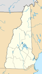
Rochester (New Hampshire)
Rochester
Rochester
Lage in New Hampshire
Basisdaten
Gründung: 1749
Staat: Vereinigte Staaten
Bundesstaat: New Hampshire
County:

Strafford County

Koordinaten: 43° 18′ N, 70° 58′ W43.301944444444-70.97305555555669Koordinaten: 43° 18′ N, 70° 58′ W
Zeitzone: Eastern Standard Time (UTC−5)
Einwohner: 28.461 (Stand: 2000)
Bevölkerungsdichte: 243,5 Einwohner je km²
Fläche: 118,6 km² (ca. 46 mi²)
davon 116,9 km² (ca. 45 mi²) Land
Höhe: 69 m
Postleitzahlen: 03800-03899
Vorwahl: +1 603
FIPS: 33-65140
GNIS-ID: 0869554
Webpräsenz: www.rochesternh.net
Bürgermeister: John Larochelle

Rochester ist eine Stadt in New Hampshire in den Vereinigten Staaten. Sie ist die größte Stadt im Bezirk Strafford County und hat 28.461 Einwohner.

Inhaltsverzeichnis

Geographie

Die Stadt hat eine Fläche von 118,6 km², davon sind 116,9 km² Land und 1,6 km² (1,38 %) Wasserfläche.

Rochester befindet sich im Einzugsgebiet der Flüsse/Bäche Salmon Falls, Isinglass und Cochecho River. Die höchste Erhebund in Rochester ist Nute Ridge (177 m), im nördlicheren Stadtgebiet gelegen.

Stadtgliederung

Rochester besteht aus folgenden Ortsteilen:

  • East Rochester
  • Gonic
  • Rochester

Geschichte

Die Siedlung Rochester wurde 1749 gegründet und 1778 eingetragen.

Am 30. November 2007 nahm ein 46-jähriger Mann in einem Präsidentschafts-Wahlbüro von Hillary Clinton in Rochester mehrere Geiseln, wodurch der Ort international bekannt wurde. Nach sechs Stunden endete die Geiselnahme unblutig [1].

Weblinks

Quellen

  1. http://www.tagesschau.de/ausland/us-wahl/geiselnahme8.html (nicht mehr online verfügbar)

Wikimedia Foundation.

Игры ⚽ Поможем сделать НИР

Schlagen Sie auch in anderen Wörterbüchern nach:

  • Rochester (New Hampshire) — Rochester Surnom : « The Lilac City » Administration Pays   …   Wikipédia en Français

  • Rochester, New Hampshire — Infobox Settlement official name = City of Rochester settlement type = City nickname = The Lilac City motto = imagesize = image caption = City Hall c. 1910 image mapsize = 250px map caption = Location within Strafford County, New Hampshire… …   Wikipedia

  • East Rochester, New Hampshire — is a district of Rochester located on the banks of the Salmon Falls River, which separates Maine from New Hampshire. Home to approximately 5,000 residents, it is located 3 miles east of Rochester proper, and one of two villages (the other being… …   Wikipedia

  • New Hampshire Democratic primary, 2008 — 2004 ← January 8, 2008 (2008 01 08) …   Wikipedia

  • New Hampshire Northcoast Corporation — New Hampshire Northcoast Reporting mark NHN Locale Massachusetts, New Hampshire Dates of operation 1986– Track gauge …   Wikipedia

  • New Hampshire locations by per capita income — New Hampshire is the seventh richest state in the United States of America, with a per capita income of $23,844 (2000) and a personal per capita income of $34,702 (2003). New Hampshire counties ranked by per capita income There are ten counties… …   Wikipedia

  • New Hampshire communities by population — The 234 incorporated cities and towns in the New Hampshire ranked by population, from the 2010 United States Census. Location of New Hampshire in the United States …   Wikipedia

  • New Hampshire communities by household income — The 234 incorporated cities and towns in the New Hampshire ranked by household income, calculated in 2006, and published in 2007. Rank Community Median Household Income 1 Windham, New Hampshire $94,794 2 Hollis, New Hampshire $92,847 3 …   Wikipedia

  • New Hampshire Route 16 — Spaulding Turnpike (Portsmouth Milton) White Mountain Highway (Milton Gorham) Route information Maintained by NHDOT …   Wikipedia

  • New Hampshire Route 125 — Route information Maintained by NHDOT Length: 51.97 mi …   Wikipedia

Share the article and excerpts

Direct link
Do a right-click on the link above
and select “Copy Link”