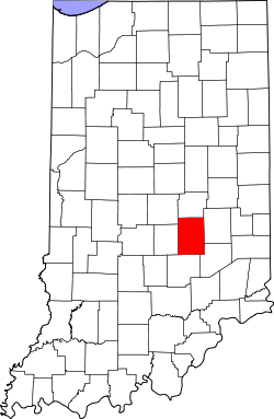
- Shelby County (Indiana)
-
Verwaltung US-Bundesstaat: Indiana Verwaltungssitz: Shelbyville Gründung: 1821 Demographie Einwohner: 42.445 (2000) Bevölkerungsdichte: 39,7 Einwohner/km² Geographie Fläche gesamt: 1.070 km² Wasserfläche: 1 km² Karte Shelby County[1] ist ein County im Bundesstaat Indiana der Vereinigten Staaten von Amerika. Bei der Volkszählung im Jahr 2000 wurden 42.445 Einwohner gezählt. Der Verwaltungssitz (County Seat) ist Shelbyville. Shelby County erstreckt sich über eine Fläche von 1070 Quadratkilometern.
Inhaltsverzeichnis
Geographie
Die Nachbar-Countys (im Norden startend, im Uhrzeigersinn) sind: Hancock County, Rush County, Decatur County , Bartholomew County, Johnson County und Marion County
Geschichte
Das Shelby County wurde 1821 aus Teilen des Delaware County gebildet und am 1. April 1822 anerkannt. Benannt wurde es nach General Isaac Shelby, der im Amerikanischen Unabhängigkeitskrieg bei der Schlacht von Kings Mountain die britische Armme geschlagen. Daraufhin wurde er Gouverneur von Kentucky. Im Britisch-Amerikanischen Krieg von 1812 führte er die Truppen aus Kentucky nach Kanada, wo er abermals die britische Armee in der Schlacht am Thames River schlug.
Das County wurde in 14 Townships aufgeteilt: Addison, Brandywine, Hanover, Hendricks, Jackson, Liberty, Marion, Moral, Noble, Shelby, Sugar Creek, Union, Van Buren und Washington.
Bevölkerungsentwicklung
Historische Einwohnerzahlen Census Einwohner ± in % 1830 6295 — 1840 12.005 90 % 1850 15.502 30 % 1860 19.569 30 % 1870 21.892 10 % 1880 25.257 20 % 1890 25.454 0,8 % 1900 26.491 4 % 1910 26.802 1 % 1920 25.982 -3 % 1930 26.552 2 % 1940 25.953 -2 % 1950 28.026 8 % 1960 34.093 20 % 1970 37.797 10 % 1980 39.887 6 % 1990 40.307 1 % 2000 43.445 8 % Vor 1900[2] 1900–1990[3]
Einzelnachweise
- ↑ GNIS-ID: 450387. Abgerufen am 22. Februar 2011 (englisch).
- ↑ U.S. Census Bureau - Census of Population and Housing. Abgerufen am 15. März 2011
- ↑ Auszug aus Census.gov. Abgerufen am 16. Februar 2011
Weblinks
Städte mit über 20.000 Einwohnern:
Carmel | Fishers | Greenwood | Lawrence | Noblesville | Plainfield | WestfieldStädte mit weniger als 20.000 Einwohnern:
Arcadia | Avon | Bargersville | Beech Grove | Brooklyn | Brownsburg | Cicero | Clermont | Cloverdale | Cumberland | Danville | Edinburgh | Fairland | Fortville | Franklin | Greencastle | Greenfield | Lebanon | Martinsville | McCordsville | Mooresville | Morristown | New Palestine | New Whiteland | Pittsboro | Princes Lakes | Shelbyville | Sheridan | Speedway | Southport | St. Paul | Thorntown | Whiteland | ZionsvilleCountys:
Boone | Brown | Hamilton | Hancock | Hendricks | Johnson | Marion | Morgan | Putnam | Shelby
Wikimedia Foundation.


