- Sunday’s River Valley
-
Sunday’s River Valley
Sunday’s River Valley Local MunicipalitySymbole Wappen Basisdaten Staat Südafrika Provinz Ostkap Distrikt Cacadu Sitz Kirkwood Fläche 3.508 km² Einwohner 34.932 (24. Oktober 2007) Dichte 10 Einwohner pro km² Schlüssel EC106 ISO 3166-2 ZA-EC Webauftritt www.srvm.gov.za (englisch) Politik Bürgermeister Mbulelo Kebe -33.425.433333333333Koordinaten: 33° 24′ S, 25° 26′ ODie Gemeinde Sundays River Valley ist Teil des Bezirkes Cacadu, Provinz Ostkap in Südafrika. Auf einer Fläche von 3.508 km² leben 39.853 Einwohner (Stand 2001). Sitz der Gemeindeverwaltung ist Kirkwood.[1]
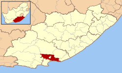
Der Gemeindename ist eine Übersetzung des niederländischen Zondags Rivier. Ein Voortrekker-Kommando unter dem Burenführer Andries Pretorius rastete hier an einem Sonntag (8. Dezember 1838).[2]
Städte/Orte
- Addo
- Barsheba
- Bergsig
- Bontrug
- Enon
- Kirkwood
- KwaZenzele
- Nomathamsanqa
- Paterson
- Valencia
Weblinks
- Offizieller Internetauftritt (englisch)
Einzelnachweise
Schlagen Sie auch in anderen Wörterbüchern nach:
Sunday's River Valley Local Municipality — is a local municipality in Cacadu District Municipality, Eastern Cape. The seat of Sunday s River Valley is Kirkwood. The municipality code is EC106. As of 2007, * the mayor of the municipality is S H Matinise. * Manager: vacant. * speaker:… … Wikipedia
Sundays River Valley — Sunday’s River Valley Sunday’s River Valley Local Municipality Sunday’s River Valley (rot) in Ostkap Staat: Südafrika … Deutsch Wikipedia
River Valley Transit — Infobox Bus transit name = logo size = 190 image size = image caption = company slogan = parent = founded = headquarters = 1500 West Third Street locale = Williamsport, Pennsylvania service area = service type = bus service, paratransit alliance … Wikipedia
Sunday River Whitecap — Infobox Mountain Name = Sunday River Whitecap Photo = Caption = Elevation = 1,017 metres (3,335 feet) Prominence = 300 m (985 ft) Location = Oxford County, Maine Range = Mahoosuc Range Coordinates = coord|44|32.95|N|70|53.80|W |type:mountain… … Wikipedia
Valley Railroad (Connecticut) — Infobox SG rail railroad name = Valley Railroad logo filename = Valley RR logo.jpg logo size = system map caption = marks = locale = Middlesex County, Connecticut start year = 1971 end year = predecessor line = New York, New Haven and Hartford… … Wikipedia
Valley Metro (Phoenix) — Valley Metro, officially named the Regional Public Transportation Authority (RPTA), is the system responsible for public transit, including buses and Valley Metro Rail in the area of Phoenix and Maricopa County, Arizona. About Valley… … Wikipedia
River Mole, Surrey — The River Mole is a river in southern England, which rises in West Sussex near Gatwick Airport and flows north west through Surrey for 80 km (50 miles) to the River Thames near Hampton Court Palace. The river gives its name to the Surrey district … Wikipedia
Cuyahoga Valley Scenic Railroad — Valley Scenic Railroad Locale Cuyahoga Valley National Park from Independence, Cuyahoga County to Canton, Stark County, Ohio Dates of operation 1972 or 1973–Present Predecessor Chessie System … Wikipedia
River Irwell — Geobox|River name = River Irwell native name = other name = other name1 = image size = image caption = The River Irwell at Salford, looking towards Manchester City Centre etymology = country = England country1 = state = state1 = region = region1 … Wikipedia
River Line (New Jersey Transit) — Infobox rail line name = River Line logo width = 130 image width = 250px caption = A vehicle used on the River Line system. type = Tram train system = New Jersey Transit status = locale = Delaware Valley start = njt sta|Trenton|type=river end =… … Wikipedia