- Tonkolili
-
Tonkolili 
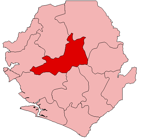
Basisdaten Staat Sierra Leone Provinz Northern Sitz Magburaka Fläche 7.003 km² Einwohner 347.197 (Zensus 2004) Dichte 49,6 Einwohner pro km² ISO 3166-2 SL-N Tonkolili ist ein Distrikt Sierra Leones mit etwa 347.000 Einwohnern.[1] Er gehört zur Provinz Northern und liegt im Zentrum des Landes. Seine Hauptstadt ist Magburaka, eine weitere Stadt ist Mile Ninetyone. Der Distrikt ist in 11 Chiefdoms (Häuptlingstümer) eingeteilt.[1]
Tonkolili umfasst eine Fläche von 7.003 km². Die höchsten Erhebungen sind Kunsulma (550 m), Kasebere (536 m) und Katikant (410 m)[2]
Die Bewohner des Tonkolili-Distrikts gehören hauptsächlich den Ethnien der Temne und Limba an und sind mehrheitlich Muslime.
Die Wirtschaft in Tonkolili besteht in Goldbergbau und Landwirtschaft. Es gibt in Tonkolili Eisenerzvorkommen in Ferengbeia, Gold und Diamanten an verschiedenen Standorten, die unter anderem von der Bergbaugesellschaft African Minerals abgebaut werden. Das Bumbuna Hydroelectric Project[3] am Fluss Rokel (Seli) soll weitere Entwicklung bringen. In Tonkolili liegt zudem der Mamunta-Nationalpark.[4]
Der Distrikt verfügte 2006 über 95 Gesundheitseinrichtungen, darunter ein staatliches Krankenhaus, ein Missionskrankenhaus, zwei Missions- und eine NGO-Klinik. 2005 waren 0,5 % der Bewohner HIV-positiv.[2] Die Alphabetisierungsrate lag 2004 bei 30 % (41 % der Männer und 21 % der Frauen) und damit unter dem Landesdurchschnitt. 42,8 % der Kinder besuchten eine Schule.[5]
Quellen
- ↑ a b Statistics Sierra Leone: Final Results, 2004 Population and Housing Census, 2006, S. 2f. (engl., PDF)
- ↑ a b Statistics Sierra Leone: Annual Statistical Digest 2005/06, 2008, S. 2f., 22, 42 (engl., PDF)
- ↑ Bumbuna Hydroelectric Project (engl.)
- ↑ Sierra Leone Encyclopedia 2008: Tonkolili District (engl.)
- ↑ Albert C. T. Dupigny, Ibrahim G. Kargbo, Alimamy Yallancy: Republic of Sierra Leone, 2004 Population and Housing Census. Analytical Report on Education and Literacy, 2006, S. 16, 22 (engl., PDF)
Schlagen Sie auch in anderen Wörterbüchern nach:
Tonkolili District — Infobox City official name = Tonkolili District nickname = | subdivision type = Country subdivision type1 = Capital subdivision type2 = Province subdivision name = Sierra Leone subdivision name1 = Magburaka subdivision name2 = Northern Province… … Wikipedia
Tonkolili District — Admin ASC 2 Code Orig. name Tonkolili District Country and Admin Code SL.02.2403287 SL … World countries Adminstrative division ASC I-II
Distrito de Tonkolili — Saltar a navegación, búsqueda El distrito de Tonkolili está ubicado en la Provincia del Norte, Sierra Leona. Su ciudad capital es Magburaka, además de ser la más grande. El distrito tiene una población de 365.465 personas. El districto ocupa un… … Wikipedia Español
Magburaka — Magburaka … Wikipedia
SL-N — Northern Province (Nördliche Provinz) Basisdaten Hauptstadt: Makeni Fläche: 35.936 km² Einwohner: 1.802.065 Bevölkerungsdichte: 50,1 Einw. je km² ISO 3166 2 … Deutsch Wikipedia
Momodu Koroma — (born in Yonibana, Tonkolili District) is a Sierra Leonean politician. He is a former Minister of Foreign Affairs and a member of the Sierra Leone Peoples Party (SLPP). He became foreign minister in May 2002, as part of a new cabinet appointed… … Wikipedia
Zainab Bangura — Infobox President imagesize = 150px name = Zainab Hawa Bangura nationality = Sierra Leonean |order = Foreign Minister of Sierra Leone term start = 14 October, 2007 term end = birth date = birth date and age|1959|12|18 birth place = Yonibana,… … Wikipedia
Salieu Turay — Salieu M. Turay In office May 2009 – Still In Office Preceded by H.E Mrs. Melrose Kai Banya Personal details … Wikipedia
Magbass — Magbass, Siera Leone … Wikipedia
Foday Sankoh — Infobox President|name=Foday Sankoh nationality=Sierra Leonean image size = image caption = order=Former Rebel leader term start= term end= predecessor= successor= birth date=birth date|1937|10|17|mf=y birth place=Masang Mayoso, Tonkolili… … Wikipedia
Tonkolili
18+
© Academic, 2000-2026
- Kontaktieren Sie uns: Unterstützung, Werbung
Wörterbücher Export, schritte mit PHP, Joomla, Drupal, WordPress, MODx.