- Koinadugu
-
Koinadugu 
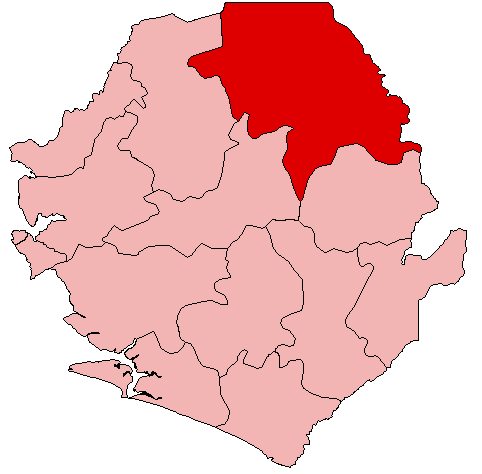
Basisdaten Staat Sierra Leone Provinz Northern Sitz Kabala Fläche 12.121 km² Einwohner 265.758 (Zensus 2004) Dichte 21,9 Einwohner pro km² ISO 3166-2 SL-N Koinadugu ist ein Distrikt Sierra Leones mit etwa 266.000 Einwohnern.[1] Er liegt in der Provinz Northern im Norden des Landes, an der Grenze zu Guinea. Seine Hauptstadt ist Kabala. Der Distrikt ist in 11 Chiefdoms (Häuptlingstümer) eingeteilt.[1]
Koinadugu umfasst eine Fläche von 12.121 km² und ist damit der flächenmäßig größte und zugleich am dünnsten besiedelte Distrikt in Sierra Leone. Der Bintumani (Loma Mansa), der zu den Loma Mountains gehört, ist die höchste Erhebung des Landes. In Koinadugu liegt auch der Sonfon-See.
Die Bewohner von Koinadugu gehören hauptsächlich den Ethnien der Limba, Kuranko und Jalonke an und sind mehrheitlich Muslime. Die Wirtschaft des Koinadugu-Distrikts besteht in Gold- und Diamantengewinnung, Rinderzucht und Palmölproduktion.[2].
Der Distrikt verfügte 2006 über 43 Gesundheitseinrichtungen, darunter ein staatliches Krankenhaus. 2005 waren 3 % der Bewohner HIV-positiv, was die landesweit höchste Rate ist. 2004/2005 gab es 234 Primar- und acht Sekundarschulen.[3] Die Alphabetisierungsrate ist mit 21 % (30 % für Männer und 14 % für Frauen) landesweit am tiefsten, ebenso wie der Anteil der Kinder, die eine Schule besuchen (31,2 %).[4]
Quellen
- ↑ a b Statistics Sierra Leone: Final Results, 2004 Population and Housing Census, 2006, S. 2f. (engl., PDF)
- ↑ Sierra Leone Encyclopedia 2006: Koinadugu District (engl.)
- ↑ Statistics Sierra Leone: Annual Statistical Digest 2005/06, 2008, S. 22, 42, 50, 52 (engl., PDF)
- ↑ Albert C. T. Dupigny, Ibrahim G. Kargbo, Alimamy Yallancy: Republic of Sierra Leone, 2004 Population and Housing Census. Analytical Report on Education and Literacy, 2006, S. 16, 22 (engl., PDF)
Schlagen Sie auch in anderen Wörterbüchern nach:
Koinadugu District — Infobox City official name = Koinadugu District nickname = | subdivision type = Country subdivision type1 = Capital subdivision type2 = Province subdivision name = Sierra Leone subdivision name1 = Kabala subdivision name2 = Northern Province… … Wikipedia
Koinadugu District — Admin ASC 2 Code Orig. name Koinadugu District Country and Admin Code SL.02.2407650 SL … World countries Adminstrative division ASC I-II
Distrito de Koinadugu — Saltar a navegación, búsqueda Distrito de Koinadugu Mapa Datos básicos País … Wikipedia Español
Danda Mohamed Kondeh — (born in Koinadugu District, Sierra Leone) is a Sierra Leonean economist and politician. He is currently a member of parliament of Sierra Leone from his home district of Koinadugu. He is a member of the ruling All People s Congress (APC). Kondeh… … Wikipedia
Mandingo people of Sierra Leone — The Mandinka people of Sierra Leone Ahmad Tejan Kabbah, former President of Sierra Leone is a member of the Mandinka ethnic group Notable Sierra Leonean Mandingo … Wikipedia
Mandinka people — Not to be confused with Mandé. See also: Mandingo people of Sierra Leone The Mandinka … Wikipedia
SL-N — Northern Province (Nördliche Provinz) Basisdaten Hauptstadt: Makeni Fläche: 35.936 km² Einwohner: 1.802.065 Bevölkerungsdichte: 50,1 Einw. je km² ISO 3166 2 … Deutsch Wikipedia
Dembelia Sikunia — Chiefdom Country Sierra Leone Province … Wikipedia
Diang, Sierra Leone — Diang Chiefdom Country Sierra Leone Province … Wikipedia
Mongo, Sierra Leone — Mongo Chiefdom Country Sierra Leone Province … Wikipedia
Koinadugu
18+
© Academic, 2000-2026
- Kontaktieren Sie uns: Unterstützung, Werbung
Wörterbücher Export, schritte mit PHP, Joomla, Drupal, WordPress, MODx.