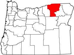
Umatilla County, Oregon — Infobox U.S. County county = Umatilla County state = Oregon map size = 225 founded = September 27, 1862 seat = Pendleton | area total sq mi =3231 area land sq mi =3215 area water sq mi =16 area percentage = 0.49% census yr = 2000 pop = 70548… … Wikipedia
National Register of Historic Places listings in Umatilla County, Oregon — This is a list of properties and districts in Umatilla County, Oregon that are listed on the National Register of Historic Places. Map of all coordinates from Google Map of all coordinates from Bing … Wikipedia
Riverview, Umatilla County, Oregon — Riverview was an unincorporated locale in Umatilla County, Oregon, United States.cite web |url=http://geonames.usgs.gov/features.html#l |title=Feature Class Types |publisher= Geographic Names Information System, United States Geological Survey… … Wikipedia
Riverside, Umatilla County, Oregon — Riverside is a census designated place (CDP) in Umatilla County, Oregon, United States. The population was 189 at the 2000 census. It is part of the Pendleton ndash;Hermiston Micropolitan Statistical Area.GeographyRiverside is located at coor… … Wikipedia
Columbia Heights (Umatilla County, Oregon) — Columbia Heights is a mountain in Umatilla County in the U.S. state of Oregon, near the city of Milton Freewater. It is convert|1319|ft|m high. [ [http://www.mountainzone.com/mountains/detail.asp?fid=2261256 Mountainzone.com entry] ] References * … Wikipedia
Umatilla County — Verwaltung US Bundesstaat: Oregon Verwaltungssitz: Pendleton (Oregon) Gründung: 1862 Demographie Einwohner: 73.878 … Deutsch Wikipedia
Morrow County, Oregon — Morrow County Courthouse in Heppner … Wikipedia
Grant County, Oregon — Grant County Courthouse in Canyon City … Wikipedia
Wallowa County, Oregon — Infobox U.S. County county = Wallowa County state = Oregon map size = 225 founded = October 14, 1864 seat = Enterprise | area total sq mi =3152 area land sq mi =3145 area water sq mi =6 area percentage = 0.20% census yr = 2000 pop = 7226 density… … Wikipedia
Union County, Oregon — Infobox U.S. County county = Union County state = Oregon map size = 225 founded = October 14, 1864 seat = La Grande | area total sq mi =2039 area land sq mi =2037 area water sq mi =2 area percentage = 0.10% census yr = 2000 pop = 24530 density… … Wikipedia

