- Wind Cave National Park
-
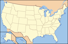
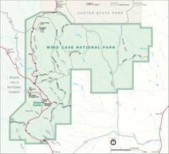
Wind-Cave-Nationalpark Wind-Cave-Nationalpark Lage: South Dakota, USA Nächste Stadt: Custer Fläche: 114 km² km² Gründung: 9. Januar 1903 Besucher: 850.000 (2003) Detaillierte Karte Die Höhle mit dem Namen Wind Cave liegt im Wind Cave Nationalpark im Westen von South Dakota und zählt mit 202 km erforschten Wegen zu den längsten Höhlen der Welt. Die Höhle ist bekannt für Boxwork genannte Kalzium-Formationen, die sich wie Bienenwaben an den Wänden ausbreiten.
Der Nationalpark wurde 1903 unter US-Präsident Theodore Roosevelt als siebter Nationalpark in den Vereinigten Staaten eröffnet. Die Wind Cave ist die weltweit erste Höhle, die zum Nationalpark ernannt wurde. Weiter westlich liegt eine weitere große Höhle, die Jewel Cave.
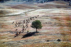
An der Oberfläche ist eine der letzten Prärien erhalten geblieben, die eine natürliche Heimat für Bison, Wapiti-Hirsch, Pronghorn-Antilope und Prairie Dog ist. 2007 wurde der Park in das groß angelegte Auswilderungsprogramm für den Schwarzfußiltis einbezogen. Die Art, die bereits als ausgestorben galt, wird in Gefangenschaft nachgezogen und seit 1991 in zentralen und westlichen Regionen der Vereinigten Staaten ausgewildert.
Weblinks
- National Park Service: Wind-Cave-Nationalpark (offizielle Seite) (englisch)
- U.S. National Parks Net: Wind-Cave-Nationalpark (englisch)
Acadia | Arches | Amerikanisch-Samoa | Badlands | Big Bend | Biscayne | Black Canyon of the Gunnison | Bryce Canyon | Canyonlands | Capitol Reef | Carlsbad Caverns | Channel Islands | Congaree | Crater Lake | Cuyahoga Valley | Death Valley | Denali | Dry Tortugas | Everglades | Gates of the Arctic | Glacier | Glacier Bay | Grand Canyon | Grand Teton | Great Basin | Great Sand Dunes | Great Smoky Mountains | Guadalupe Mountains | Haleakalā | Hawaii Volcanoes | Hot Springs | Isle Royale | Joshua Tree | Katmai | Kenai Fjords | Kings Canyon | Kobuk Valley | Lake Clark | Lassen Volcanic | Mammoth Cave | Mesa Verde | Mount Rainier | North Cascades | Olympic | Petrified Forest | Redwood | Rocky Mountain | Saguaro | Sequoia | Shenandoah | Theodore Roosevelt | Virgin Islands | Voyageurs | Wind Cave | Wrangell-St. Elias | Yellowstone | Yosemite | Zion
43.556137166667-103.47807884167Koordinaten: 43° 33′ 22″ N, 103° 28′ 41″ W
Wikimedia Foundation.


